…Deal Daemon is published in the Android Market. Check it out!
![]()
Mobile users, click here.
Deal Daemon is nearly ready for prime time. The UI is shaping up and all of the major features are working consistently. More testing is needed, to be sure; but I can’t just stare at it forever. It eventually needs to be released out into the wild where people will (mercilessly, no doubt) critique the interface and functionality and offer feedback. And after that goes on for a while, I’ll eventually realize that it’s time for an update!
But for the time being, here’s what I’ve got:
The video looks best in YouTube. It’s recorded using video capture software and the app is running in the Android 2.3.3 Emulator, which is made available for free in the Android Software Development Kit. You basically launch a program on your desktop which looks and acts just like the phone would. It’s a bit sluggish for two reasons. 1) The software is not optimized yet. When I compile the production release it should get smaller (installation wise) and faster. 2) The Android Emulator has the uncanny ability to bring even the burliest PCs to their knees. Such is the nature of virtual machines…
 |
| Defining a search on my HTC Inspire 4G running Android 2.2.1. |
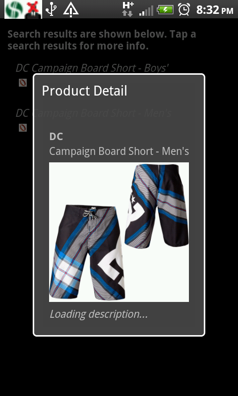 |
| Same hardware/OS. Viewing a product detail page to be sure I’ve chosen reasonable search terms. |
 |
| Same device again. Notification panel shows two matches: one for a pair of shorts on Dogfunk, and another for a camp duffel from Steap and Cheap. |
Well, that’s about it for now. Next on my agenda, is to compile the production release, digitally sign the app so that the Android Market can securely and reliably deliver it to users, register as an app developer with the Market and then start fielding bug/feature requests!
Oh, one last thing. I figured out a way of collecting commissions from backcountry.com et al upon sales generated from Deal Daemon. Why should you care? Because I now no longer have a good reason to charge people for the software. That’s right, it’s going to be 100% free!
Enjoy,
brian
 |
| HTC Inspire 4G notification pane with a real live alert from Deal Daemon. |
That’s right folks; as of about 5 minutes ago this thing finally does something moderately useful. I think I’m about ready for an open beta test. Any volunteers? If you actually help me with this, I’ll hook you up with a free copy of the software and updates for as long as I continue to update it.
Yes, there’s a bug in the screen shot: I printed the word twice for no good reason (apart from it being a Saturday night and I’m mid way through a pint of brew), but such is the nature of software – it’s not perfect. Rest assured, it’ll get close.
For those unfamiliar with the project, check out the project landing page.
People seriously interested in helping me beta test this sucker should drop a comment with their email or other contact info in this post. More info will be forthcoming…
Thanks!
As per the main Pemi Loop TR, here is the ski beta companion post. If you are not interested in backcountry skiing, this is probably a good post to skip: it’s pretty dry and in essence just a bunch of maps and weird photos. At the risk of providing too much detail (not sure if that’s possible for this topic), each entry will follow this general format:
And without further ado…

View Pemi Loop in a larger map
View Pemi Loop in a larger map
View Pemi Loop in a larger map


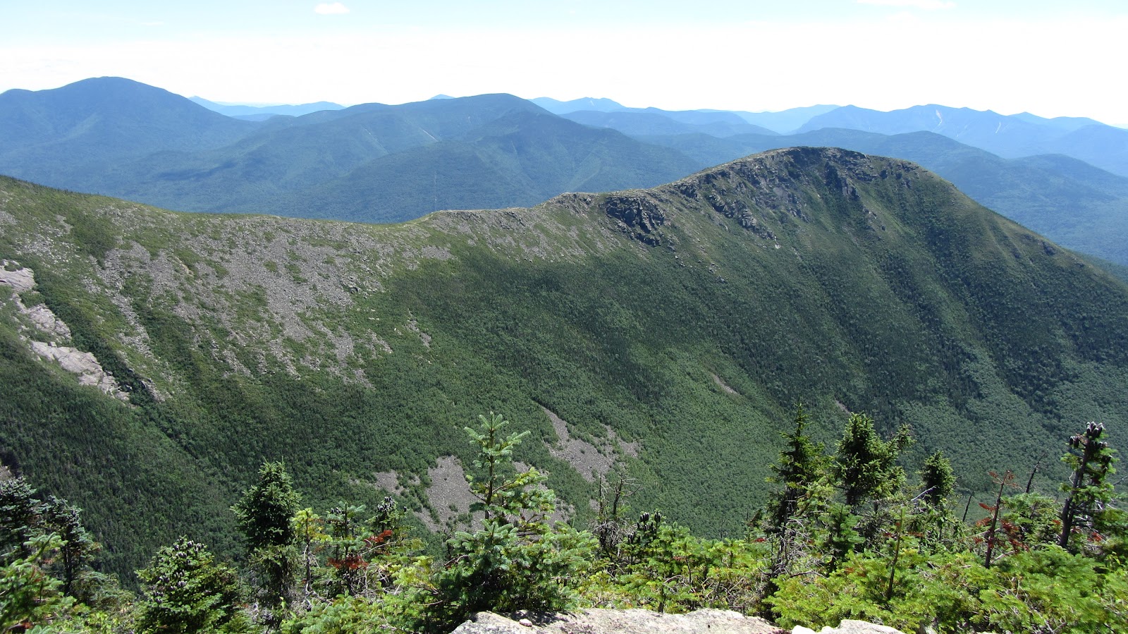
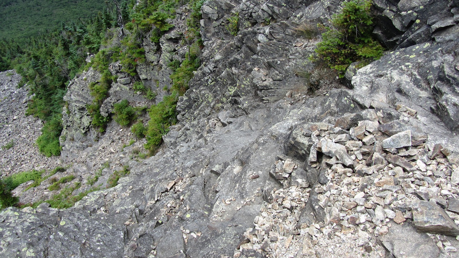
West Bond and Bondcliff
Bondcliff is tempting for obvious reasons, but it’s questionable at best. It’s extremely steep and all of the crazy terrain features would require a stupendous amount of snow to fill it in. It’s northwest facing, so it probably get’s blasted but upslope weather, but may well get scoured by the prevailing winds. I think the more promising looking runs are actually on West Bond.

View Pemi Loop in a larger map
View Pemi Loop in a larger map
View Pemi Loop in a larger map


Osceola and Scar Ridge Slides
These are actually not in The Pemi, their across the Kancamagus just east of Loon. I hear they slide left and right but if appropriate conditions could be found, they look like fun. These slides are roughly a mile from the highway and each of them drains out into the Hancock Branch of the Pemi River which runs parallel to the Kanc, so access is pretty straight forward.
View Pemi Loop in a larger map
View Pemi Loop in a larger map
View Pemi Loop in a larger map
|
View Pemi Loop in a larger map |
View Pemi Loop in a larger map |
|
View Pemi Loop in a larger map |
View Pemi Loop in a larger map |

View Pemi Loop in a larger map
View Pemi Loop in a larger map
View Pemi Loop in a larger map

View Pemi Loop in a larger map
View Pemi Loop in a larger map
View Pemi Loop in a larger map


View Pemi Loop in a larger map

View Pemi Loop in a larger map
View Pemi Loop in a larger map
View Pemi Loop in a larger map
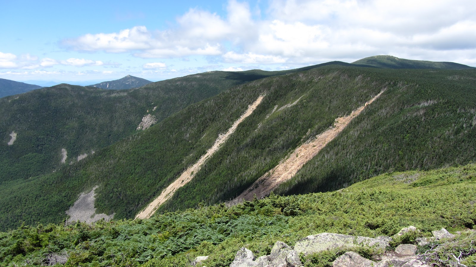
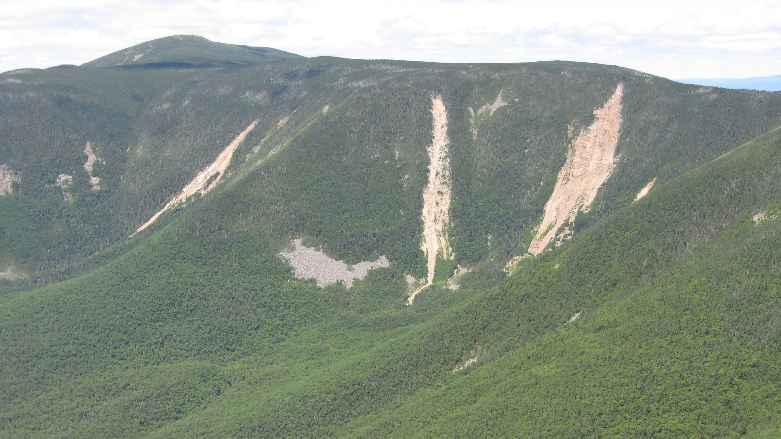
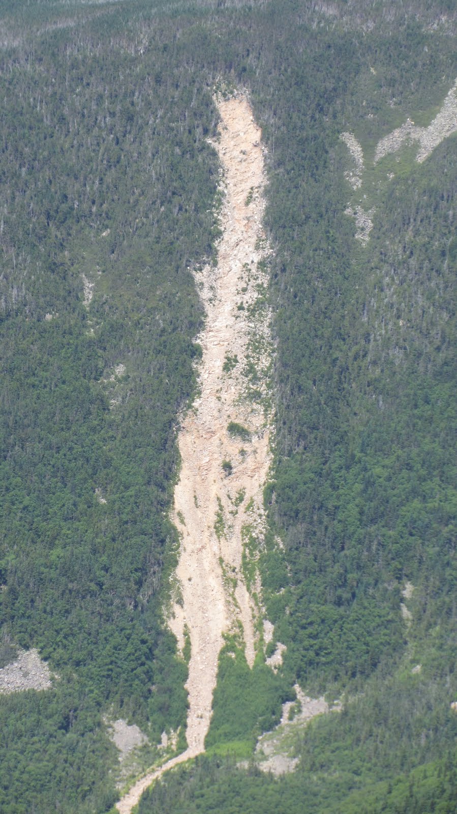
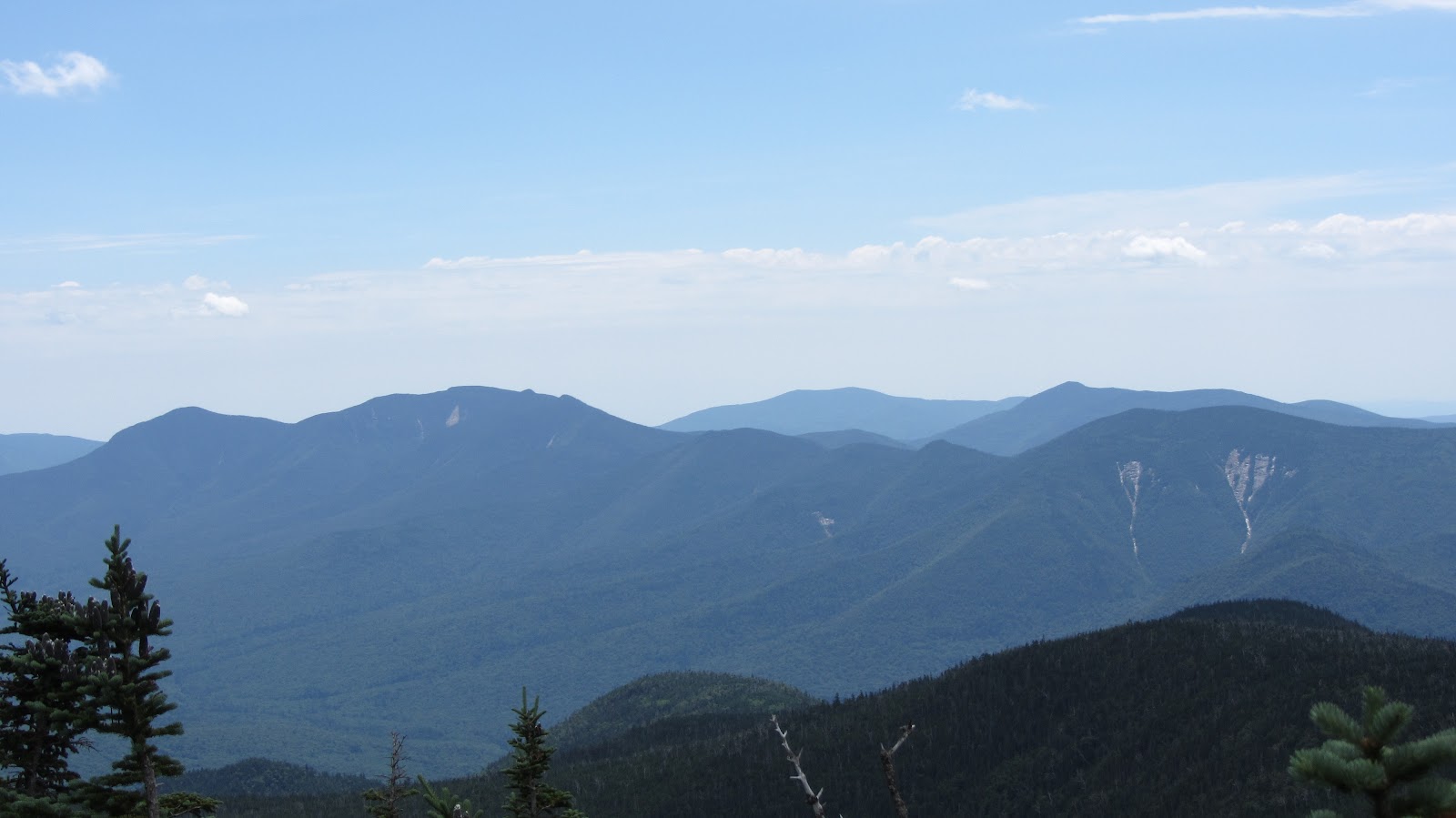
Lincoln Slides – East Slope
The east slope of Franconia ridge has several nice looking runs however, there’s no easy way of getting to them. The shortest route may be to climb the west side of Lincoln, and then simply ski down the west side. Of course then you need to get back. Additionally, conventional wisdom dictates that you climb the line you’re going to ski. The safer route involves a 5 or 6 mile slog through The Pemi over easy terrain, followed by some bushwhacking to get to the base of the slides. Yet another alternative, would be to follow Lincoln Brook, possibly skinning up it all the way to the bottom of the drainage. This is more direct than following the Franconia Brook Trail, but may not be faster due to the comparative slowness of bushwhacking on skis. The north aspect of these slides is wide and relatively mellow, however punctuated by lots of passenger car sized boulders, which should make for good fun on a powder day. The south aspect is considerably steeper and narrower – an exciting looking technical line. The photo we got is actually not a great perspective (I think the sun was starting to get to me…), so really rely on the maps to see what’s going on here.

View Pemi Loop in a larger map
View Pemi Loop in a larger map
View Pemi Loop in a larger map


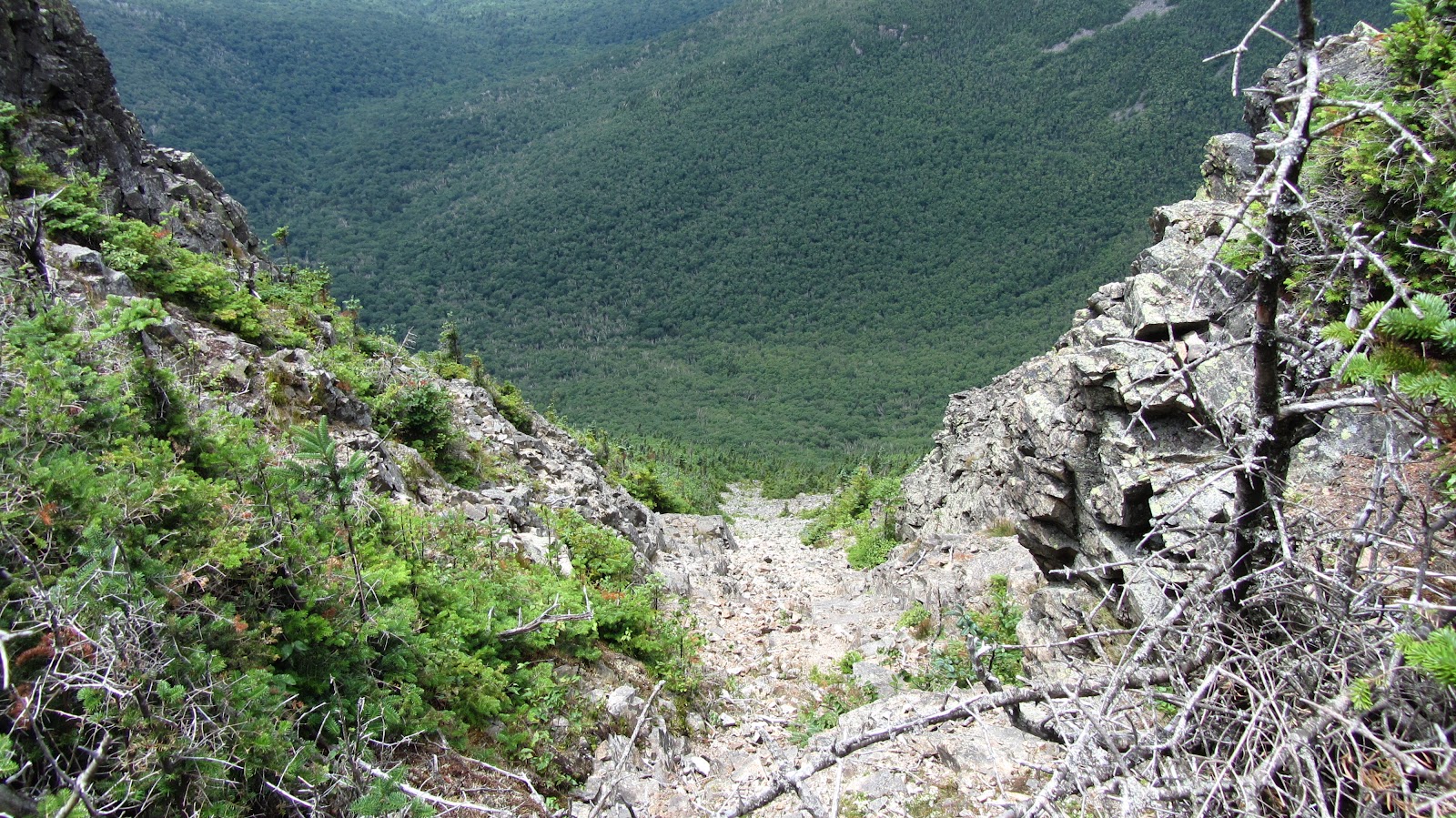
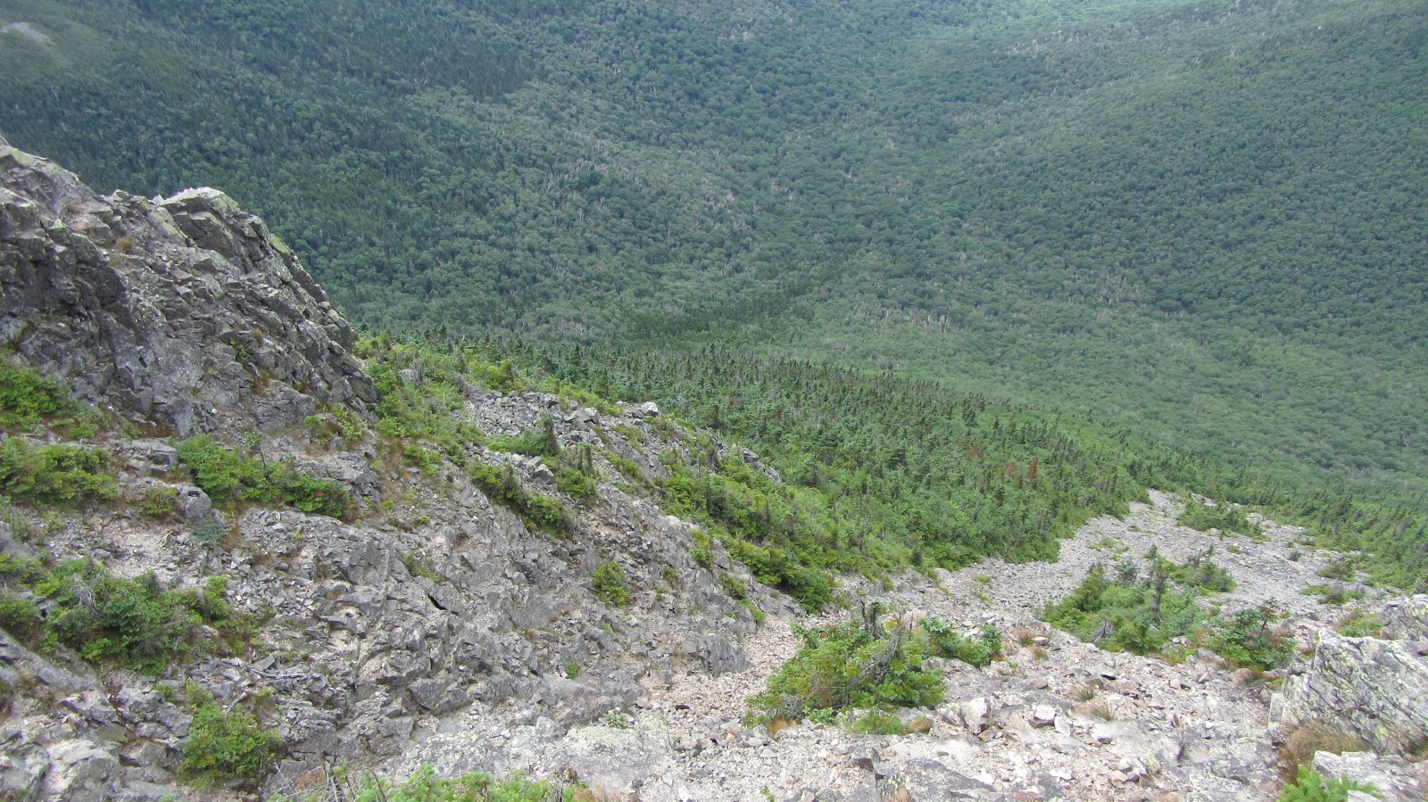
Lafayette Slides
These look gnarly and could be accessed without any sort of bushwhacking at all, although the fastest route would almost certainly be to take the Old Bridle Path to the base of the drainage and just follow it up from there.

View Pemi Loop in a larger map
View Pemi Loop in a larger map
View Pemi Loop in a larger map
