Author Archives: Brian Sweeney

About Brian Sweeney

Computer programmer, blogger and home-brew software developer with a penchant for back-country adventures, old metal, black coffee and micro-brew.

Peak-bagging and Summit Beers

Freshly warmed up from Mt. Monadnock, and thoroughly convinced that there’s no ski-able snow left in New England, Alex and I geared up (read: had huge dinners and a few beers) and rolled up to Lincoln, NH to crash early and get a fast start for a long hike in Crawford Notch.  We wanted to do something long and fairly challenging, with some decent rewards, but avoid the Memorial Day hordes.  This turned out to be the perfect solution: the plan called for nearly 17 miles, over 8000′ elevation change, it’s remote compared to much of the Whites, and our early start and rapid pace nearly guaranteed few encounters with any crowds.


View Avalon, Field, Willey, Webster in a larger map

As usual, we got off to a slower start than we hoped for, most likely owing to general morning grogginess and a pronounced need for some White Mountain Bagel before seeing any real action.  Still, we managed to hit the trail at 10 of 7.

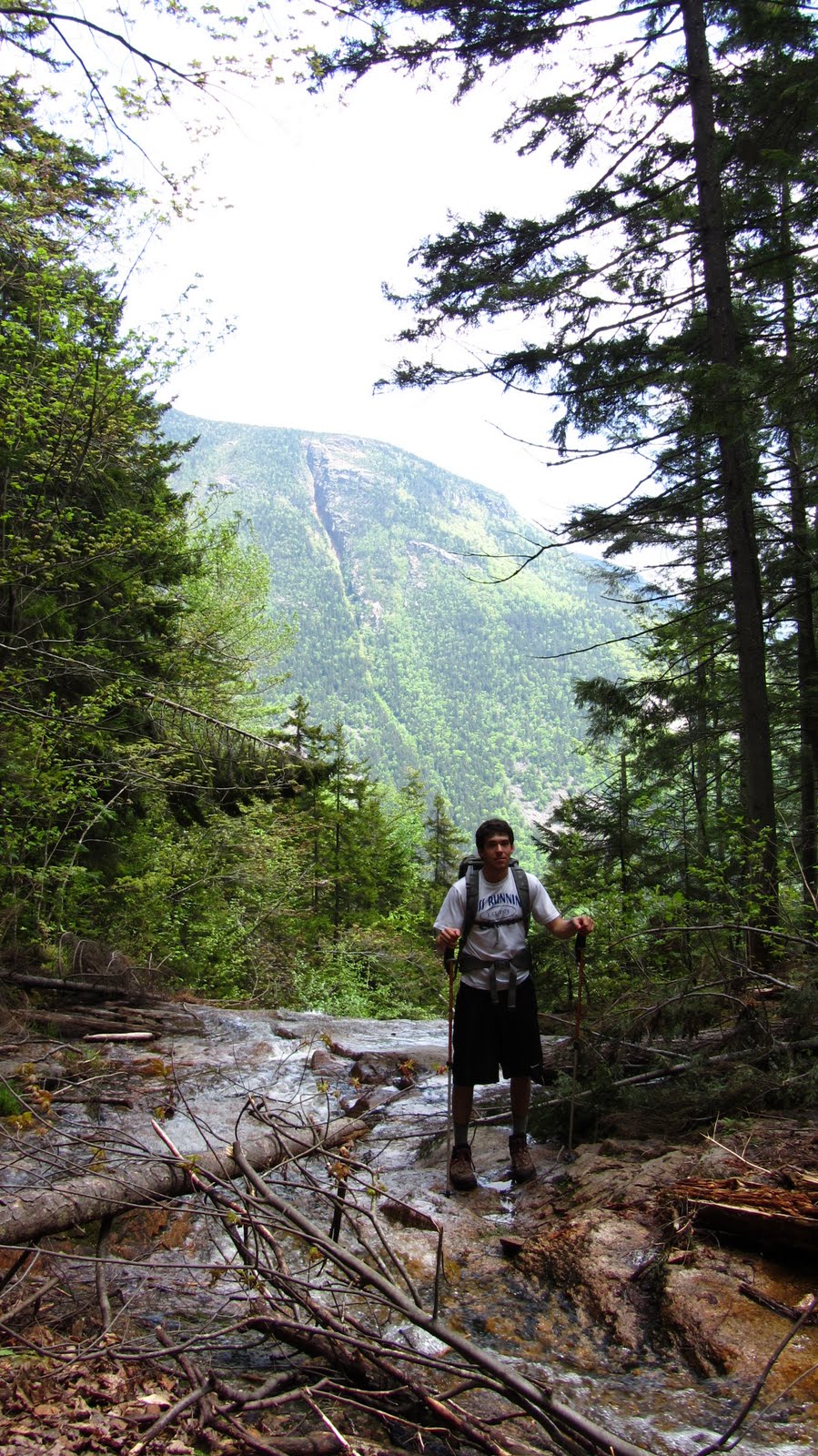
We set off at a clipping pace up the steep Avalon Trail, out of the AMC Highland Center.  The Avalon Trail goes pretty much straight up, without relenting until you pass Mt. Avalon, where we took a brief detour to play with my camera’s new smile auto-detect feature.  We experienced mixed results.  Next time I think I’ll just go with a tripod and 10 second timer…

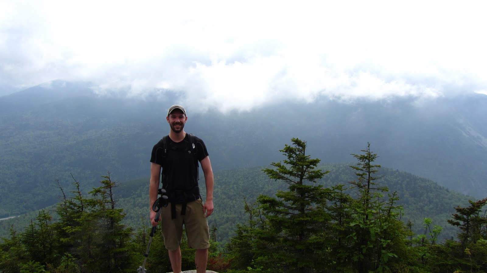
Alex tries to figure out what it takes to trip the smile detect.
We gave up and did things the old fashioned way.
Photo Credit: Alex

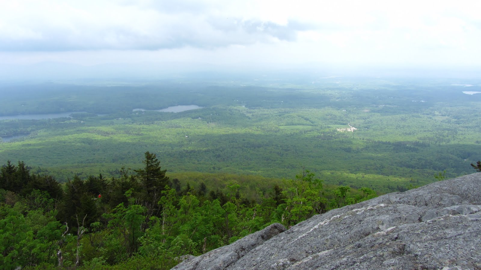
With all the serious climbing of the morning out of the way we sped off toward Mt. Field.  The trail dips down and up again between Avalon and Field but is considerably easier traveling than the route up from the Highland Center.  The trail wraps around the west flank of the ridge yielding impressive views of the Pemi Wilderness.  Without much trouble we summit Field and push on toward Willey, the final stop before descending toward and the crossing back over Rte. 302.

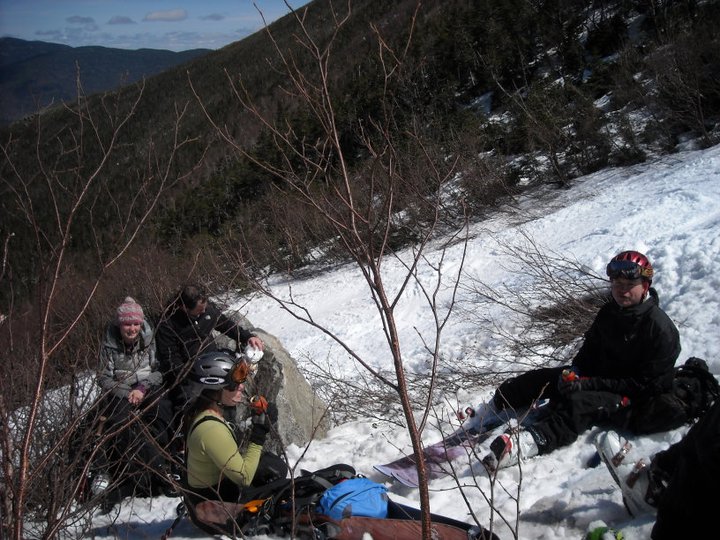
Willey offers some great view and some nice rocky spots to hang out and relax.  The sun was starting to get pretty high, and the morning’s haze and mist were starting to burn off, so we decided it was about time for Summit Beer Number 1.  Turns out it was a good chance for some more photos.

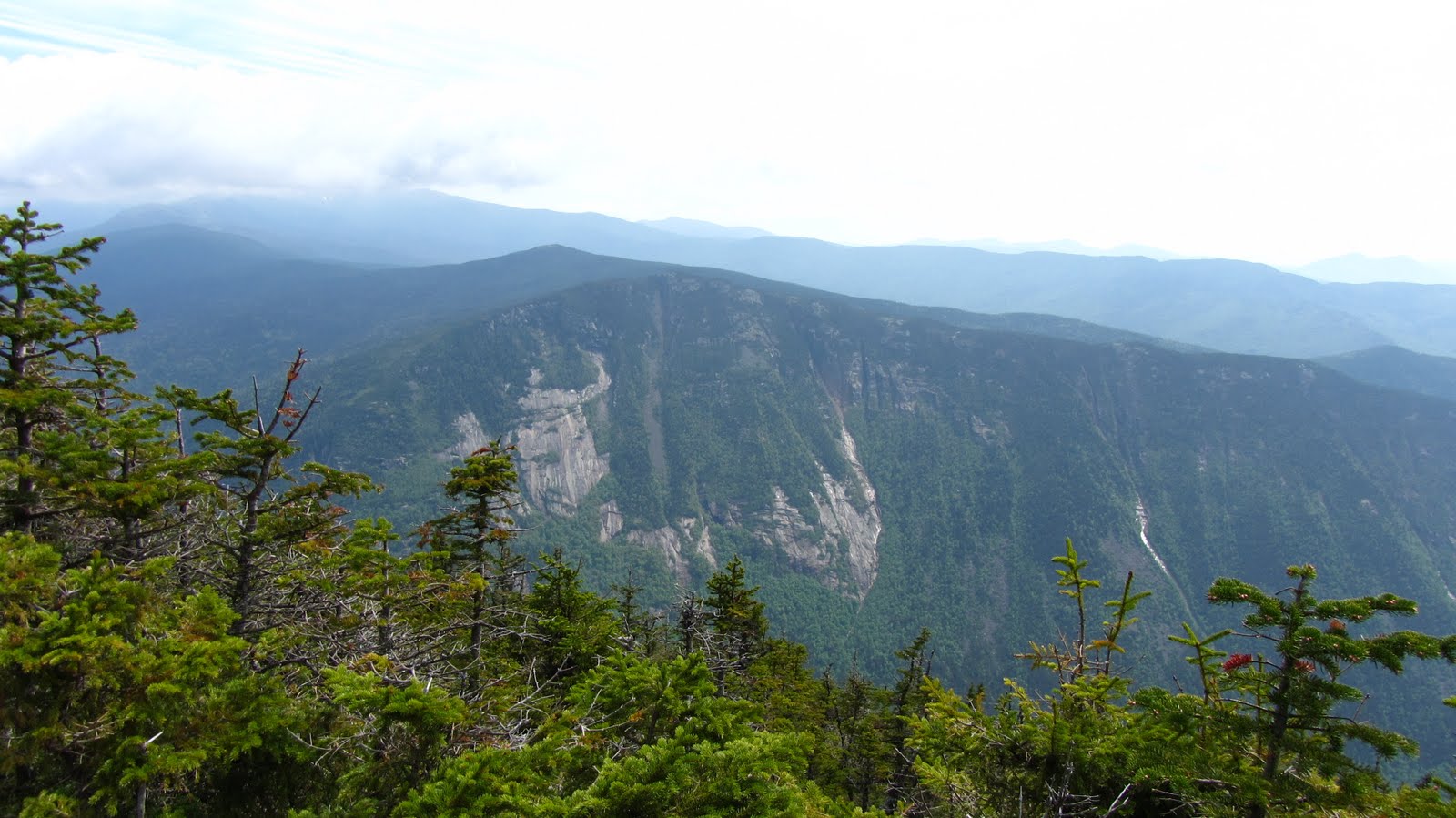
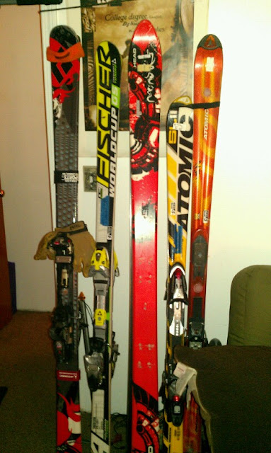
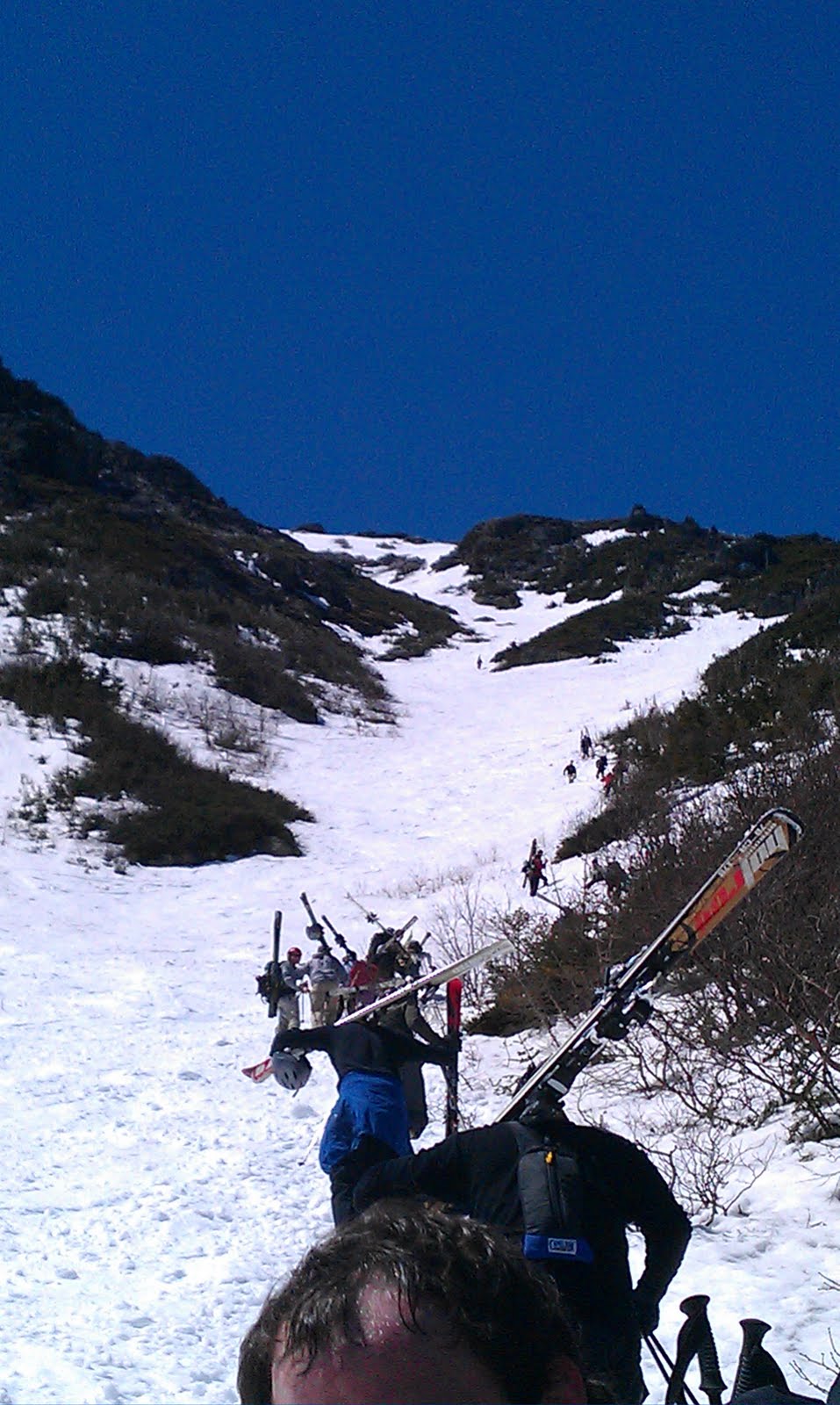
Some of these slides have to hold enough snow to be
ski-able.  Let’s hope a 3-degree file guide and some diamond
stones find their way into next year’s Christmas Stocking.
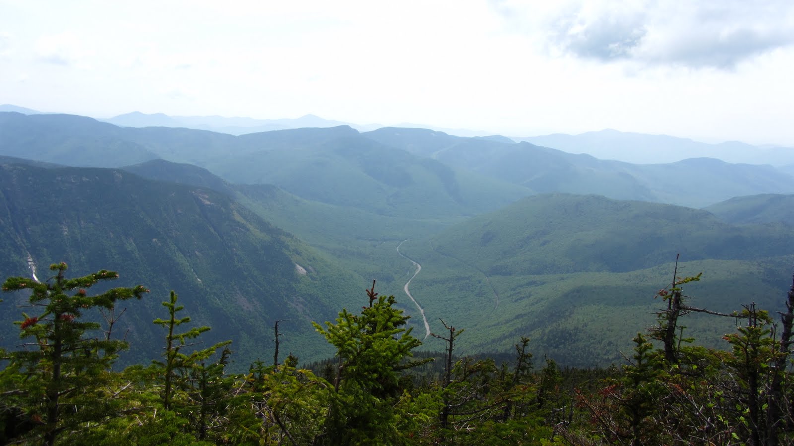
302 Snakes along the Notch floor.
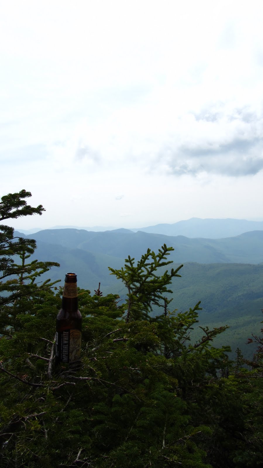
Summit Beer Number 1.  The
Sam Imperial White seemed like a solid bet
in terms of slaking our thirst  on a humid
day in late spring.
Nature.
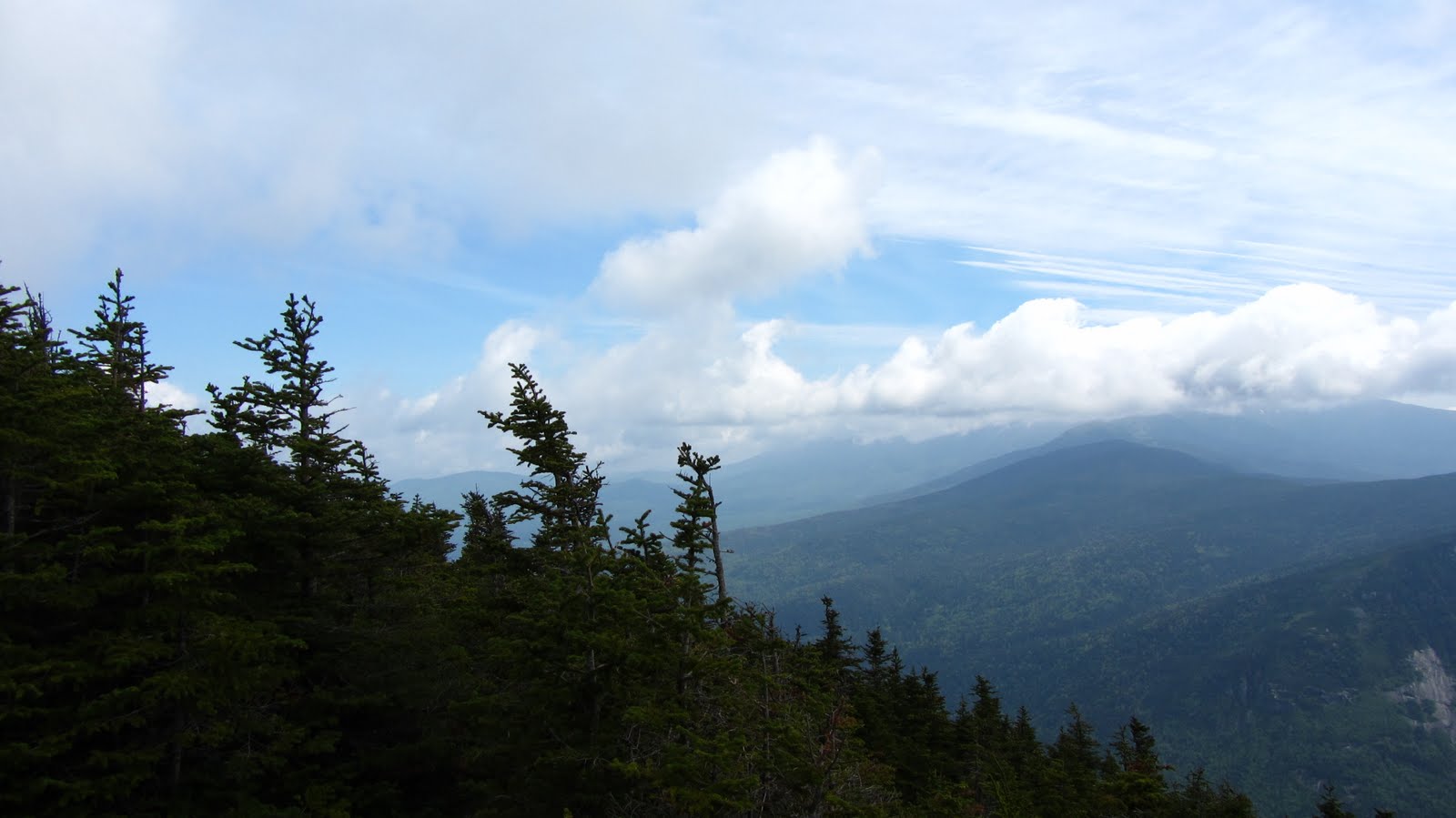
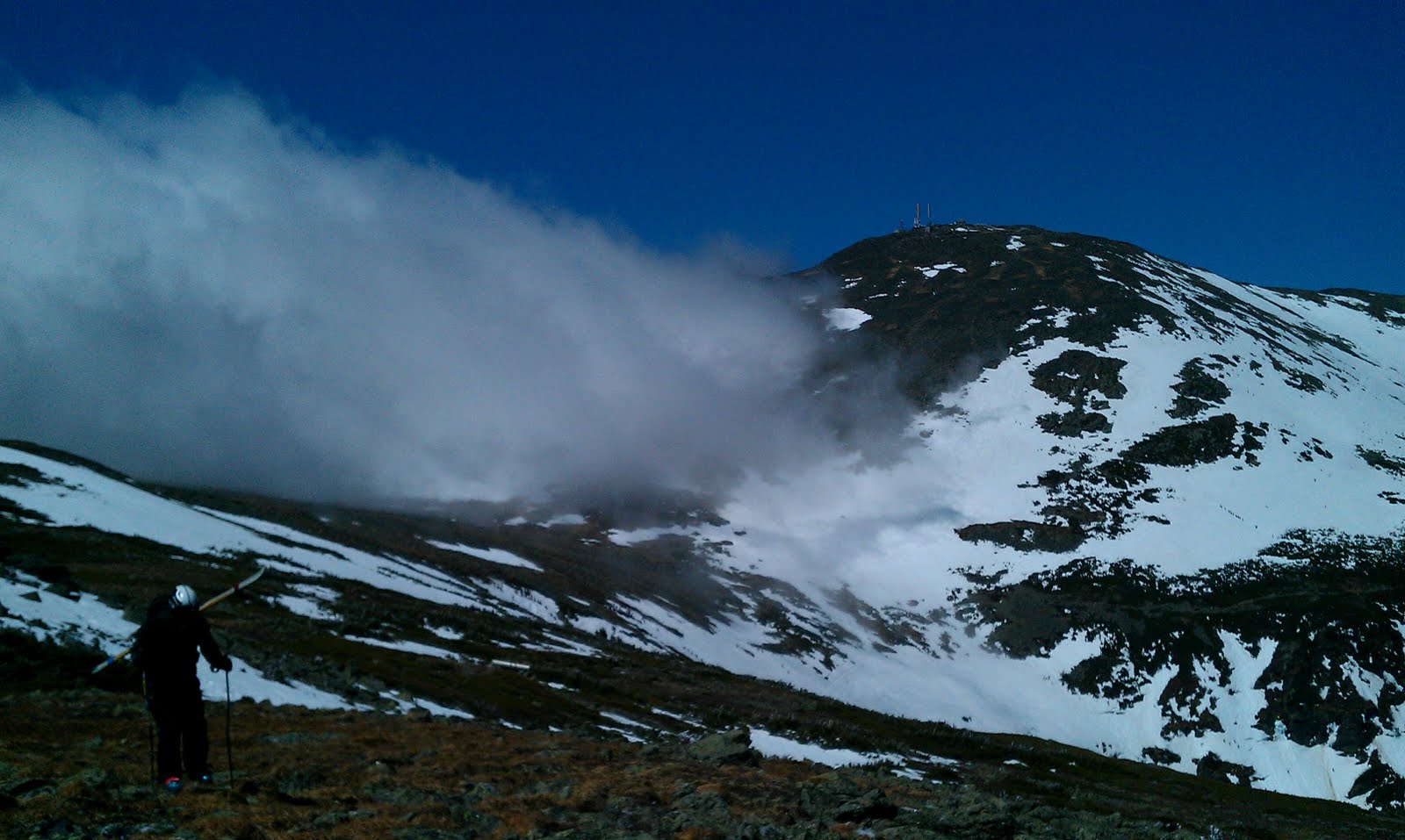
Clouds culminate over Mt. Washington.
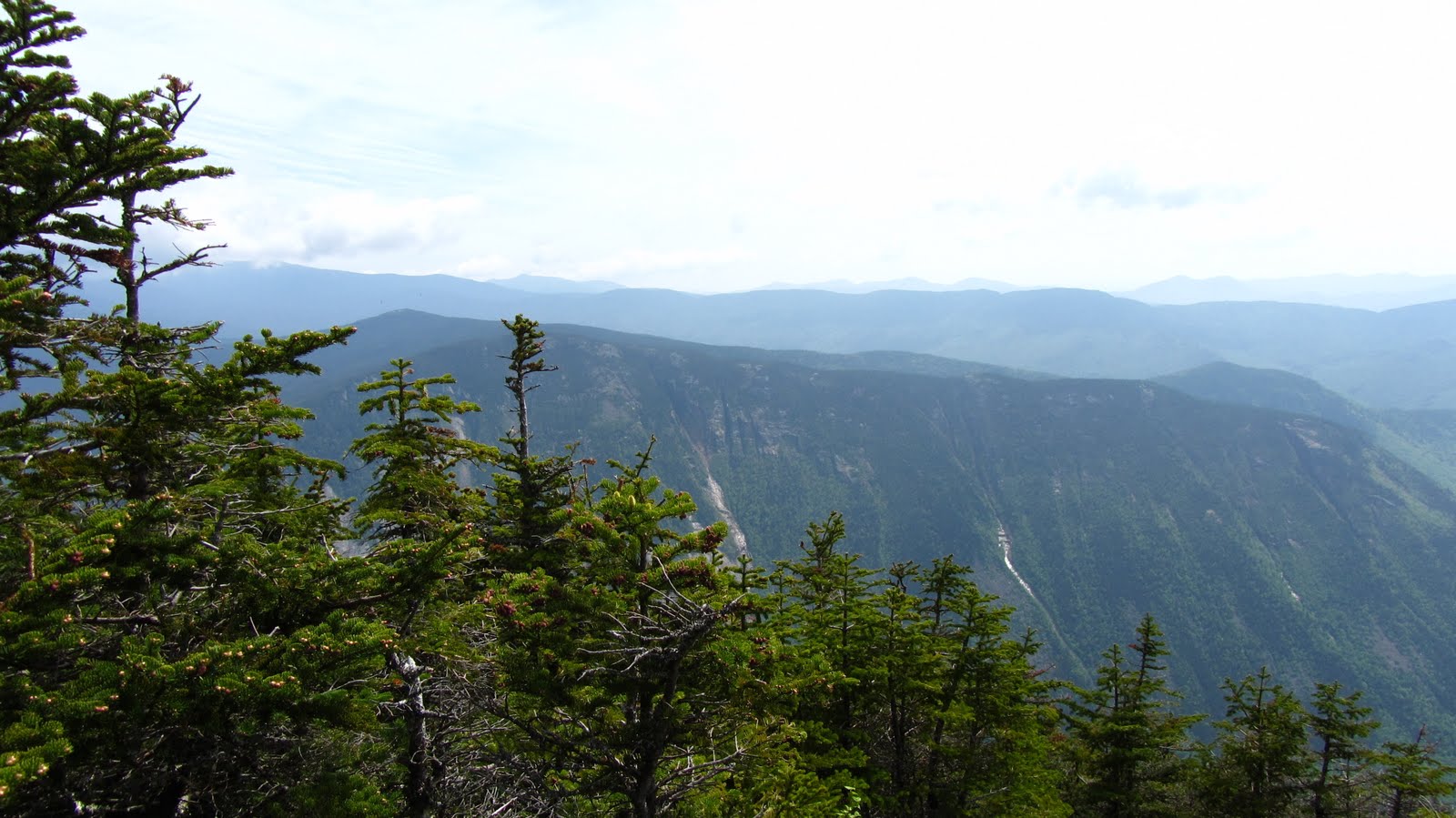
A sweeping view of the Notch.
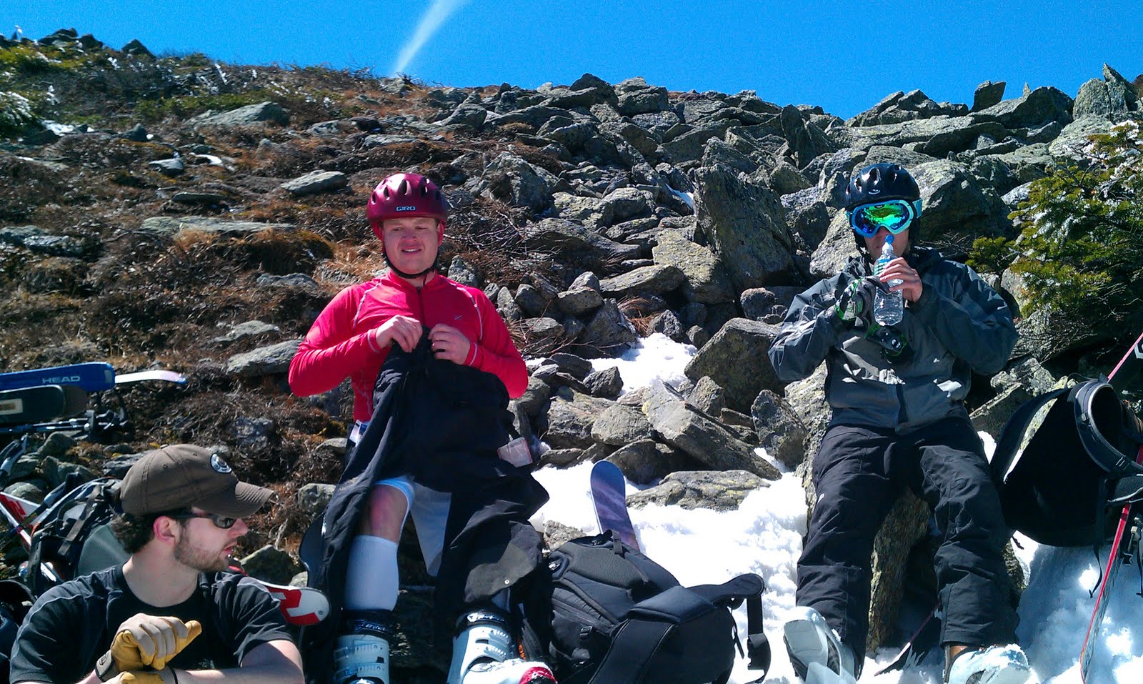
More backcountry skiing recon missions.
Danger to fun ratio: acceptable.
Once refreshed and rested we set off back down toward 302.  The way down along the Kedron Flume Trail may be steeper than the way up in many places, and it’s challenging, but with a stiff pair of telescoping trekking poles you can really cruise down this trail.  We stopped for a few more quick photos at the flume and then again shortly there after as we crossed the Conway Scenic Railroad.
Jose chillin’ atop the flume.
Just plant, dammit.
Photo Credit: Alex
Alex stands his ground over a
modest railroad trestle.
We emerge from the woods on of the Willey House, a gift shop and ranger station at the crossing of 302.  We fill up on water, change into fresh socks, eat (Alex had an ice cream) and steady our nerves for the next big climb or the day: Webster by way of the Webster Cliff Trail.  We cross the highway, and head back into the woods, roughly following the Saco River toward the shoulder of the cliff, at which time we head more or less straight up.  The Avalon Trail is no joke, but the first mile or so of the Webster Cliff Trail is a real kick in the pants.  Numerous switchbacks notwithstanding, it relentlessly crawls up to the top of the cliffs.  By the time we approach the ridge my quads are starting to cramp up and Alex is working on some Long-Trail-esque blisters.  The arduous climb eventually gives way to an exciting ridge walk; not as exposed as Franconia Ridge but every bit as fun.  After a quick look around we move out.  
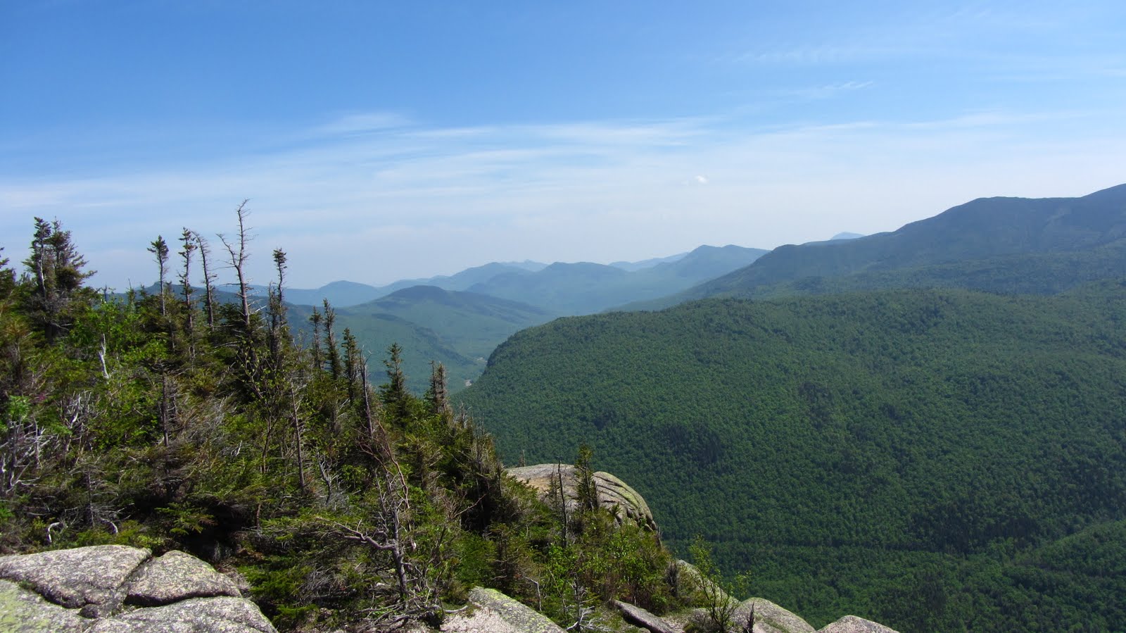
The view to the southwest just after cresting the ridge.
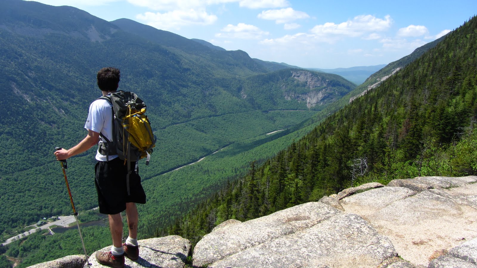
Alex surveys the Notch looking north west back toward the
Highland Center.
We charge ahead toward Webster, eagerly anticipating Summit Beer Number 2.  By the time we arrive at the summit of Webster, we’re starting to wonder if summiting Jackson is entirely necessary: we conclude that we actually have a superior view of the surround land from Webster and decide to can the extra 1.5 miles and beeline for the Highland Center, but not before fueling up and snagging a few final photos.
Him again…
Photo Credit: Alex
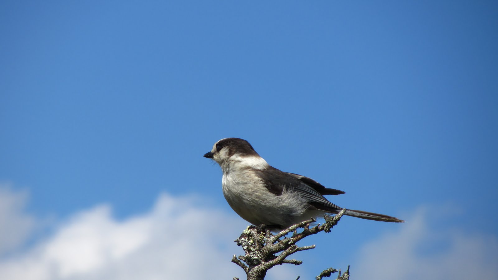
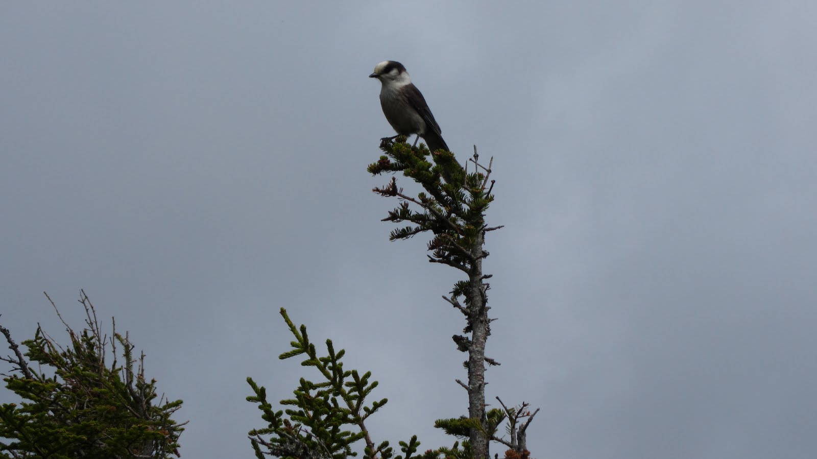
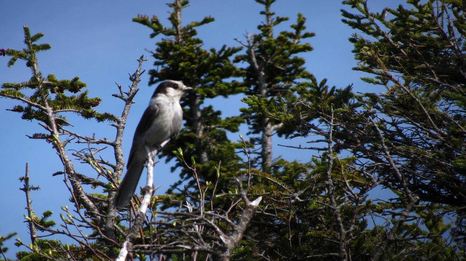
This bird was completely undeterred by any of our noise
making.
Photo Credit: Alex
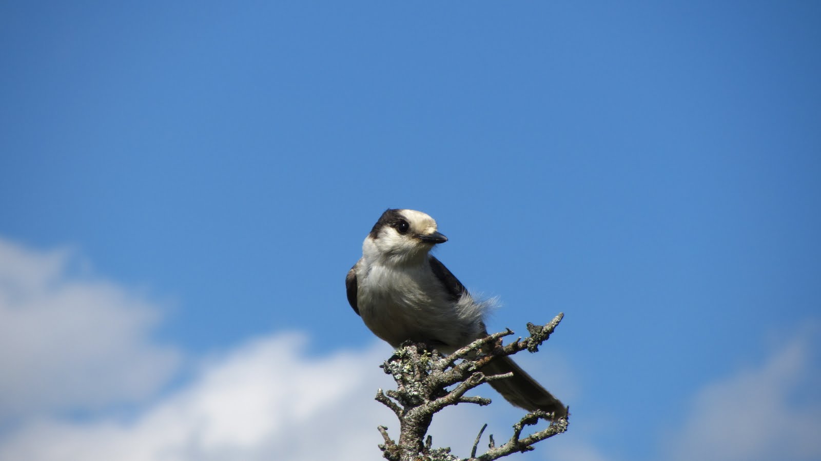
We speculate that he followed our scent across the Notch.
Photo Credit: Alex
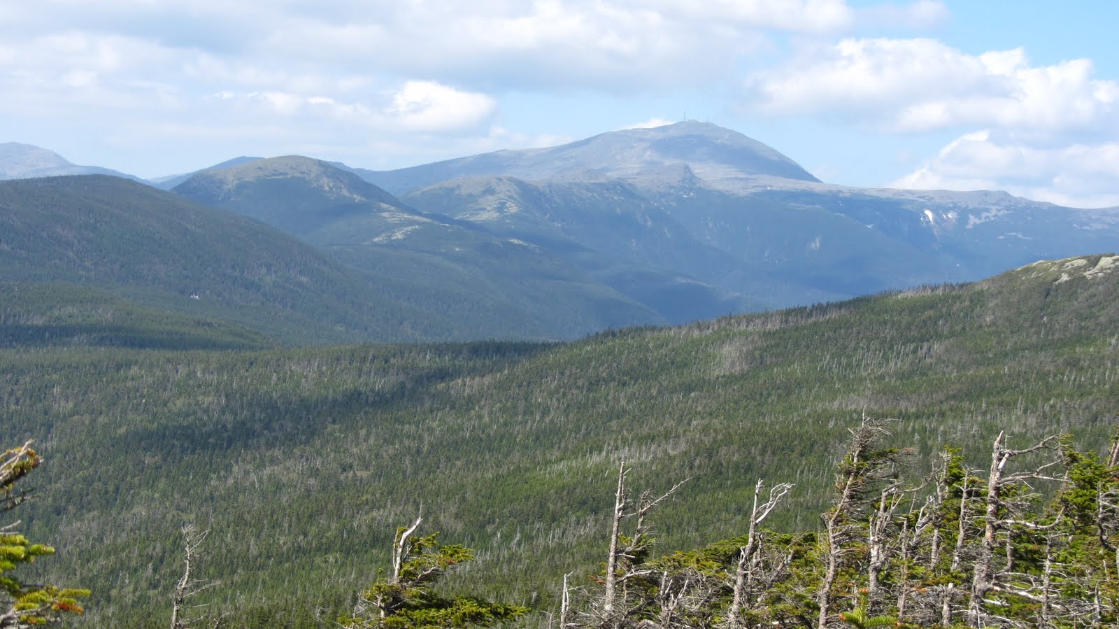
Mt. Washington and the Souther Presidentials from the
summit of Webster.
The Mt. Washington Hotel.
A brief respite the Highland Center, just past 5 in the evening.
Gear List:

Asolo TPS 520 GV Boot - Men'sBlack Diamond Contour Elliptic Carbon Trekking Pole Ink Blue, One SizeBlack Diamond Traverse Ski Poles

Monadnock Warm Up Run

Now that it’s just about June, I’ve resigned myself to the fact that ski season is finally over.  I even pulled all of my skis out of the Thule box and propped them up in their summer resting place.

All is not lost, however.  With the weather getting nicer every day, I can’t help but find myself excited for the summer hiking season, and I certainly won’t miss dragging a million pounds of gear all over New England every weekend.

To get warmed up for the summer I headed out to Mount Monadnock with Abby (who practically just got home from a winter in Vail, CO).  Monadnock is certainly not the most challenging mountain but the summit is rocky and bald, with a few decent rock scrambles toward the top.  It can be crowded, but its pleasant, and perhaps most enticingly, it allows for a none-too-shabby day hike with time left over to head back to Boston for some R&R.

Here’s a quick look at the loop:

View Monadnock in a larger map

Since it was relatively light hike, I took the opportunity to do some experimentation.  The first item I wanted to test out my Merrel Chameleon hiking sneakers.  Perhaps the real test was running the Tough Mudder in them, after which I realized that they are probably hearty enough for a decent hike as well.  Until recently I really had never entertained the notion of hiking in sneakers since my ankles are in such rough shape, but in the absence of any real disasters on the Tough Mudder course I was inspired to try out some hiking in them.  As I suspected all along, as I get fatigued my ankles get more and more floppy, which is when I’d begin to wish I had boots, however I think as a new rule of thumb, any hike less than about 10 miles is probably fine for hiking sneakers, but for longer, harder hikes I think I’ll stick to boots, at least for a while.

The next item on the agenda was the new camera.  I figured it was time for a new one when I crushed my last one by rolling over it while sleeping on the floor of Denver International…  This time around I wanted to find a camera with superior optical zoom, good image quality, HD video, and a high speed burst mode, all while remaining compact enough to actually bring hiking and skiing.  I found all that and more in the Canon Powershot SX230 HS.  The Powershot series is just plain great.  They’re all full featured, take great photos, are relatively easy to use and are at a pretty reasonable price point.  Unfortunately it was overcast and foggy for most of the hike, but I managed to snag a few sample photos here and there.

And on that note, it’s time to finish gearing up for tomorrow’s 17 miler up in Crawford Notch! 
Gear List:

Merrell Chameleon3 Ventilator GTX Hiking Shoe - Men's Gunsmoke, 8.0

Spring: the part of the ski season where the weather is more enjoyable.

That’s right, even after hanging out on the beach in California I could not be deterred.  As of April 30th there was still plenty of snow on the mountains (if you know where to look) and it wasn’t going to get skied on by itself!  This time out, me managed to round up a pretty epic crew: myself, Alex, Rob, Shane, Hannah, Ziehl, and Christine.  The plan was ski Tucks (or more accurately, what’s left of it) on Saturday.  The weather was shaping up nicely: partly sunny, breezy, and highs in the mid 40s.  An excellent day of spring skiing by any measure!

Anticipating crowds, we tried to arrive reasonably early.  Even so, we ended up parking down the street from the trail head.  All of the overflow parking was in use.  I dropped Alex, Ziehl and the gear in the main parking lot and went to park the car.  Miraculously (given the thousands shambling around the area), when I got back to the parking lot, Alex and Ziehl had managed to meet up with the rest of the party who had arrived separately.  After messing around with our backpacks and skis for a good 20 minutes we were ready to hit the trail.

Tucks, on a late spring day is a sight to see.  Whether you love it or hate it, it’s a spectacle.  In fact there is no shortage of people who are along just for the ride: to watch hundreds of people rocket down the icy slopes.  On  one hand, the situation is annoying: you’ve come to do some backcounty skiing and enjoy the pristine White Mountains but find yourself surrounded by hordes of people who may or may not have any idea what they’re doing, and seemingly going out of their way to be right in front of you at all times.  On the other hand, it’s pretty cool: the place is transformed into a huge staging area, full of people ready to embark on various expeditions, which likely have gone through several stages of planning and possibly hours of travel, all leading up to this point.    You really have to take a glass is half full approach here: it just so happens that loads of like minded people have arrived to enjoy the same awesome place.  Who can blame them?

After a couple hours of mixed hiking and skinning, we arrive at Hojos, which serves as a base camp of sorts.  Here we get our first good look at the bowl.

Some obvious deterioration, but still plenty of snow!

After a quick breather, we start planning our attack.  Word on the street was that Dodge’s Drop, one of steepest, tightest and most technical runs in the area was skiable.  The Drop is not really in the bowl proper, it’s to looker’s left of Hillman’s Highway, which in turn is to lookers left of the Bowl.  We decided that we’d head for Dodge’s by way of Hillman’s Highway and take a stab at it, while anyone not wishing to tackle the Drop could return via the slightly mellower Hillman’s.

Wait, so much further?
Photo Credit: Ziehl
A long way up!
Photo Credit: Ziehl
Our approach: Hillman’s Highway.
And a long way down…
Photo Credit: Ziehl

Anxious to get to the top, we climb up about as fast as we can, laden with skis, clothes and other equipment.

Just for frame of reference…

Once at the top we re-assemble and start getting into our ski gear – near the top of the run the wind is quite a bit stronger and the temps are probably a good 10 degrees cooler than at the base.  From the top of Hillman’s be begin the short walk south-east toward Dodge’s Drop.  Up on the ridge, the weather is up to it’s usual tricks.  High winds, wand fast moving clouds race up and over the ridge in dramatic fashion.

The usual business…
Shane outrunning the clouds.
We find the Drop without too much trouble, click into our skis and give Rob the honor of first tracks, as it was mostly his route finding that led us here.

Rob, off to an aggressive start…

Unfortunately, shortly after he dropped in, we started to hear him calling back to us.  Over the wind, we can just barely make out something along the lines of ‘still pretty firm’, ‘not worth it’ and ‘no fun.’  We hastily get out of our skis and head back to Hillman’s Highway, where we knew the snow to be plenty soft.  Rob took one for the team this time…

The staging area.
Ditto…
Hannah declares victory.
Photo Credit: Ziehl
Just about ready for the good part.
Photo Credit: Ziehl

This is where the left entrance to Hillman’s
rejoins the main part of the run.

We take a nice run about two thirds of the way down Hillman’s where we stop for lunch and rest.  We find a sunny spot by a rock where we can all sit comfortably and watch other skiers going up an down.  

Snacks and beers.
Photo Credit: Ziehl

After another run we pack up our gear and roll out.  The snow from the top of Hillman’s, all the way down past Hojo’s until about one mile from the end of the the Sherburne was excellent spring skiing: bumped up but soft and forgiving.  We all but ran our way out for the last mile.  By this stage of the game I was starting to turn my thoughts toward dinner, which would certainly be more attainable at the bottom of the mountain, out of my ski boots and with the aid of car.

View Hillman’s Highway in a larger map


Gear List (click links for more product info):

Petzl Cordex Belay/Rappel Glove Tan, LMerrell Chameleon3 Ventilator GTX Hiking Shoe - Men's Gunsmoke, 8.0Black Diamond Contour Elliptic Carbon Trekking Pole Ink Blue, One SizeBlack Diamond Factor Alpine Touring Boot - Men'sPOC Synapsis 2.0 HelmetPOC Lobes Goggle Black/White, One SizeBlack Diamond Ascension Nylon STS Skins One Color, 95mmBlack Diamond Havoc SkiOakley Bruce Irons Signature Hijinx Sunglasses Polished Black/Warm Gray, One SizeMountain Hardwear Axial Jacket - Men's Red, XLFree Shipping on Orders over $50