Author Archives: Brian Sweeney

About Brian Sweeney

Computer programmer, blogger and home-brew software developer with a penchant for back-country adventures, old metal, black coffee and micro-brew.

Flash! Thunder!

Similarly spectacular, but an order of magnitude more perilous, hike number two is in the books for Brian and Kelly in Colorado: Season 2.  Objective hazards don’t really eat at me all that much.  A long climb in no-fall terrain, for example is cut and dry: be careful and don’t fall.  Or storm skiing in the backcountry: stay off the steep slopes or anything attached to a steep slope.  Risk mitigated.  It’s the stuff that you really have no control over – no effective means of mitigation – that freaks me out.

Like lightning.

What to do about lightning…  Run for cover I guess?  A dubious proposition at best, if above treeline.  Or in an an expansive pasture which extends for miles in all directions.  I suppose the best you can do is make haste downhill until you find yourself surrounded by old growth where the chance of being directly struck or of being fragged by a Lodgepole Pine whose impedance was a bit too high to transmit 100 million Volts is reasonably remote is really your only recourse.

Yikes!

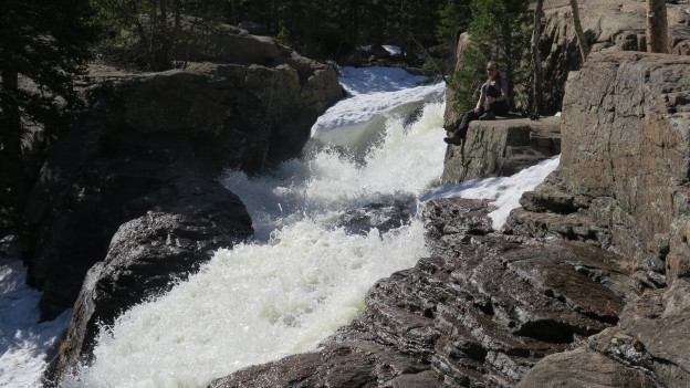
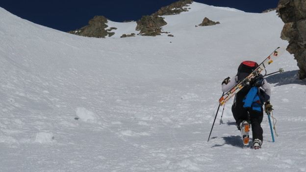
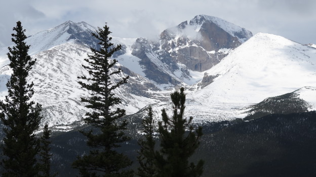
We checked the living daylights out of the forecast, saw that there was a chance of showers and thunder around 2PM and settled on a turnaround time of noon.  We hit the trail at quarter to 9AM, summitted at or before 11AM, took stock of the brooding, dark clouds, and hightailed it out of the alpine.  As soon as we hit treeline we were greeted by an unmistakable blue-ish flash and a near-contemporaneous crack.  We hit the deck, no doubt far too late to make any difference to mother nature, cinched up our pack suspensions and hauled ass downhill as fast as wet snow and micro-spikes will allow.  Our new friend Rolling Thunder followed us downhill for a good mile or so before we began to feel comfortable with the level of risk.

To make a long story short, we were not struck.  We did, however, capture some cool pictures of the ominous skies and swirling clouds between running for our lives and wondering whether or not NOAA is to be trusted in the future…

IMG_5015 IMG_5020IMG_5026 IMG_5027 IMG_5032 IMG_5033


profile (1)

The Loch

Hinge season in Colorado Rockies!  Honestly, I usually have a tough time with the end of winter, but between the great hiking conditions and steep skiing opportunities, there’s not much to complain about.

A couple weeks ago Kelly and I shot up to RMNP for a casual hike out to the Loch.  You depart from the Glacier Gorge trailhead off of Bear Lake road and follow a moderately ascending trail past numerous stunning vistas. Herein lies the magic of hiking in these parts: in New England (what I’m used to, and my point of reference for much mountain-sport), grand and sweeping views are usually only had at the top of a mountain. Out here, with the relatively thin foliage and close proximity to treeline, you quickly find yourself in the realm of the breathtaking. Thus, a casual stroll uphill terminating nowhere near the summit of anything can easily result in scenes worthy of Ansel Adams’ attention. It’s almost too easy!


profile

So what do you get for 1200′ of climbing over ~3.5 miles?  Behold!

#rmnp #mountains #timelapse #hiking with @kellyahowie

A post shared by Brian Sweeney (@briangsweeney) on

That’s the frozen Loch where we had lunch and took in the view for an indulgent length of time: it was like 60 degrees after all!  For the more ambitious, it’s possible to proceed up the ravine toward Sky Pond which is supposed to be equally beautiful, but we were satisfied our first hike of the season and turned around here.

My usual M.O. for drafting these posts is to present media in chronological order, or occasionally to organize photos and videos for maximum thematic impact.  For this one, I have no such compunctions!  Cutting to the climax, spectacular as it may be, was hardly culpable when viewed next to splendor, of basically the entire rest of the hike.  Check out some highlights from the approach, below…

IMG_4873IMG_4881 IMG_4884 IMG_4888IMG_4893 IMG_4901 IMG_4903 IMG_4909 IMG_4912 IMG_4914 IMG_4929 IMG_4938

IMG_20170513_111252 IMG_20170513_111748 IMG_20170513_124218

Notchtop Couloir

After over a year of ogling, I’ve finally managed to tick off a big line in Colorado.  Various recon trips, scenic car rides, and guide books had stoked my fervor to get after some burly skiing, and with Kelly’s encouragement to go do something crazy without her, I started poking around on the internet looking for a backcountry shred crew.

The Boulder Backcountry Ski and Snowboard Facebook group delivered in the form of two dudes from Boulder, Joe and Aidan.  I was lucky to have these guys along; they were experienced with the Colorado snow pack and pushed for an earlier start time than I would have guessed was necessary.

We hit the trail at Bear Lake around 5:30 AM, and summitted around 9:30 AM – not a moment too soon as the snow was quickly starting to warm up.  No roller balls just yet, but it seems like things were going in that direction.  The return trip was slow going due to the warm snow and the handful of sections of melted out trail close to Bear Lake, but it was worth it to be able to stand on top of a gnarly mountain and then fly down it!

profile

IMG_4812 IMG_4814 IMG_4825 IMG_4853 IMG_4858 IMG_4860

It’s Like Melt-Refreeze-Sastrugi

Kelly and I went out for a birthday sojourn in RMNP and found some really exotic snow conditions. I really can’t describe it any better than I’ve done in the title. This weird substance didn’t dominate the slopes but it certainly injected itself here and there just to add some spice to our Flattop descent. We departed from Bear Lake at the lazy our hour of 11 AM and headed up the trail per usual, but rather than following the normal approach that leads directly to the bottom of the banana bowls, we decided to follow the Flattop Trail. It’s summed up best as the scenic route: it is not the direct route by any stretch, but the views on a clear day are second to none. In fact the approach, despite being the inefficient route, was the highlight of the day.

As shown in the map, the ascent hugs the southern ridge of Flattop.  Each subsequent switchback provides a new and spectacular view across the valley toward Dream and Emerald Lakes, and Hallet, Otis, Thatchtop and finally Long’s Peak.  The clear skies and low winds left us with some of the best viewing conditions we’ve ever had in RMNP, but the relative exposure probably means that for most trips up this trail you wouldn’t want to linger for long: there’s almost no shelter from the prevailing wind.

IMG_4729

Long’s Peak

IMG_4730

I’m quickly developing an obsession with this mountain…

IMG_4732

Notchtop from Flattop. I’ve got my eye on that big line in the middle…

vlcsnap-2017-04-04-20h15m03s505

Just look at this jacked up snow…

vlcsnap-2017-04-04-20h19m42s615

It’s worth if for the scenery though…

vlcsnap-2017-04-04-20h24m27s887

Can’t ever have too many cameras!

IMG_4737 IMG_4757 vlcsnap-2017-04-04-20h26m34s468