The weekend following the Bigelows I was planning to visit my sister up in Burlington. Originally I’d wanted to do a brief overnight, but due to the weather and a slight lack of time, we turned it into a nice day hike.
Camel’s Hump is Vermont’s third highest peak, but it seems there might be a bit of debate over that. I didn’t get a good look at the distinct shape until I was heading back to Boston, when it was clearer, but it stands clearly above the surrounding mountains. Unfortunately I failed to get a good photo of it before it was out of sight.
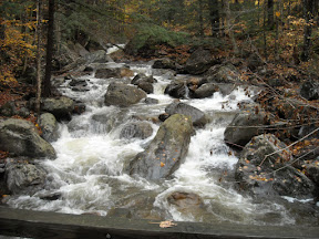
The previous evening it rained pretty heavily, but luckily we only caught wind and fog. We started on the western side, on the Burrows trail, with a link up to the Long trail. I’d read that the eastern Camel’s hump road was still closed after damage by hurricane Irene. The western side ascends a little more steeply, but it made for a great hike, and despite the fog we caught a few good views. The peak had a stiff wind, but as we descended, the sun came out and it turned into a beautiful fall day.

One of the few breaks in the clouds.

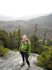
Not much to look at behind me.

My sister next to the survey marker on the peak.
In the end the hike was the perfect length. We got to stretch our legs and still have time to head in to Burlington for an afternoon lunch.