Deal Daemon – Android Apps on Google Play:
Deal Daemon version 2 is available in the Play Store! Check it out! Here are some screens:


Deal Daemon – Android Apps on Google Play:
Deal Daemon version 2 is available in the Play Store! Check it out! Here are some screens:
On the surface, this post is almost silly. But I assure you, the only thing silly about it, is that the industry hasn’t gotten their act together and done this themselves. Alas, the industry is frequently swayed toward form before function. Anyhow…
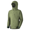
…If you’re wearing your ski jacket, then you’re probably wearing your gloves and you probably have all you can do to access all of the zippered compartments of your jacket or day pack with your maimed manual dexterity. They give you about an inch of string or fabric to clutch onto with a finger with is like two and half inches thick. OK, I exaggerate slightly, but you get the idea.
There is a simple solution to this. Grab you’re favorite ski jacket, buy a few feet of p-cord from your local mountain shop and tie longer zipper pulls onto each of the zippers. If you plan to be outside for more than a few hours at a time, you’ll thank yourself that you have arranged your gear in such a way that you never have to remove your gloves.
 |
| Cut about 8 inches of p-cord off and loop it through the metal zipper tab. |
 |
| Tie the biggest burliest knot you can so that you’re gloves or mittens have more surface to grasp onto. |
 |
| I’ve used an 8-knot because it’s easily tied, neat, and bulky. They tend not to pull out too often either. |
 |
| As a backup measure and to add extra surface area, I tied a second 8-knot with the slack ends of the p-cord. |
 |
| After you’ve cut the p-cord, you can fuse the frayed ends with a lighter to prevent them from raveling. |
 |
| Check ’em out in action. This can be done with back packs, and tents too. |
 |
| These like the burliest gloves ever. And the pit zips are hard enough to get to with no gloves at all… |
And that’s it. Go play outdoors all day without getting cold fingers!
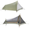
Gear List (click links for more product info):

After an entire week of sweating my face off around Boston, Rob, Shane and I figured it was about time to head back up north for some cooler climes, fresh air and good old fashioned exercise. The plan came together at the absolute last minute, with details lacking finalization until some late hour of Friday night. Per usual, we reasoned that we’d better stock up on calories, so we hit the town in search of beers and burgers. Around midnight we skulked back to our respective apartments, set our alarms for 6:30 AM and crashed. Shortly after 7 AM we all rallied and set off for Lincoln, NH.
For those not familiar with the Pemi Loop, familiarize yourselves:
View Pemi Loop in a larger map
View Pemi Loop in a larger map
Ok, so here’s what you’re looking at. The Pemigewasset Wilderness (or Pemi, for short) is the large tract of land between I93, the Kancamagus and Rte. 302. In many cases, the word wilderness might seem a bit overstated. In the case of the Pemi, not so. There are many places in the Pemi that are basically a day’s hike from any sort of civilization with the only mode of transport being your feet. When you get out there, it actually feels like you’re in the middle of nowhere…it’s cool! The Pemi Loop is a 36 mile loop of trail, which essentially surveys the whole Wilderness. Much of it overlaps the AT and most of it is at elevation. In fact, only the 7 or 8 miles on either end of the loop are spent below 3000′. Totaling about 36 miles, the route is frequented by trail runners looking for a challenging, single-day distance run.
By contrast, we opted for a more casual two day pace: about 14 miles on day one and the other 20 or so on day two. We tried to pack as light as possible by bringing various ultra-light gear. Rob and Shane each used a Hennessy Hammock and I used my Sprite in it’s pitchlight configuration. We each brought summer sleeping bags, ultra-light mattresses, food, rain shells, water/purification equipment, and minimal miscellaneous equipment. I somehow managed to fit all of this into my North Face Off-Chute 26, all weighing in at 19.8 lbs! I’m sure people have gone farther with less, but I was pretty proud of myself…
We hit the trail about 10 AM on Saturday morning. The first few miles are an easy cruise along a former railroad bed. Eventually you come to the Osseo Trail which heads uphill toward the backside of Mt. Flume and Franconia Ridge. This is basically the last time you’ll be anywhere near the valley floor for the rest of the hike. We thought this was great for a number of reasons. Escaping the heat was certainly a concern. Gaining elevation quickly and hanging onto it for as long as possible tends to do wonders for morale – it seems as though you’re storing up potential energy that way… But, perhaps of greatest importance was the outstanding view of the surrounding wilderness offered from the high ridges of the Pemi Loop. One of our highest priorities on this trip was to produce as much documentation of ski-able backcountry lines as possible for the winter.
After a quick perusal of the incredible amount of photos and GPS data we collected, I realized that the ski beta probably deserves a post of it’s own. So… the rest of this entry will be a straight-forward trip report from our Pemi Loop excursion and a follow-up entry will recount all of our ski recon in a more concise and dense format.
And on that note, I’ll let the photos do the rest of the talking…
 |
| Rob and Shane at our first break about half way up the backside of Flume. As it turns out the back is nearly as steep as the front… |
 |
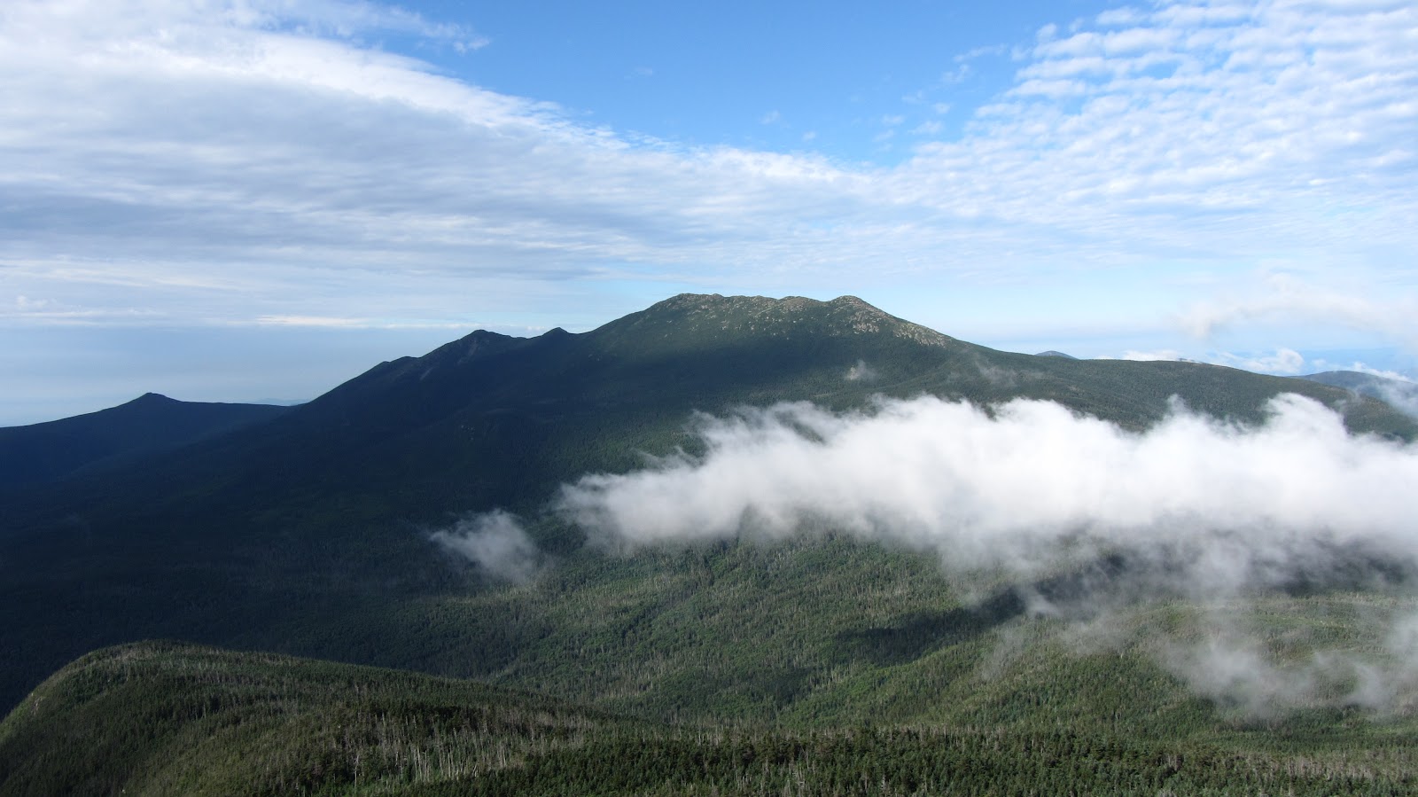
| Franconia Ridge: Lincoln and Lafayette |
 |
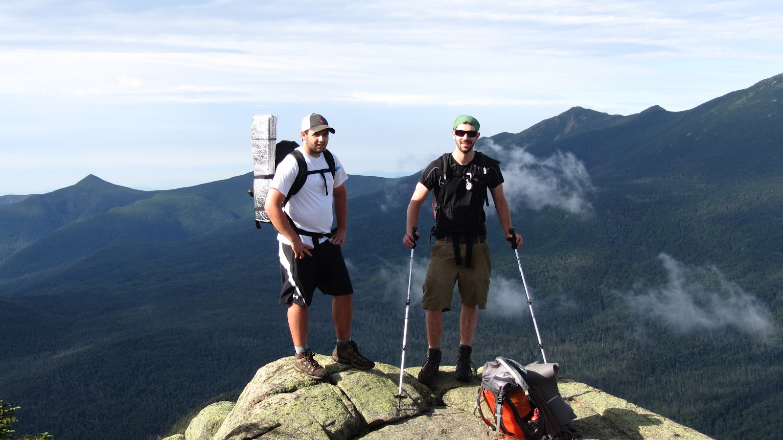
| Rob atop Liberty with the ridge in the background. |
 |
| The Ridge north of Lafayette. |
 |
| Our campsite should be down in there some where… |
Our campsite with the days progress in the background:
View Pemi Loop in a larger map
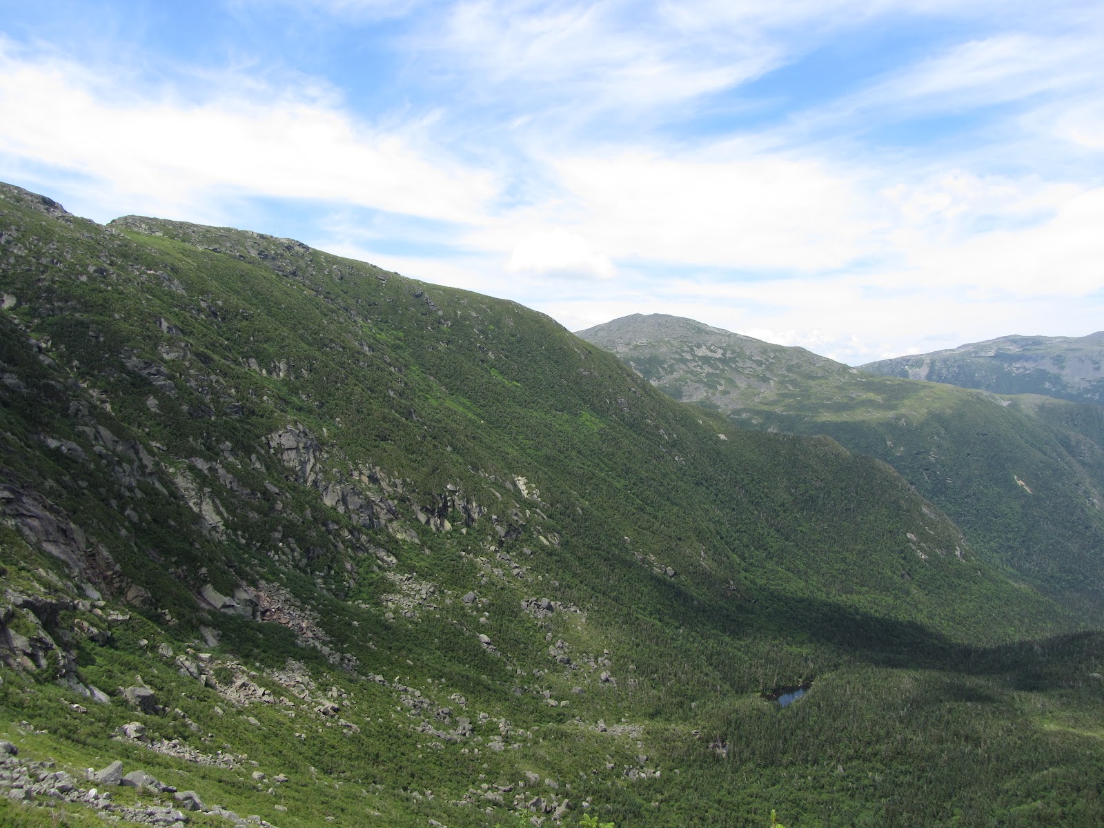
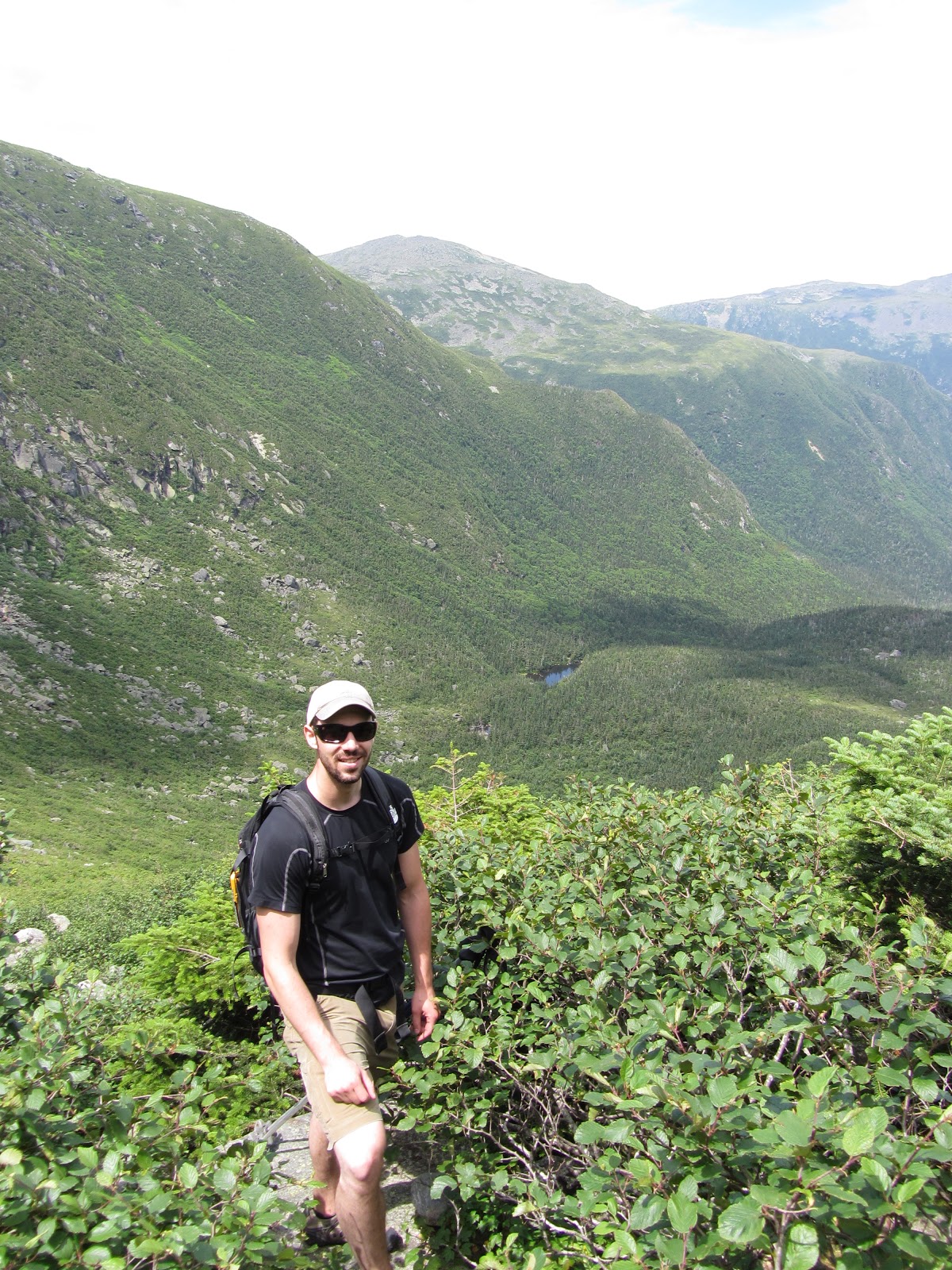
It took us a lot longer to get from Lafayette to Garfield Pond than we expected. You always intuitively expect the descents to be easy and fast, but frequently, as was the case here, the steep challenging terrain causes you to go even slower than the same slope would were you going uphill rather than down. It didn’t help that we had just climbed four mountains plus like three false summits.
As we got closer to the pond we began to worry that it might be obscured by dense trail side brush and that we might miss it. This concern turned out to be unfounded, as the pond is easily visible from the trail. In fact there are a number of reasonable (but totally unofficial) camps on either side of the trail right next to the pond. Just to be on the safe side we used an an altimeter in conjunction a topo map to get our rough location. For maximum accuracy, I was able to use Backcountry Navigator on my phone which uses the GPS and pre-cached map tiles to pinpoint your current location.
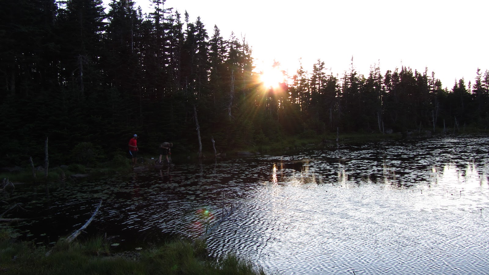
We arrive just before sunset and make our first priority water…
 |
| Rob and Shane at work with the water filter. |
 |
| Dusky pond. |
 |
| Sunset begins over Garfield Pond. |
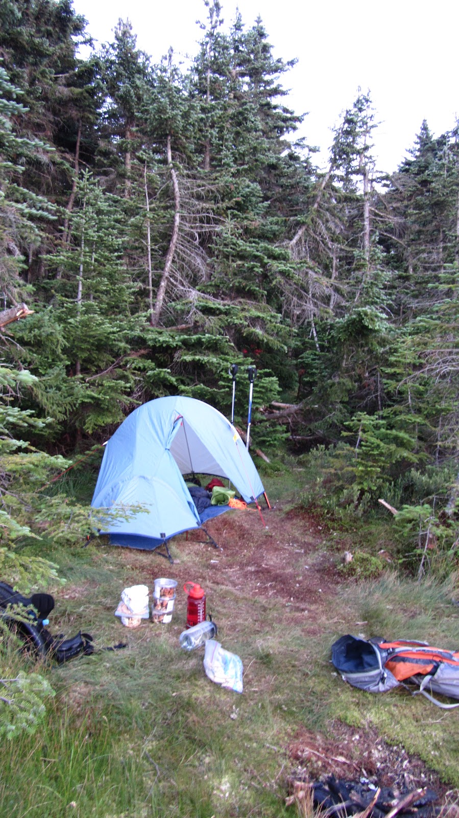 |
| Sprite 1 Pitchlight: ultralight summer comfort! |
 |
| The Hennessy Hammocks: pitch anywhere and sleep in comfort! |
 |
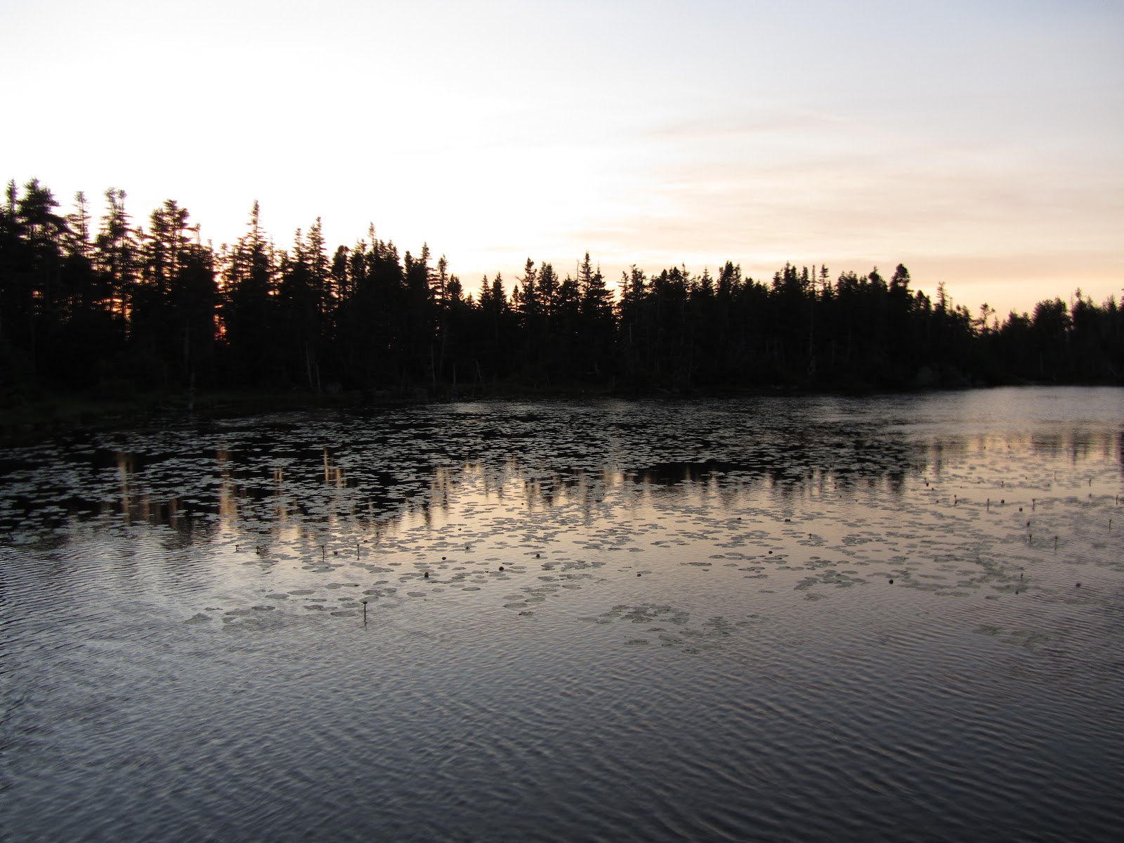
| A pretty solid sunset ensued… |
 |
| Ideal ratio of clouds to clear sky for maximum sunset action. |
 |
| Rob hoisting the food into a tree for the night. |
 |
| We awoke to wisps of cloud drifting across the pond. |
 |
| Looking back toward Franconia Ridge as we make our way up Garfield, early Sunday morning. |
 |
| Our first summit of the day: Garfield. |
 |
| Same thing… |
 |
| The Pemi from just below Garfield. |
 |
| Owl Head and The Pemi. |
 |
| The precipitous scramble down from Garfield, and a good example of why descending frequently takes a long time. |
 |
| The ridge up on top of Guyot. |
 |
| The three of us at the summit of Guyot. |
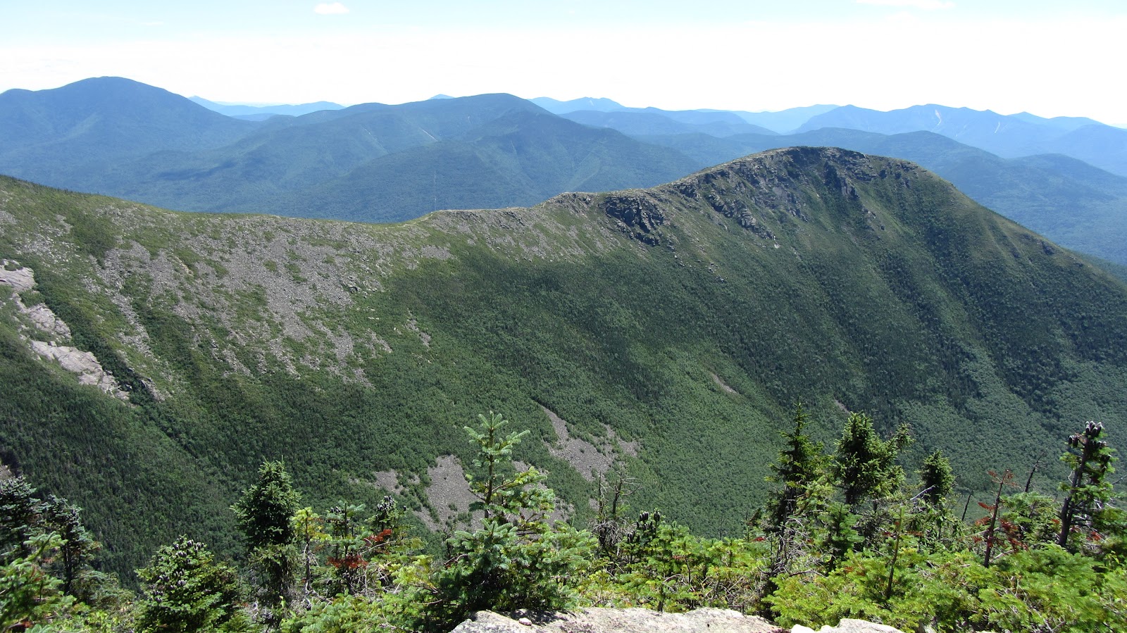 |
| Bondcliff. |
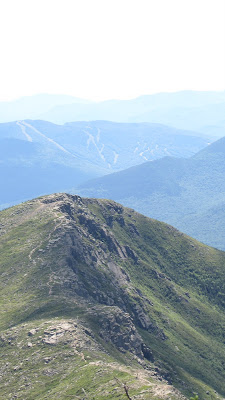 |
| More Bondcliff… |
 |
| Rob surveying the land in epic fashion. |
 |
| Ditto… |
Gear List (click links for more product info):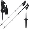


In an effort to escape last weekend’s heat, Rob, Ziehl and I literally ran for the hills. At the time of this trip’s original incarnation we actually had a decent sized crew signed up to attend, but one way or another, all but the three of us bailed at the last minute. We began to realize this while en route to our camp site Friday night. In light of these developments we began to wonder if something more ambitious than the original plan was in order. By the time we made camp and had cracked our first cans of Harpoon (yes, cans!) the plan had grown in mileage by a whopping 100%. But I’m getting ahead of myself…let’s rewind.
Our main objective was to satisfy our annual Huntington Ravine requirement. If you live in New England and like to climb mountains, this should be one of your annual objectives, as well. Its like a huge outdoor playground – it’s steep enough that it’s a technical climb in winter or wet conditions. In the summer it’s just plain fun.
Additionally, Ziehl and I were hoping to smoke test our tents in their respective ultra-light configurations: sans tent body, pitched with only the fly and footprint. The weather was expected to be fair and we would car camping at Dolly Copp Campground the night before the hike. It seemed like an ideal sandbox for testing gear before trying this out in the field without the benefit of an escape plan.
View July 2011 Huntington Ravine and Great Gulf Trek in a larger map
As we approached the campground on Friday night we began to hash out various routes down from Huntington Ravine. The obvious options were Lion’s Head, Tuckerman Ravine Trail, Boot Spur, etc… All of these are nice hikes, but on exceptional weekends such as this, they’re all bound to crowded. A fourth alternative became clear: hike out through the Great Gulf, find the AT and ramble back toward Pinkham Notch. The only real question was whether or not this would be feasible with a large group. As you may have guessed by now, this problem promptly solved itself. We made our camp, spec’ed out the mileage – about 13 miles, had a quick night cap and hit the sack under a bright full moon.
My Sprite 1 Pitchlight configuration actually turned out to be extremely pleasant – the tent actually becomes slightly more spacious, the lack of a tent body prevents condensation, the whole thing becomes extremely packable and it’s still fairly easy to set up. Here’s some wobbly video and a photo, just for posterity:
 |
| You can imagine some trouble in a hurricane, but I think for summer camping, this is going to be my go-to setup. |
We hauled ourselves out of bed around 7:30 Saturday morning, cleaned up our mess and made the arduous drive from Dolly Copp to Pinkham Notch – a grueling 3 minutes followed by about 5 more spent searching for a parking spot. We were on the trail by quarter of 9.
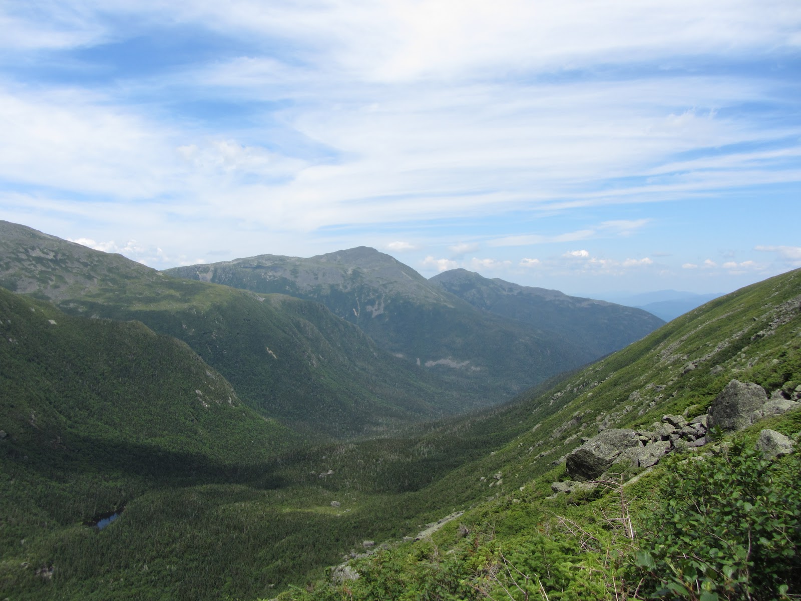
We flew up the Tuckerman Ravine trail in an effort to beat the crowds to Huntington Ravine, but as it turned out, more than just a few people had the same idea – and who can blame them? By the time we made it to the cutoff, I was rough shape – it was less than two miles of hiking, but I must have been dehydrated, out of shape or some combination therein. Either way, once we started to catch glimpses of Huntington Ravine my strength began to return. It’s an intimidating but surmountable challenge. Anyone with the slightest bit of adventurousness in them would jump at the chance to scramble up this cliff:
View July 2011 Huntington Ravine and Great Gulf Trek in a larger map
The view above roughly represents the perspective observed when you first begin to see the ravine through the trees on the approach. We took a break for some snacks and water toward the floor of the ravine and then charged up it. Unfortunately, in our haste we neglected to take any photos while in the ravine. Once at the top we took some time to relax in the cool breeze and snap a few photos.
 |
| Ziehl, and Wildcat in the background. |
 |
| Looking southeast over the Ravine. Photo credit: Ziehl |
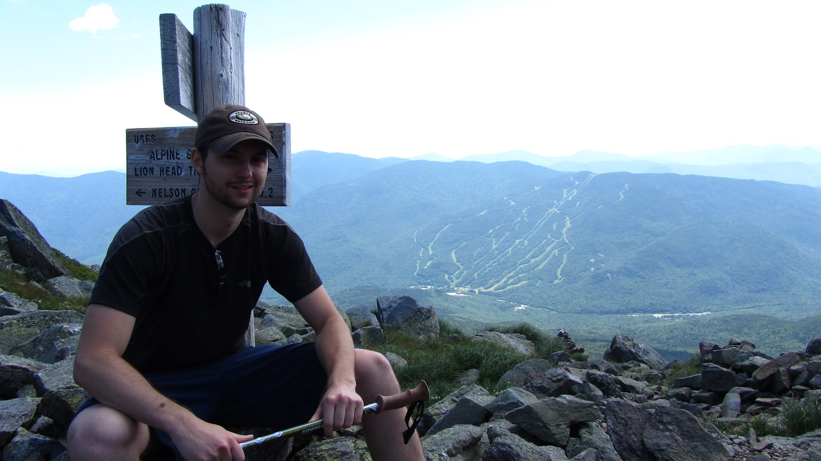
After catching our breath we headed up to the summit – a fairly short stretch of scree and pavement – where we enjoyed some summit beers, and trail mix. Once we were good and recharged, we filled up our water bottles and headed North, toward the Great Gulf. Behold:
View July 2011 Huntington Ravine and Great Gulf Trek in a larger map
 |
| Looking toward the Great Gulf. |
 |
| Ditto. |
 |
| On our way into the Great Gulf! |
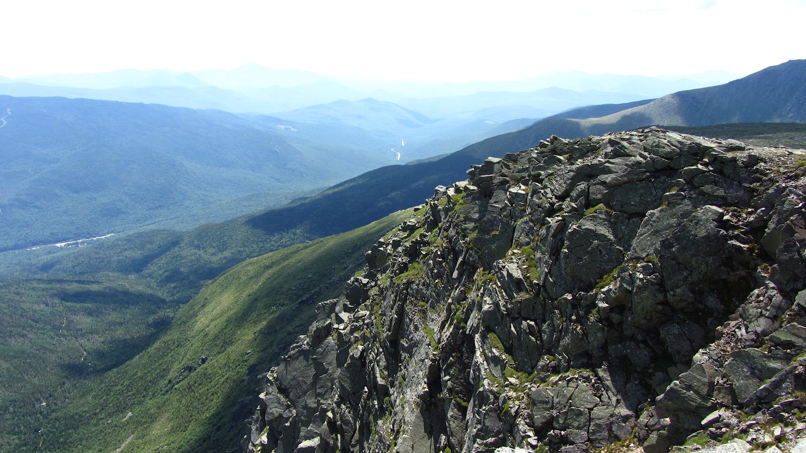
The trail basically plummets over the rim and into the Great Gulf. At some point during the descent Rob remarked that had we bothered to read the guide book, it probably would have advised us against down climbing this particular trail. It was steep, wet and full of loose rock. In any event, it offered us an excellent view of the Gulf.
 |
| Looking Northeast out of the Gulf. |
 |
| Same |
 |
| Ziehl. |
 |
| Me. Photo Credit: Ziehl |
 |
| The trail doubles as a waterfall in many places… |
 |
| Spaulding Lake |
 |
| Looking back up the ravine. |
 |
| This was a typical scene on the route out. |
 |
| Swimming hole! |
None of us had really spent much time in the Great Gulf, so this part in particular turned out to be pretty enjoyable, especially since we had ample opportunity to study the area before next ski season!
