Last month I was in serious need of some R&R before I joined the workforce permanently. It was the perfect time to visit my parents where they live in the Netherlands, for a European holiday.
Almost all the following photos were taken by my sister Elisabeth. At least all the good ones are hers.

A very Dutch photo, with a standard Dutch bike.
The majority of the trip was centered around good food and good beer, but we did a fair amount of exploring, especially on a four-day jaunt over to Deutschland. It was awesome to be back in Europe after almost seven years, and touring by car and experiencing more of the day-to-day activities gave me a fresh perspective.
As we headed to Nijmegen by train, The first thing I noticed was how flat the Netherlands is. I knew it was flat, but it is another thing to see the endless fields and orderly rows of trees. The highest points of land seemed to be mainly dykes and highway bypasses.

Orderly trees on a hiking trail near Malden, the Netherlands.
The trip got off to a nice leisurely start. I went for a bike ride with my Dad and got a feel for the Dutch lifestyle. Every one of the Dutch owns several bikes, and usually get their first bike around 5 years old. No one wears a helmet, which astounded me. Another major change is that bikes have the right of way over pedestrians and cars, so almost everywhere the cars must yield at rotaries. Coming from biking in Boston this was unsettling–more than once I hit my brakes inadvertently.
Wijchen, where I was staying, being a very Dutch town, has both a castle and a mill.

The Wijchen working mill at dusk.
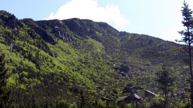
On the 18th I went for a walk in the woods. There aren’t many forested areas in the Netherlands, at least around Nijmegen, and I was struck by how young the trees were. The trails were wide, sandy and flat, yet still about as close to hiking as you can get without leaving the country. Many of the Dutch were biking on the extensive scenic trail network that connects most of the cities and towns in the Netherlands. Whereas around town most bikes have internal hubs and are more of a comfort style with upright handlebars, out in the woods I saw bikes more common in the US, with derailleurs and drop bars.

One of the oldest trees I found. Most of the trees in the Netherlands seemed very young.
That Saturday we drove off to south-western Germany to visit friends nearby Heidelberg. They were kind enough to put us up at their house and show us around. That evening I had the pleasure of enjoying my first Germany beer of the trip in Schwetzingen at the Brauerei zum Ritter. Though there aren’t tons of different hoppy microbrews like in the US, the Germans know how to make a great hefeweizen.

Gardens at Schwetzingen Schloss

Enjoying the unusually good weather

The most majestic peacock.

A very German, but inexpensive dish. Meats, including Saumagen…which is meat cooked in cow’s stomach. And of course sauerkraut.
The Neckar river valley near Heidelberg where we were is very picturesque, almost exactly as I remembered it. There are many Roman ruins dating back to before the common era. We hiked around some walking trails that were part of the Kunst weg (Art trail). It’s incredible that the Roman watch towers built as early as 1100 are still standing.

A Roman Watchtower on the Neckar, partially restored

Looking down from the Schwalbe Nest onto the Neckar

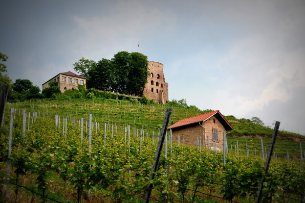
Vineyards on a hill outside Schriesheim

This hillside quarry looked like it had some sweet climbing. Apparently there are 3 tiers to it.
We visited Koblenz on our way back to Wijchen, a city that both my sister and I had been to on our Germany exchanges. However, this was the first trip my family has been overseas together in many years. In Koblenz is the Deutsches Eck, where the Mosel joins the Rhein, and the site of an enormous statue of Emperor William I, as well as several pieces of the Berlin wall. It’s quite a tourist attraction, but also a cool place to check out. Besides the statue, the surrounding monument stands as an aspiration for German unity since the country was divided, then reunited.

William I monument at the Deutsches Eck
Unfortunately the trip was over all too quickly. We spent a bit more time in Wijchen and also an afternoon in Nijmegen. Anyone who has seen the movie “A Bridge Too Far” might recognize the Nijmegen bridge that is crossed on the way to the Arnhem “bridge too far”. The movie depicts Operation Market Garden, an unsuccessful Allied incursion during World War II.

Nijmegen bridge.
We took the train to Amsterdam the Sunday before we left. We managed to go on one of the several Dutch holiday weekends in May, and it was pretty busy. Again I was surprised that no one even in the city wore a helmet while biking–the bike lanes didn’t seem nearly as safe on the narrow streets packed with tourists not watching where they were going.

I Amsterdam
We took the obligatory boat tour, which gave us a quick overview of the city and its history, then decided to head for the Heineken brewery tour. On the way we passed many of the famed Dutch “coffee shops”. The brewery, though no longer in use, was pretty cool, and Heineken did everything they could to teach you, not just about their beer, but about their company’s advertising. Even so the beer was tasty and the motion ride in the POV of a beer was unique. We were near the I Amsterdam statue afterwards, so we headed to the museum park to see it. Although Amsterdam was interesting, it wasn’t really for me partly due to the number of other tourists we encountered.

Inside the Heineken Brewery.
We spent the last day in Xanten, the only Germany city that begins with X. Next to the city is the excavated Roman town of Colonia Ulpia Traiana. The town was active between the years ~70-400 mainly to support a Roman military base. At one time 2 of the 28 Roman legions were stationed in CUT (Xanten), which accounts for around 10,000 soldiers. Though there were bits of the city, including a restored Amphitheater, the highlight was the museum with Roman weapons, tools and preserved baths excavations.

Partially restored temple in Xanten
I don’t think Xanten is a typical American tourist location, since I believe we were the only ones speaking English there, although all the information was in several languages.
I’m already making plans to return for a different sort of trip next winter, so I’ve got a few months to brush up more on my German.