Category Archives: Skiing

Franconia Ridge

Having been confined to lift serviced terrain thus far in the season, Rob and I decided it was about time we ventured into the backcountry.  Specifically, we chose to ski Lincoln on the western slope of Franconia Ridge.   We arrived at the Lafayette Place parking area around 7:30 am.  After a solid 20 minutes of messing around with our gear, we were on the trail.  It was bright and clear, the wind was still and it was about 10 degrees: perfect skinning weather!

Here’s an overview:

View Franconia Ridge in a larger map

We shot off down the the Old Bridle Path toward the Greenleaf Hut, shedding layers left and right despite the cold.  The plan was to follow that trail until it passed the bottom of the drainage and then follow it all the up to the top of the slides.  After about 2000 feet of vertical, we realized we had missed the cutoff.  on the upside, we got a pretty good look at the slides we were about to ski.

View Franconia Ridge in a larger map

We skinned back down the trail about 300 vertical feet, until we found the point where the trail comes closest to Walker Brook.  Once there, it was obvious that someone had hiked out of the woods on skis.  We should have known to follow these tracks when we first encountered them.  We quickly found the brook and followed a week-old skin track toward the slides.


Left: the bottom of the drainage and the slides in the distance.  Right: Rob and I skinning.

Eventually the pitch becomes too steep for skins, so we stash the skis and start boot-packing our way up the 1300 foot slide.  This was fun but a lot of work.  The snowpack was mostly powder, but every now and then we’d find some crust or ice, and in many places we were scrambling over larger rocks that were buried just beneath the snow.  For much of the way up we were in thigh deep powder.  The ascent was about 35 degrees sustained and we had to use our poles to ladder up for nearly 50% of the time.

This was my first time hiking in my new North Face Off Chute 26.  When I first found it, I pretty much concluded that this thing was the perfect winter day pack and my conclusion still stands.  I was able to get all of my technical gear, extra layers, food and water into it and it still carries pleasantly.

Rob scrambles upward – I still  owe him a case of beer for
 breaking trail most of the way.

By the time we got to the top the skies had socked in and it had begun to snow lightly.  The wind was blowing steadily, though thankfully not too hard.  Even so, it was still pretty cold, so we scrambled to get dressed and ready for the descent.  On the way down, we alternated between taking fresh tracks and working the cameras.  Check it out…

Rob, wrapping up his snow pit and packing his bag.

A quick review of the run.

Rob, ready to slay pow. 

Killin’ it.

Rob disappears behind a small drop, in a cloud of smoke no less.
He talks me into dropping it shortly after…

Me looking like a fool…

Rob shreds up a nice pitch.
Many have already correctly observed that I was on the verge of experiencing cardiac arrest during the filming of this line.  This is hard work, we just climbed straight up a mountain!  I attempt to redeem myself as seen below:

Ducking under a tree on the way out.

By now, we’d worked up a pretty serious appetite, so we went into town and got sandwiches.  All in all, it was a darn good day.

Gear List (click links for more product info):

Black Diamond Sabretooth Clip CramponsBlack Diamond Raven Ice Axe Gray, 55cmBlack Diamond Axe Protector Bd Orange, One SizeBlack Diamond Spike ProtectorBlack Diamond Guide Glove - Men's Natural, LBlack Diamond Trail Trekking Pole Cinnamon, One SizeBlack Diamond Havoc SkiBlack Diamond Ascension Nylon STS Skins One Color, 95mmBlack Diamond AvaLung IIBlack Diamond QuickDraw Tour Probe 190Black Diamond Deploy 3 Shovel Cinnamon, One SizeBackcountry Access Tracker DTS BeaconBlack Diamond Whippet Self-Arrest Ski PolePOC Lobes Goggle Black/White, One SizePOC Synapsis 2.0 HelmetBlack Diamond Factor Alpine Touring Boot - Men'sFree Shipping on Orders over $50

Head Monsters, Marker Dukes, Mad River Glen, Jay Peak and La Niña…

…Are all my new favorite things.

Northern Vermont got blasted with snow last week and over the weekend. Mad River Glen and Jay were both 100% open so we packed the car and headed north. MRG had been mostly closed during the week, so we figured we’d hit MRG on Saturday for some fresh tracks, and then migrate up to Jay on Sunday to take advantage of the overnight snowfall they were expecting.


I’d never been to MRG before, but I’d heard the stories: they have a single (chair lift), don’t do much in the way of snow-making or grooming, and they still don’t allow boarders. Additionally, from a brief chat with a patroller, Rob discovered that ropes and closed signs at MRG are kind of like stop signs in Italy: more of a friendly suggestion. This all made for some exceptional tree skiing: scratchy in places, but mostly knee deep powder with deeper drifts. The woods there are both tight and steep. We spun around 8 laps in the woods before we ran out of gas around 2 pm.

Jay got nearly a foot over Saturday night, and fortunately for us (but not so fortunately for every behind us) we managed to get the first chair up. We were among the first people to hit the woods to far skiers left (Beaver Pond and Andre’s). Again, there were a few bares spots, but mostly it was knee deep powder, with thigh deep drifts no uncommon. It snowed all day, and we continued to find fresh tracks until our last run of the day, just past 3. Behold:

Be envious!

Plenty of snow left by the afternoon…

Of course, in order to best enjoy these epic January conditions, a sweet pair of powder boards are necessary.  Thanks to Quiver Killers, I was able to pull my Dukes off of my BD Havocs and plop them onto my Head Monsters with relative ease the night before.  At 193 cm long and 95 mm under foot, the Monsters are, well just that: monsters.  When I first pulled them out of the box like two years I began question my judgment in buying such a pair of skis on the East Coast.  And then they sat in the corner of my room while I decided what to do with them.  The excellent snow conditions over the weekend prompted me to pull ’em out and take ’em for a spin.  It took me a run or two to figure out how to handle them in the woods, however due to a variety of factors, I found them to handle nearly as well as a significantly smaller ski.  The Monsters are exceptionally light, even for their size (in fact they are the lightest of all of my skis).  Coupled with the snub-nosed form factor of the Dukes, the whole setup keeps a very low moment of inertia.  I found that this really lets me throw them around quickly.  The Dukes are mounted well aft of center which allows me to pivot on my heels quickly and easily, and the added length up front lets you keep an aggressive forward stance.  All in all, they could hardly have worked out better.  I can’t wait to take these beasts out west…

The Vermont sunset on the way home from Jay.

Guyot Backcountry Skiing Recon

Rumor has it, that there is some truly great backcountry skiing nestled deep in the
Pemigewasset Wilderness of the White Mountains.  My partner in crime Rob, did much of the background research, citing viewsfromthetop and the TGR forums as his main sources.  Two sizable and steep bowls punctuate the southwestern flanks of Guyot.  Unfortunately the nearest road (in winter at least) is no less than 8 miles away from the either of the bowls.  In winter it would likely take the better part of a day to get there, making the minimun reasonable trip length 4 or 5 days: one to get in, one to get out, and 2 or 3 days spent skiing and camping at the base.  The goal for the weekend was to ‘swing’ by Guyot, scope out the skiing and assess the whole plan for feasibility unencumbered by winter gear and while conditions are still mild.

View Guyot Recon in a larger map
In order to fit this whole thing into one of the shortening days we’ve been experiencing, we came out of hibernation at the ripe hour of 4:30 on Saturday morning.  (Actually the plan was to get up at 4, but my alarm happened to have AM and PM reversed and Rob’s had some similar problem.  I just happened to roll over and see that time around 4:20 AM.)  We arrived at the trail head around 6 AM and were on the trail shortly thereafter.  The sun had just recently crept over the mountaintops.

The first leg of the approach is literally pretty straight forward.  You head north along the Lincoln Woods Trail and eventually the Franconia Brook Trail.  These trails are formerly a railroad bed used for logging in the late 1800s.  The remaining ties and several bridge footings can still be seen for most of the way.  As you might expect this part of the hike isn’t that challenging, however it is a pleasant walk alongside all sorts of rivers (notably, the Pemi and Franconia Brook), ponds, and marshes.  It’s prime moose country and we even saw some tracks on the trail, highlighted by the light dusting of snow and frost.

View Guyot Recon in a larger map
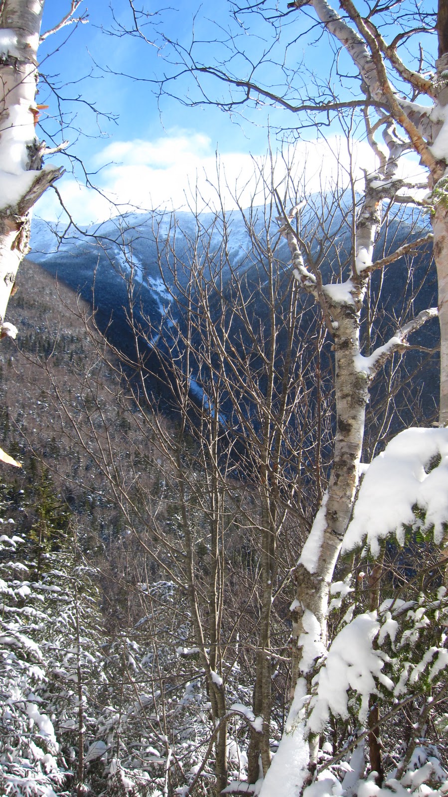
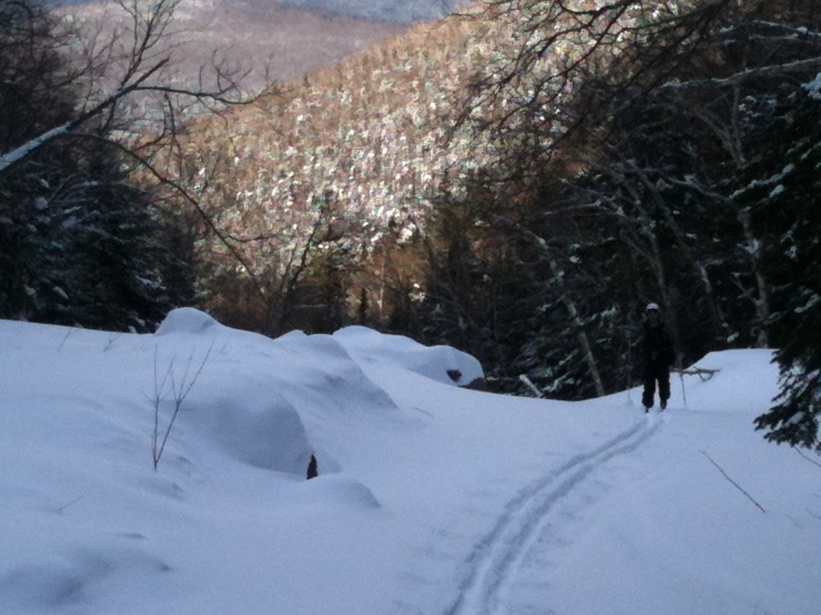
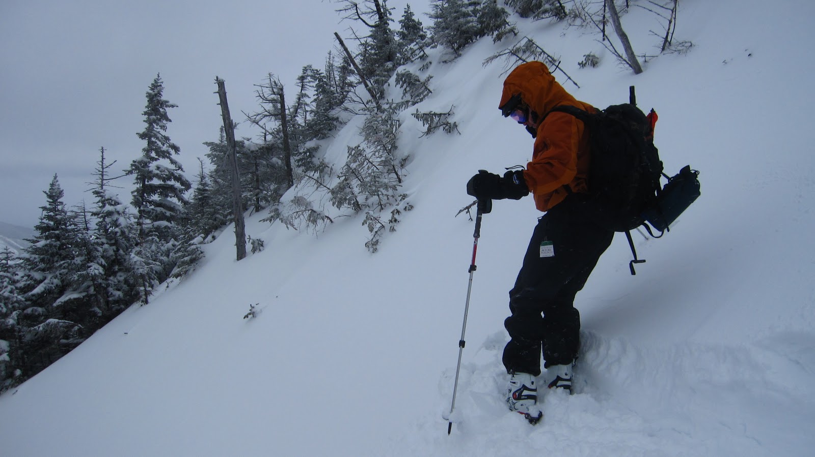
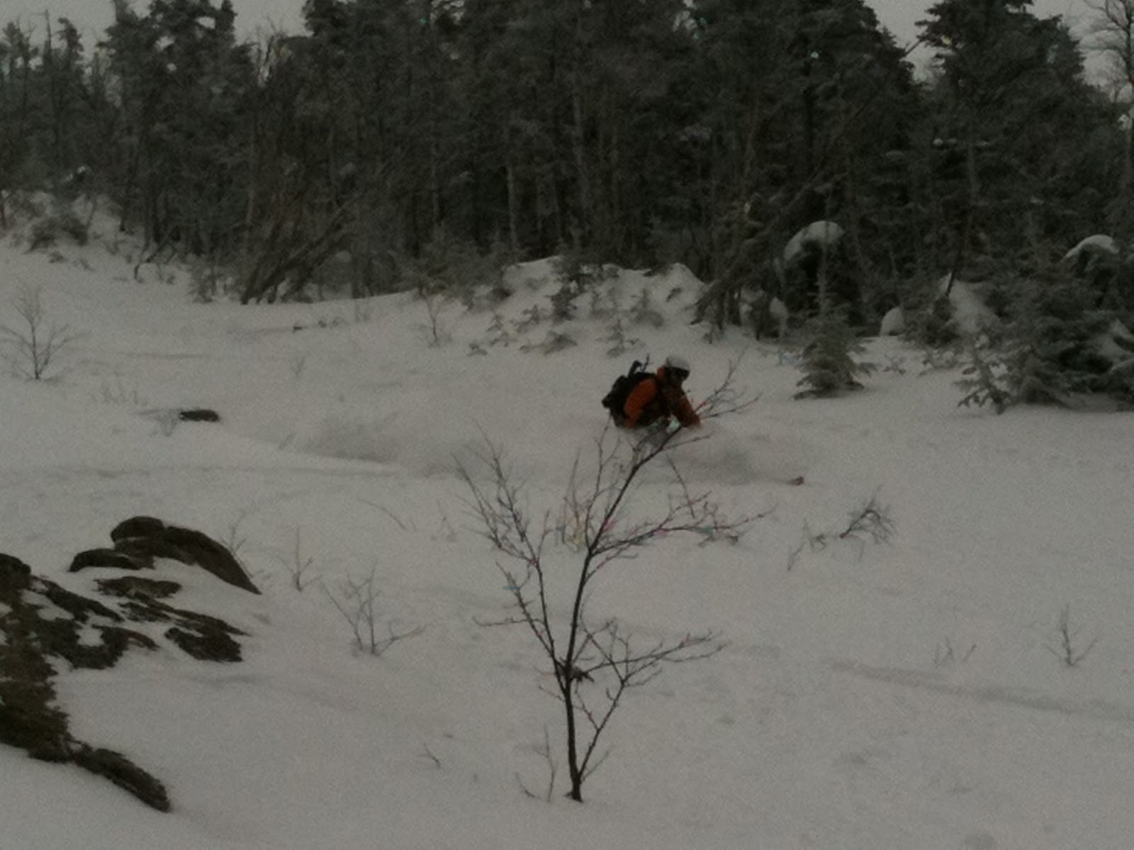
Redrock Brook marks the cutoff point for leaving the trail and heading off toward Guyot, at which point you turn Northeast and follow the brook into the bowls.  We made fair time on the 7 mile approach, arriving at the cutoff point in about 3 hours.  Having achieved only several hundred feet of elevation, the brunt of the trek was still ahead of us.  We had several miles of bushwhacking and about 2000′ of vertical remaining – none of it was on proper trail.  There are several abandoned logging roads and rail beds, however all of them are grown in and eroded.  In the winter the best route would likely be simply skinning up the brook.  We varied our approach, following the stream bed, animal paths, water runoffs and abandoned roads according to whatever seemed easiest.  At one point the stream runs almost entirely underground and you can just walk right up the middle of it.  However, for the great majority of the slog, you’re plowing through a morass of underbrush.  It was a challenge to say the least and our pace slowed considerably.

View Guyot Recon in a larger map
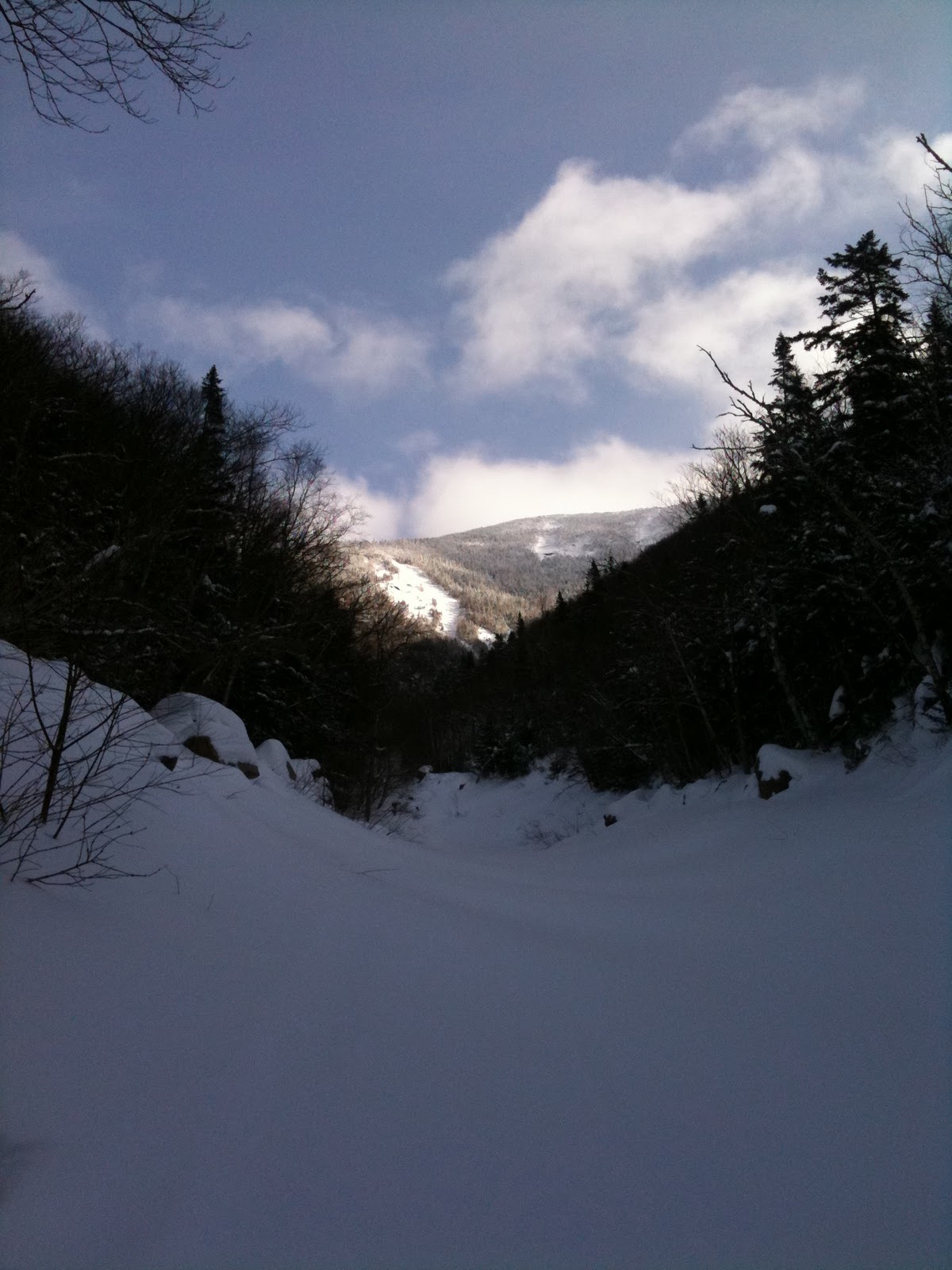
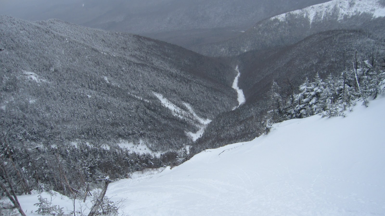
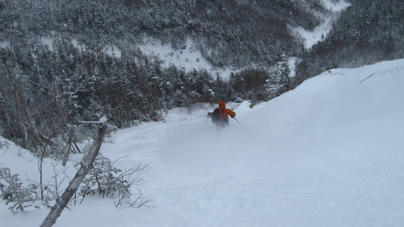
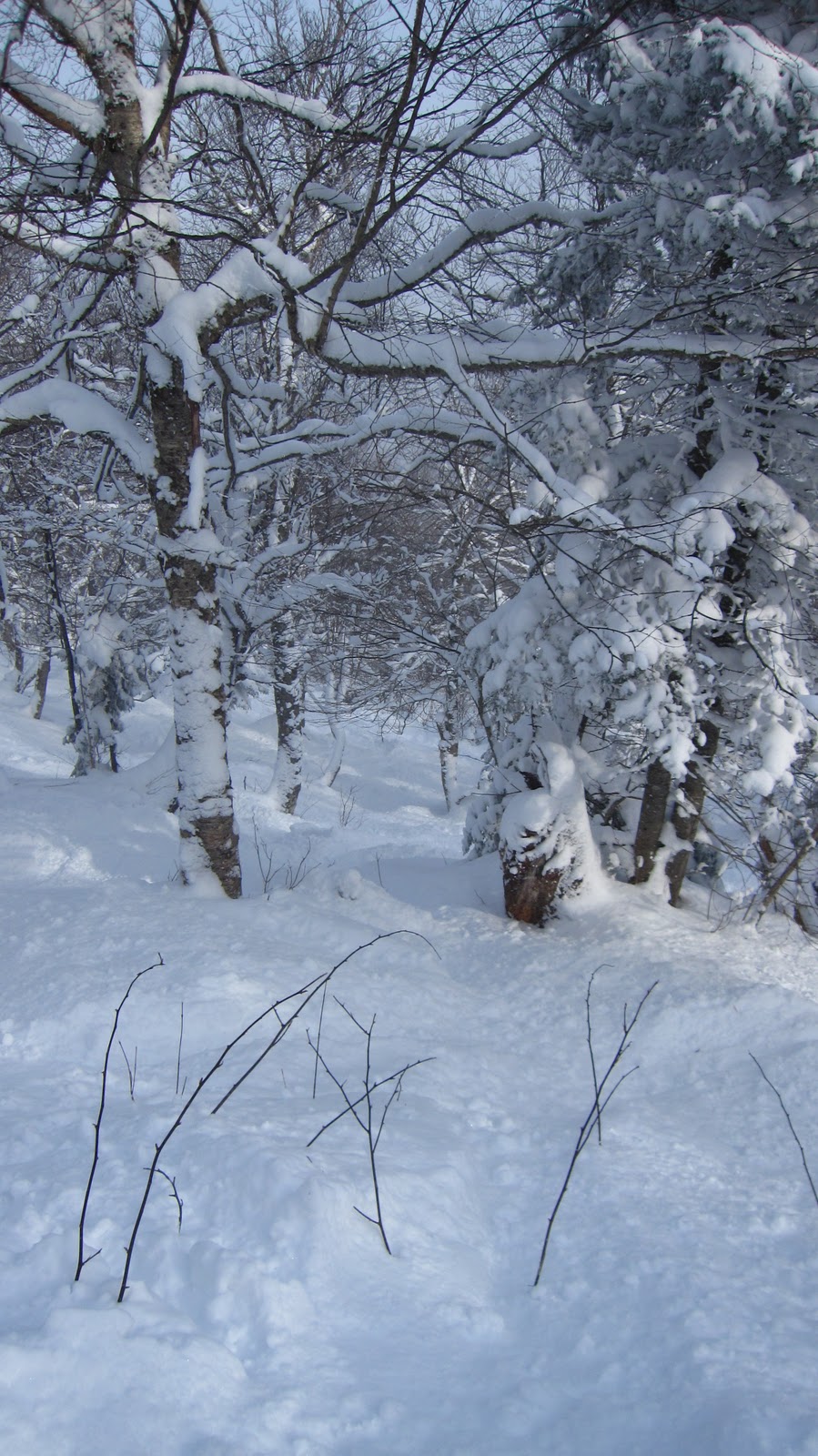
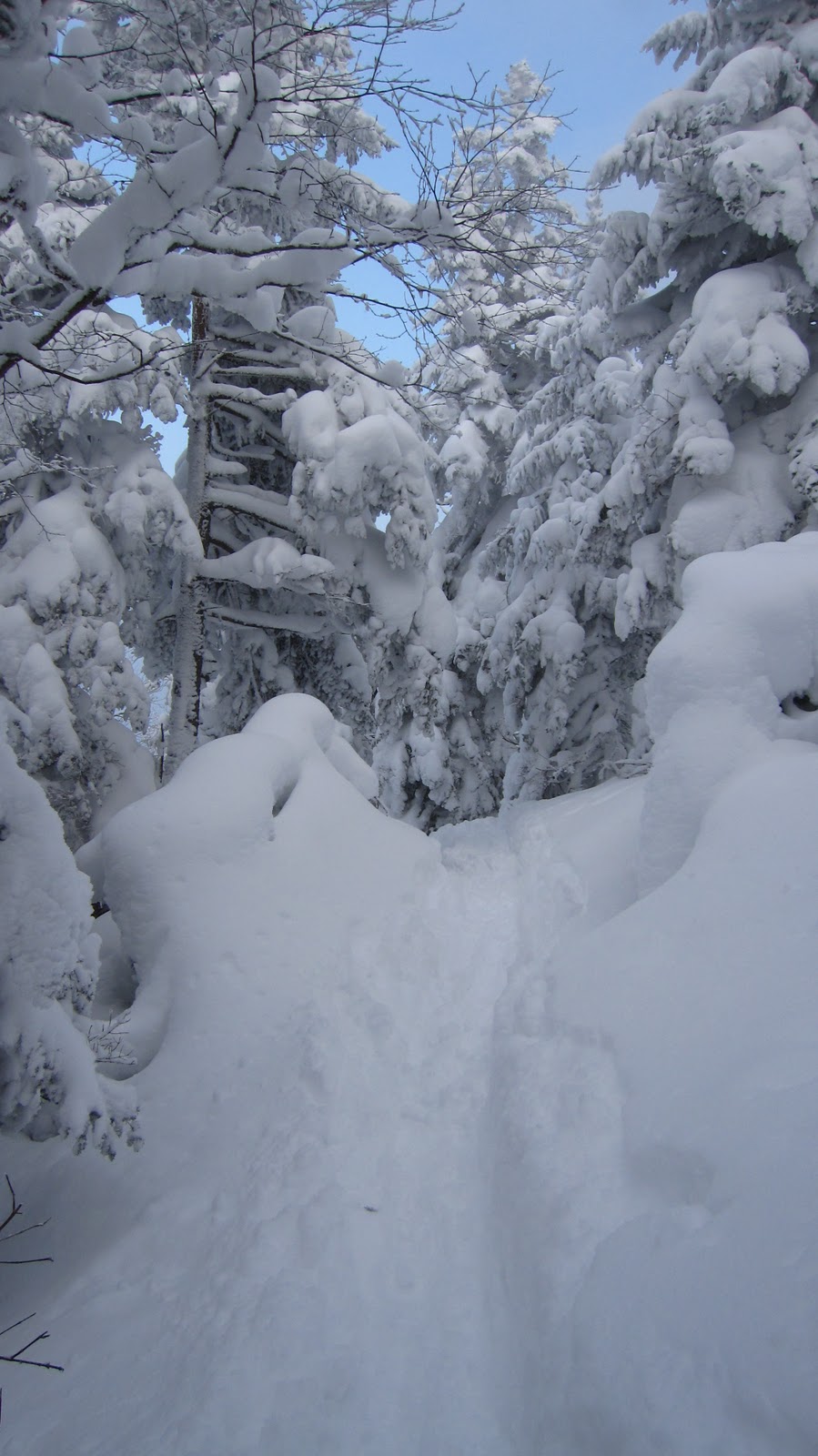
We started the day under cloudy skies, and as the day progressed it became party cloudy with enough sun to warm us whenever we stopped for food and water, however as we gained elevation and got closer to the bowls it was an entirely different story.  The wind seemed to funneling up the ravine into the bowls bringing with it plenty of cold and apparently moist air.  We made it within 300 vertical feet of souther bowl but by this time virtually all horizontal surfaces were coated in fresh snow.  The winds were outright howling and and snow was coming down pretty thick.  I was tempted to pull out some of goggles.  As we looked up the stream bed we could see that it became increasingly challenging: running water, snow, water ice, boulders, fallen tree…the banks of the stream were dense pine and spruce.  It was now past noon and we’d been on the trail for over 5 hours.  We had no idea what the weather was outside of the bowls, but it was a full blown blizzard where we were.  We decided to call it quits and head back just short of our goal.  It would take us another 5 hours at least to ex-filtrate and we would be lucky to be out before sunset.

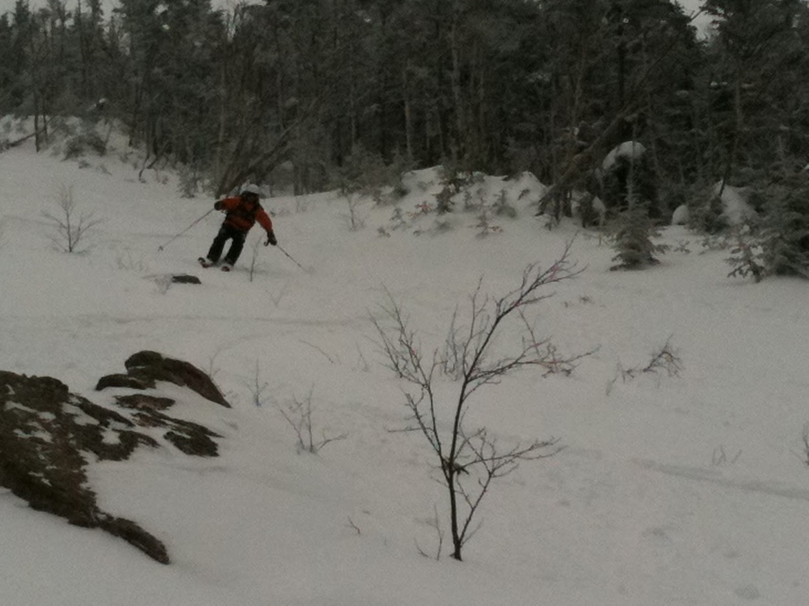
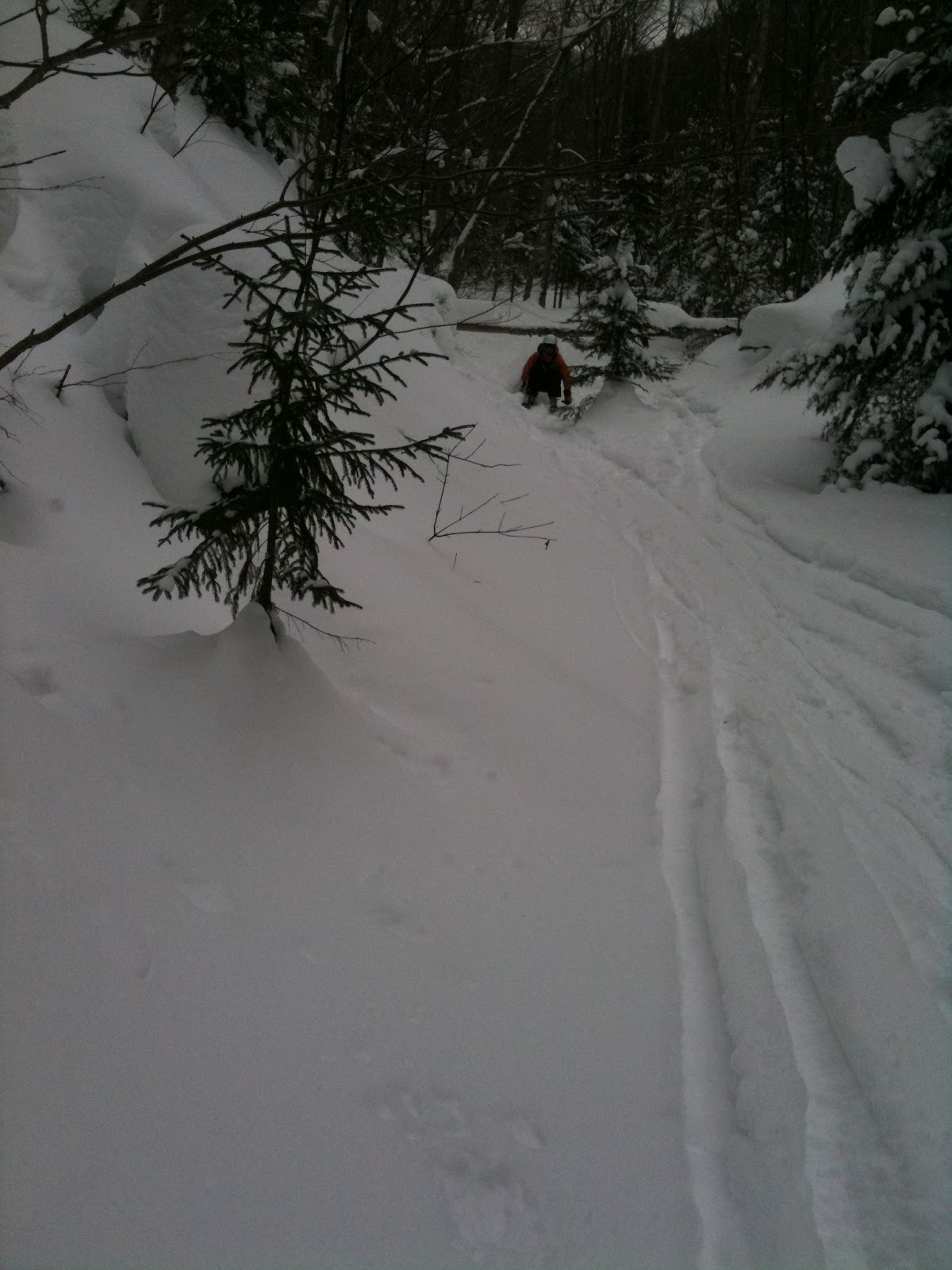
The slog out was basically the same as the slog in since we mostly just retraced our steps in the snow.  We tried to pick up some the abandoned roads which were reputed to be in the area but were not entirely successful in this endeavor.  We picked up the actual hiking trail around 3 or 4 and hauled back out to the parking area, just off the Kancamagus.  We finished around 4:30 PM after about 17 miles.

While we were unable to get a really good look at the skiing terrain, I have to claim that we accomplished our overall goals.  We know the skiing will be great just from looking at topo maps and satellite imagery.  The real unknown quantity was the hike into the area, which we now have a very good feel for and have learned many things from.  Given the length of time required to get there we can’t really consider going for less than 4 days.  Three would work technically, but it seems like a lot of work for only one full day of skiing.  Given the duration of our stay in the this exceedingly remote area and the amount of food and other supplies we’d need while there, using sleds or ski-pulks would be mandatory.  We’d skin nearly the entire way in.  By storing the gear in a duffel lashed to the sled, we would have the ability to carry the entire apparatus short distances for any areas that prove unskinnable, though those would seem to be infrequent given a deep snowpack.  An ultralight touring setup would go a long way toward easing our efforts on the way.  Something to seriously consider would be purchasing cheap X-country gear and using some kick-wax for the entire approach and hauling the alpine ski gear in the ski-pulks.

Some obvious safety concerns surround the entire trip.  It’s considerable remoteness would really force us to be completely self sufficient – if something were to happen we’d be a day away from help in good conditions.  Avalanches are a real concern as well, especially with no formal forecasting for that area.  We’d have to rely on our own limited forecasting skills and be prepared to make decisions accordingly.  We’d also have to be ready to prepare some really weather-proof shelters if the wind and snow are anything like what we witnessed on Saturday.  If we were to attempt such a trip, we’d have to wait for an ideal window of weather and avalanche conditions, free up an extended long weekend, prepare the pulks, maybe get X-Country gear, brush up on avy skills, be in seriously good physical condition and finally hope for the best along the way.  It would be a pretty serious undertaking but would probably be incredibly fun if well executed.

Gear List (click links for more product info):
Black Diamond Ascension Nylon STS Skins One Color, 95mmMountain Hardwear Expedition Duffel Bag - 3000 - 8000cu in Black, LFree Shipping on Orders over $50