Experience and Education

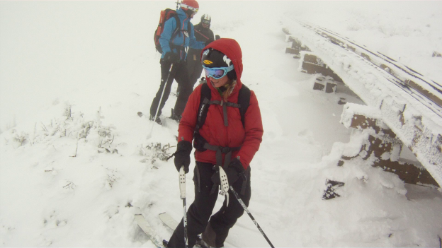
Sweeney and I often talk about how little you see of the education side of mountain travel.  Snow science and avalanche assessments are not the coolest content to be cramming into three minute clips of slaying lines or getting lost in powder.  Nevertheless last season I began to realize the importance of avalanche education. This season I set myself down the path of learning about it, culminating in the completion of an Avy Level 1 NSP course , a course which Rob and Sweeney took last year.

CameraZOOM-20130302115215837

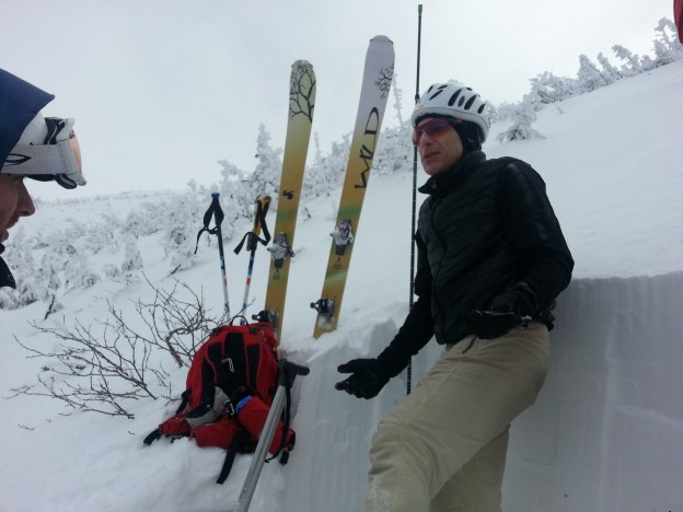
Jonathan discussing a snowpit’s results

There are a number of courses, yes, even on the East Coast, that offer instruction and in the field learning, and I can say I definitely learned great deal during the final portion of the course three weeks ago.  The course itself was a fair bit of work, requiring more effort than many of my college courses, though well worth it.  Our instructors, Jonathan and Mark had well though out lessons both in the classroom last fall and in the field, and I high recommend their course for anyone interested in backcountry skiing, which is what Sweeney said to me about the course last year.

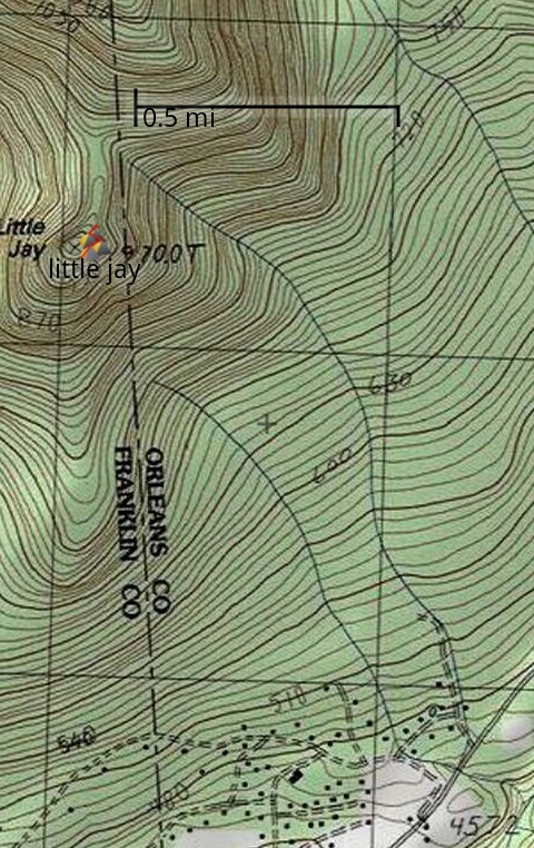
Our route plan took us up above Great Gulf, into Huntington and back down the Sherburne the first day, a extensive ski tour. The second day we went into Gulf of Slides to dig a snow pit and across to Hermit Lake before doing rescue practice to wrap up the weekend.

I took only a few photos of the weekend, although there’s a few of our course on Mt. Washington Auto Road’s FB page.

CameraZOOM-20130302125833112

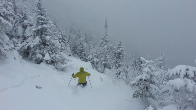
Our first ski leg off the Auto Road

CameraZOOM-20130303095119830

At the base of GOS

CameraZOOM-20130302094945707

Looking at the summit

A Cog-side Jaunt

With the grandest of plans in the makings for Sunday, Kelly, Shane, Ben and I decided to take a leisurely stroll up the Cog in search of soft snow outside of avalanche terrain on Saturday.  We surmised that the light East winds and recent snowfall would have loaded up the Cog pleasantly, so we went to investigate.  What we found was a decent amount of skier and snowshoer traffic, a bit less snow than we’d hoped for, and a bit more fog than would have been ideal for route finding above treeline…

All nitpicking aside, it turned out to be a decent tour.  After an 11 o’clock start, we pushed past treeline around 1PM.  We ate and drank, and considered our options: climb into the fog in search of snowfields or just ski the Cog.  With poor visibility and a late start, we opted to just enjoy the Cog rather than shamble around the summit cone in search of the elusive pow.  After a brief schralp through some wind affected crusts above treeline, we cruised a tracked, but soft Cog and enjoyed just about every minute of it!

vlcsnap-2013-03-05-18h44m43s241

Gear prep…

vlcsnap-2013-03-05-18h50m29s161

Gear failure…

vlcsnap-2013-03-05-18h59m06s242

Ready for action!

vlcsnap-2013-03-05-19h01m35s22

Low vis.

vlcsnap-2013-03-05-19h18m00s76

The good part…

vlcsnap-2013-03-05-22h31m19s44

vlcsnap-2013-03-05-22h29m27s193

vlcsnap-2013-03-05-19h18m43s245   vlcsnap-2013-03-05-19h30m56s168

vlcsnap-2013-03-05-19h35m47s36

vlcsnap-2013-03-05-22h26m27s83

vlcsnap-2013-03-05-22h35m50s213

vlcsnap-2013-03-05-22h35m19s184

vlcsnap-2013-03-05-22h31m38s207

Little Jay

This past weekend Mother Nature continued to bless us with a moderate “refresher” snowfall.  After lapping it up in the Jay inbounds, Kelly and I decided to mosey over to Little Jay in search of some untracked.  With the internet yielding a surprising lack of trip reports concerning our objective, we really were just winging it.  From asking around, we determined that we should park at the Big Jay parking lot, cross the street and follow a pretty obvious skin track up the mountain.  Armed with this scant intel, we set off in search of pow.

The skin track was well traveled and easy going the entire way up.  It brought us within about 50 vertical feet of the summit before dense foliage and steep, deep powder halted us.  We took in the view for a bit before descending.

littlejay

After a good look at the map and our surroundings, we realized that the only real way to screw up is to head too far toward skiers right, or W-SW off of the summit.  Such a course would dump you in the wrong drainage, a bit of a hike from the parking area and through who knows what sort of bushwhack.

We decided to trend a bit toward skiers right for a short distance and then push back toward the left of East, toward the two streams which would certainly deliver us back to the parking area.  In general I think this was the right idea, but we ended up too far into the stream bed which peters out into a bit of a mellow bushwhack.  In hindsight the best skiing would probably have been to skier’s right or West of the the stream bed.  The slopes in this region were tracked but plenty soft and getting free refills throughout the weekend.

Kelly gettin' deep!

Kelly, gettin’ deep!

One Year To The Day

It was one year to the day since I’d first skied Big Jay, and now we were back for more.  On such an anniversary day, we couldn’t let the opportunity pass us by.  In fact, it was the first day Rob and I met Jen, and we’d skied it together.  Rob, Jen and I got to the top of the line early in the day, and figured we’d take our time getting down and snap some footage.  I think our efforts paid off.

Group Photo

Some kind stranger snapped our photo, and didn’t snap up our line.

Rob Fox Big Jay 2

Someone told us it was all tracked.  Lucky for us that wasn’t the case.

Jen Big Jay

In fact, it was fresh and deep.

Rob Big Jay 3

Rob Big Jay 6

We switched off camera roles so we all had a chance to play.

Andrew Big Jay

Andrew Big Jay 2

One of my favorite things about leaving the resort is that it feels like you’ve suddenly been transported to a winter wonderland.

Jen Big Jay 2

Andrew Big Jay 6

Andrew Big Jay 5

Rob Big Jay 7

And when we were done we caught a ride back…

Jen Heading Back

Andrew Rob Heading Back