Coming Soon! Available here.

This post is part of a series.
The conditions on the final day were less than epic, and with our day-packs overloaded with extra gear, spare parts, extra clothes, trash, etc. we decided to just schuss straight back to Halfway via the snow-mo path and steal a few turns here and there as the opportunities presented themselves. The snow predictably grew heavier, wetter, and slower as we lost elevation culminating in literally skating and poling the final 6 miles out of the woods. Brad declared it to be torture, and Ryan dubbed it the trail of tears. I offered no argument here. We skulked back to Carson House, showered ate snacks and then made a hasty egress, across Oregon and toward a civilization rife with beer, pizza, more showers, couches and other amenities that we hadn’t realized we might miss so much.
 |
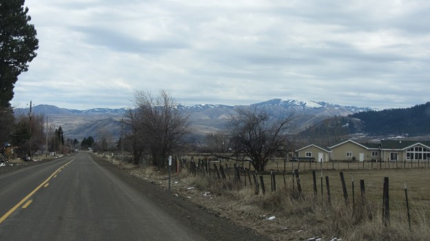
| Back to Halfway, OR. |
 |
| Goodbye, Wallowas… |

We arrived back in Portland late that night and crashed. The next day we feasted on unreasonably large breakfasts and took a ride out to Mount Saint Helens for some casual touristry. The scenery was every bit as stunning as in the Wallowas. The visibility and lighting were exceptional and we got great views into the crater.


The very next day we realized we hadn’t quite had our lift served resort skiing fix for the year, so Rob, Brad and I piled into the car and set out for Mount Hood. Again, we were greeted by uncharacteristically blue skies and overall pleasant weather. We found ourselves lacking sufficient ambition for the usual profusion of still photos, but we managed to snag a few minutes of quality chase cam footage on some of Hood’s more exciting terrain.
 |
| Mt. Hood. |
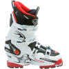
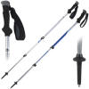
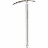
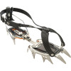
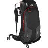
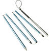
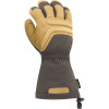
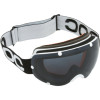
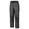
Eventually we realized that we all had real lives that needed attention, so after a week of exceptional fun in the mountains we parted ways with half-baked plans of a round two already beginning to formulate in our collective consciousness… Gear List (click links for more product info): 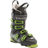


This past weekend was great, and nothing went as planned. It also stands as a testament to the unpredictable and extreme weather around Mt. Washington.
My original plan was to backpack two days, one night, and then ski Tucks today (Sunday). I’d been itching to camp out, and a solo trip seemed like the way to go, since Sweeney and Rob were busy getting their backcountry powder fix in the Wallowas in Oregon. From the get go I had to make some quick adjustments to my trip plan. Originally I wanted to park near Glen Falls, and head up to Boot Spurr, and then hike along the southern part of the presidential ridge, hitting Monroe, Eisenhower, Pierce, and possibly Jackson, camping at elevation, but below treeline at Nauman.
But, when I got to Glen Falls parking area south of Pinkham Notch, the area was gated and all the signs were bagged. It didn’t look too inviting so I re-routed my ascend to the Boot Spur trail. Later I saw cars parked where the gate was, so I guess it wasn’t too big a deal. At Pinkham I checked the weather, then threw all my gear, both winter clothing and overnight essentials into my big 70L Osprey Aether pack, and headed up the Ravine trail to the cutoff.
As I crossed the bottom of the Sherburne, it was completely bare and dry. The Tucks trail was a mess of mud and rock at the bottom. Were we really just skinning from the base only a month ago? And skiing all the way down? It looked like a different world.
As I got higher up on Boot Spur I began breaking through the remnants of snow and ice into the running water below, which I was not a fan of. The wind was picking up, and looked like it trying to blow down the trees. As I crested treeline I nearly got blow away. The wind was fierce and it was very exposed. I’d read that the summit was reporting gusts above 85 mph, but I did not expect to need to make a hasty retreat to the shelter of the trees.

I snapped a quick photo of the bowl as I got above treeline on Boot Spurr
I quickly realized there was no way in hell I was hiking ~5 miles completely exposed on the peaks. I didn’t really want to give up and go back the way I’d come though, so I decided the brave the wind for about a mile while I headed up to connect with Boot Spurr Link trail, and descend into the Ravine. I threw on my shell, gathered my wits, and made agonizingly slow progress against the wind, sometimes on all four or bracing against cairns. The steep descent of Boot Spurr Link wasn’t too much fun–no one had broken trail and I was postholing the entire way down the Hermit Lake.
It was still early morning, but there were a bunch of skiers at Hojos, heading up to Hillmans and the bowl, so I decided to make a day of it, and enjoy the blue skies and warm weather (and lower wind speeds). There was the usual assortment of spring skiers, including people duct taping their skis to their packs and almost falling down left gully. I hiked around the bowl a bit and took my time before descending the Tucks trail. I felt a little silly hanging out in the bowl with a big pack but no skis with me.

Hillmans Highway from Hojos

Skiers heading up left gully, which had some soft bumps

The rapidly deteriorating bowl, and waterfall hole
Afterwards, I camped out at Barnes Field and prepped for some skiing Saturday, since my backpacking plans had been comprised. Due to some miscommunication between Alex and I, we didn’t meet up Saturday like we’d planned, and so Saturday morning I hung around Pinkham Notch until it looked like things were going to soften up, then made my way up to Hermit Lake on my own. I made record time to Hojos, about 40 minutes I think, and chatted with a few people on the way up, including a guy who was planning to summit via Lion’s Head, since they just re-opened the summer route.
At Hermit Lake I talked with a ranger who speculated that the bowl still wouldn’t soften up to prime corn for another hour or so, so I took my time and snapped a few photos for a group who were from the Johnson State College Outing Club. When they found out I was on my own, they offered to let me join them. They seemed like they knew what they were doing, so we departed together to ski Left Gully. It turned out I’d been hiking up the Tucks trail with their friend earlier, and a few of them had been into back-country skiing and coming up to Tucks for a number of years. It worked out great, they were super chill and it certainly made the day more fun than skiing on my own, and also gave me some peace of mind.
Though it was supposed to be cool and cloudy, the sun broke through, and I was sweating bullets in the heat as we ascended. We hit Left Gully just as it got soft, and had a great first run. I was feeling a bit slow on the ascent, I guess my jaunt Friday left me a bit tired. For second run, we headed up Left Gully again just as some hiker narrowly avoid taking out the whole line after he lost his footing and slid down the entire run. We topped out and headed towards Hillmans Highway across the rock fields, looking for a bit of variety. I hadn’t skied Hillmans all season, so I was game to give it a try. There was a choke point on the descent where you had to side-step down and the snow pack briefly got narrower than my skis, but the rest of the run was good spring conditions, though I doubt it will be worth skiing much longer. The Sherburne was in rough shape. You could kind of ski 30% of the way, as long as you didn’t mind skiing over rocks and grass and doing a bit of hiking in between.

In the sun on top of Left Gully, you can see my skin beginning to take on a reddish hue.
The weekend ended up much different than I’d planned, mostly due to the rapidly changing weather. Mt Washington is getting a bit of rain today, so it probably wouldn’t have been as much fun to ski anyway. Thanks again to the friends I met at from outing club, especially Jess and Sam, it was a blast skiing with you guys!