Tag Archives: day hike

Bagging the End of the AT

Just before the 4th,  Rob, Sweeney and I were up with friends rafting near Baxter State Park.  Though the camping weather was overly moist, the rafting was a blast.  That night Rob and I set our sights on peak bagging Katahdin.

We were heading out around 8 when our friend Ben showed up and we all drove off into Baxter. The hike began under cloudy skies into dense fog up from Abol campground.  We quickly rose above treeline where the trail followed a rock slide and led us up one of the steepest continual ascent we’ve encountered since Great Gulf.

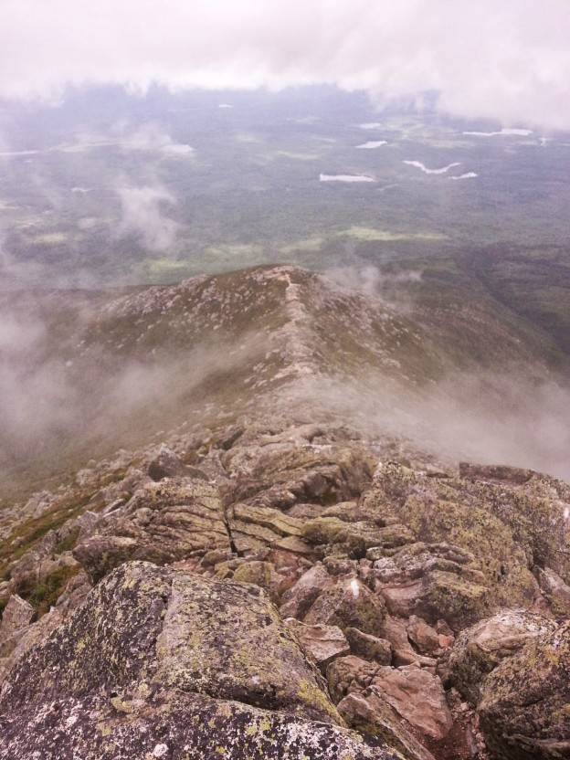
Poor visibility at the summit

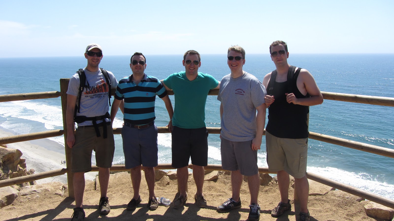
Ben and I get the age old shot…even through we didn’t thru-hike

We summitted the nearly 4000 vertical gain in two hours flat.  On the way up we’d decided to loop the hike by descending via the AT to expedite our trip.

Katahdin

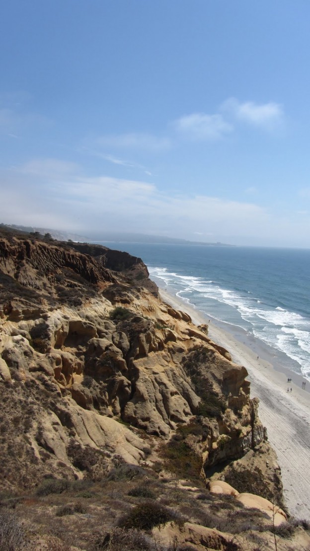
Rob above the Knife edge

Katadhin - 6
Katadhin - 5

Heading down the AT was definitely the right choice as we were awarded great views and stopped briefly to chat with an early season thru-hiker.  I pulled my phone out to snap photos only a few times as we made our way down.

Katadhin - 14 Katadhin - 3  Katadhin - 7

We made the 9 mile loop in 4.5 hours but were still 2.2 miles from our car, which put us back at the rafting lodge a little later than we’d anticipated.  Rob jogged and we speed walked to the car, very satisfied to have finally hiked Katahdin.


Peaked Mountain and Middle Mountain

Here’s another great hike for those in the mood for a great alpine view, but without the time or energy for a more ambitious full day hike.  Best of all, this hike is literally moments from down town North Conway, for your après-hike convenience.  Here’s a quick overview:


View Middle and Peaked in a larger map

The hiking is fairly quick, and the views from the top serve as ample reminder why you came out in the first place!  Through the trees a few peaks at Mount Washington can be had, but the real highlights are the Southern Presidentials, the eastern slopes of the Pemi, and the Sandwich Range.  See for yourself:

Mt. Chocorua
North Conway, Cathedral, the Southern Presis…
Chocorua Again
Sandwich Range


Gear List (click links for more product info):

Mountain Hardwear Compressor Insulated Hooded Jacket - Men's Blue Chip Sapphire, LPatagonia Capilene 1 Graphic Crew - Men's Mango, LREI Shuksan Pants with eVent Fabric - Men's 32REI Gear ShopFree Shipping on Orders over $50

The Bigelows, Revisited

It’s been a while since I’ve been hiking, nearly a year since I’ve had the pleasure of visiting Maine, and even longer since I’ve been kayaking, so with these things in mind, Tripp and I hashed out a plan for a multi-day, multi-mode excursion in the Flagstaff Lake region.


The Bigelow Range makes for one of New England’s best ridge walks.  The only real shortcoming, is that it’s difficult to perform a traverse of the entire range (from end to end) without backtracking anywhere.  Last November, we made a traverse of the ridge starting from the Stratton Pond Brook area and descending well before the end of the ridge, simply because it did not require us to return along the same trails.  This time around, we hoped not only to make a lengthier stay in the region, but to see more of the range and return by a totally novel route.

From these stipulations, we came up with the following template:

  • Day 1 (Friday afternoon / evening)
  • Pick up people / boats
  • Drive to Round Barn Campsite and deposit boats some place secure
  • Drive to Trout Brook Campsite, set up camp, crash
  • Day 2 (Saturday)
  • Depart Trout Brook via car and head to Trailhead and Parking
  • Traverse Bigelows on foot
  • Arrive back at Round Barn Campsite, retrieve boats, setup camp
  • Day 3 (Sunday)
  • Pack up Round Barn camp
  • Put boats in water and begin paddle back toward Stratton, past Trout Brook
  • Arrive at Stratton Elementary school boat launch
  • Potentially stop again at Trout Brook (or wherever else is convenient)
  • Day 4 (Monday morning)
  • In case we don’t finish on Saturday…finish paddling and camp
  • Drive home and store boats

And of course, here is a map of the rough plan:


View Bigelow Range Traverse / Flagstaff Lake Paddle in a larger map

The trip is tentatively scheduled for the second weekend in October for ideal temperatures and foliage viewing.  Update to follow, but for now I need to pack and rest for a warm-up hike in Franconia Notch tomorrow morning!

Torrey Pines

This past weekend I was out in San Diego for LBK and Emily’s wedding.  Amid all of the pre-wedding hustle we found time for good old fashioned outdoors fun.  LBK brought us out to Torrey Pines State Reserve, where we went for a great walk through the hills of SoCal which abut the coastline in so many places.  This is another great hike if your pressed for time, but are in the mood for some great scenery.  And since San Diego has virtually the best weather possible, you can just show up whenever you feel like it and enjoy the scene.


View Torrey Pines State Reserve in a larger map

We made a quick loop on the Guy Fleming Trail, but a quick pan to the south reveals a number of other enticing routes for future exploration.  There are several look out areas along the Fleming Trail which make good places for pit stops and the obligatory imbibing of local micro-brew.  Here’s a few of the highlights:

Some interesting sandstone formations.
Looking south down the coast.
From left to right: me, LBK, Zac, Neville, Shawn.
Pelicans.
More pelicans.
Cannon Powershot SX320 high speed burst mode for the win.
The Coaster (Amtrak) to the east of the Reserve.

Gear List (click links for more product info):
Merrell Chameleon3 Ventilator GTX Hiking Shoe - Men's Gunsmoke, 8.0Free Shipping on Orders over $50