Another New England classic, Tripp and I decided to hike Mansfield last weekend. The weather turned out to be excellent with almost no clouds at all and temps in the mid 60s. We got up at the crack of dawn, drove up via I93 to I89 and hit the trail at 11 AM. There are numerous parking areas in Smugglers Notch, providing easy access to the trails.
Conceptually, this hike can be split into three really distinct parts: the ascent (red), the traverse (green), and the descent (orange). Now this statement may appear less than profound, but when broken down and examined it becomes clear. In my opinion, it’s this feature of Mansfield that makes it such an interesting hike. There is great variety during the course of the day, leaving you with a distinct sense of having accomplished quite a few different things. Here’s a quick overview of the route (Note: this map has a lot of detail which is best viewed by following the link below each inset):
View Mt. Mansfield in a larger map
We ascended via the Hell Brook Trail, one of the steepest hiking trails in New England (at least that I’m aware of). Just for reference, it took us about 3 hours to summit and it’s only about 1.5 miles from the parking area to the summit. I was somewhat under the weather, which only compounded the problem. Here’s a closer look:
View Mt. Mansfield in a larger map
The first leg is really the hardest part of the hike, which if fortunate because after the first excruciating hour, things only get better. You basically ascend up a steep watershed hallmarked by step like boulders and well worn tree branches and stumps giving evidence to the numerous hikers who’ve hauled themselves up practically and over hand in the past.
Nearly half way are two points of interest (the blue push-pins). The lower one denotes a spot that looked good for an emergency bivy, although you’re so closed to the road that it may not really be of much worth. The second (uphill) pin is extremely confusing. I’ve done this hike twice and each time we loose the trail in that very spot! There are numerous tributary water sheds that run across and parallel to the actual trail. In this case I think what happened, is that the trail hooked to the left, while a small water runoff ran straight down hill and into the trail. In our beleaguered state, we waltzed right off the trail into increasingly dubious terrain before realizing that this arduous slog over fallen trees and ill marked trail is actually not the trail. Actually we were only off of the trail for like 30 or 40 yards, but since it’s happened twice now, I thought I’d make a note of it.
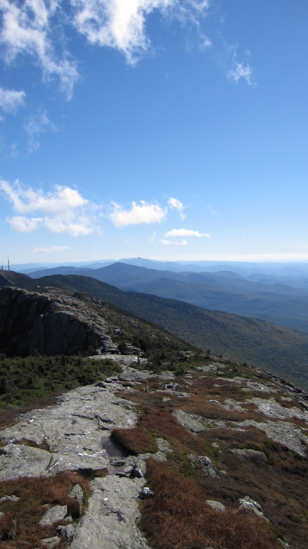
The second leg of the ascent mellows out by quite a bit. Around this time, you begin to get some previews of the views to come. Eventually you come to Lake of the Clouds, which is more of a pond, and on this particular day there were no clouds… In any event it’s nice. Here the trail splits giving you the option of heading over Adams Apple or circumventing it and heading straight for The Chin. Both routes are equidistant while Adams Apple gives you a gain of several hundred feet. The view is worth it: you get a good look at the final real ascent of the day:
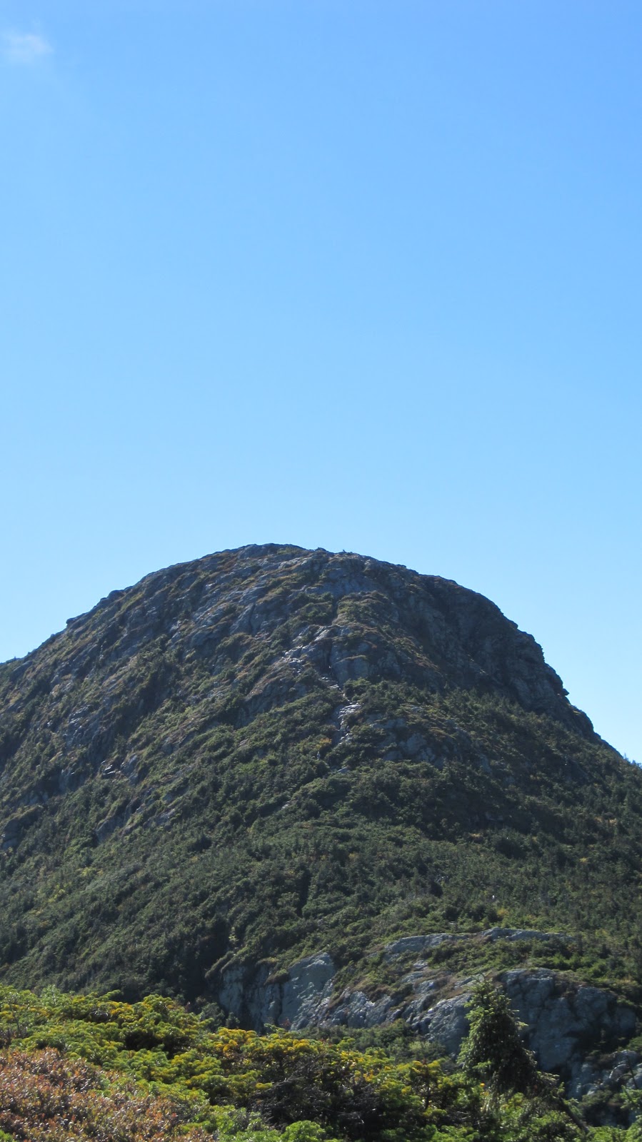 |
| The Chin – the squirrelly notch up the middle is the trail! |
This ascent is up there with other great (non-technical yet precipitous) New England climbs such as Flume Slide Trail or Huntington Ravine Trail. The route up is less than obvious for much of the way simply because it’s so steep that you can’t see very far from your present position in either direction. For example:
 |
| About half way up the Chin ascent. |
 |
| Looking south from Mansfield. |
View Mt. Mansfield in a larger map
 |
| Canyon Trail – Champlain and Adirondacks in the distance. Southwest facing. |
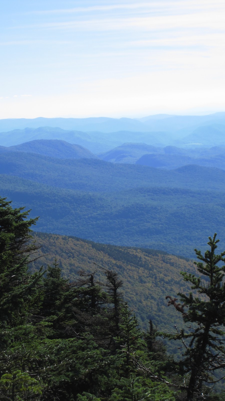 |
| Canyon Trail. Facing south looking over the Green Mountains. |
 |
| Burlington, Champlain and the Adirondacks. Facing east from Canyon Trail. |
View Mt. Mansfield in a larger map
 |
| A look back at where we’ve just come from. The gondola station is seen just underneath the cliffs (of Cliff Trail infamy). |