Tag Archives: hiking

Pikes Peak

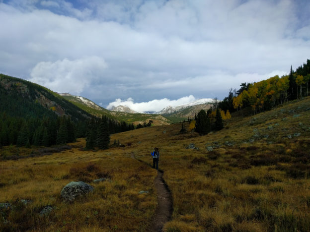
Maybe the last 14er of 2017?  I guess we’ll see, but it’s gonna be ski season any time now.  Either way, pounding out some extra vertical won’t hurt when it comes time to dust off the climbing skins! Crawling out of our sleeping bags at the base at 7:30 in the morning to find ourselves shivering in 22 degrees certainly drove home the imminence of winter!

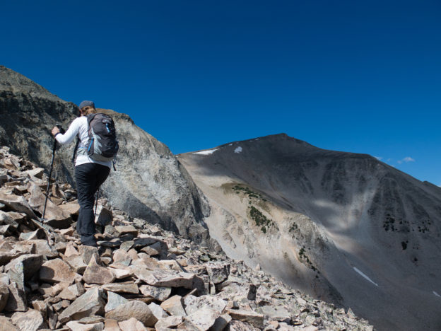
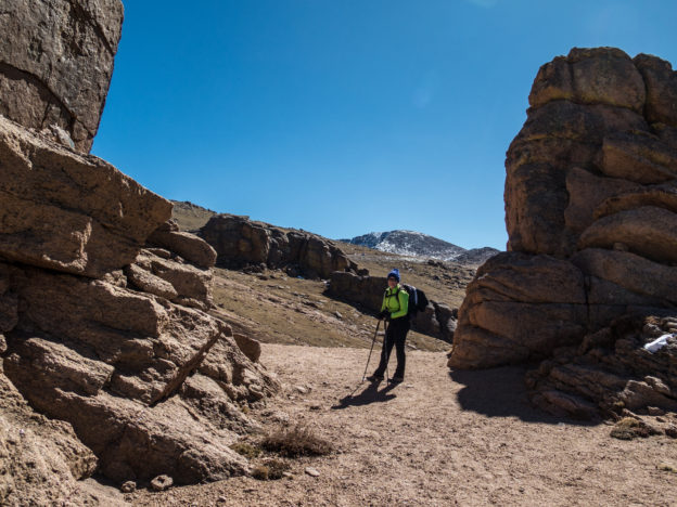
In terms of overall difficulty, Pikes Peak is comparable to Mt Sopris, even through Sopris isn’t even a 13er!  Mileage and elevation change are similar: the only real difference is that for the last couple miles you can’t really catch your breath.  The northwest approach features a consistently steep climb for the first ~3.5 miles.  Fortunately, just as you break 13k’ the trail flattens out for about 2 miles at which point we undertook at 1.5 miles icy rock scramble to the summit.


During the lengthy traverse from the northwestern slope, to the summit cone, you catch glimpses of impossibly steep gullies with names like Bottomless Pit.  Apparently, the Barr Trail ascends from the east by way of one of these alpine nightmares – definitely something to keep in mind for the future!

Perhaps unsurprisingly, the gift shop at the summit was sort of a zoo, but after a slippery scramble in howling winds, we enjoyed the chance to sit back and snack on our most-certainly-not-brown-bag lunch in comfort and warmth…

One last #camping hurrah before #winter sets in! @kellyahowie

A post shared by Brian Sweeney (@briangsweeney) on

High Lonesome Loop

This is easily one of my favorite hikes of the year, both because it satisfies the ‘well-rounded adventure’ requirement and because of the amazing variety of terrain.  It’s in the Indian Peaks Wilderness, which is accessed via 4th of July Road.  Passing through the town of Eldora and riding up the 4th of July road is cool enough, and if you have a stout 4×4 you can mercifully knock a mile or so off of the 15 mile total.  Depending on the weather, this may also prevent you from having to walk an appreciable distance through a giant puddle.  Either way, you add a short but mildly technical off-road jaunt to your otherwise human-powered day.  As icing on the cake, the final stretch deters most motorists, leaving the limited parking at the end of the road a pretty good bet.

Our day started off inauspiciously: drizzly and cold.  Once the rain had more or less quit, we hit the trail.  We were slightly disappointed to find ourselves in the company of large party whose crime was nothing more than excitedly talking amongst themselves, but it sort of tainted our wilderness experience for the first few miles: alas the trails must be shared!  Eventually, they took a different fork than us and we seemingly had the wilderness to ourselves.  Free at last!

Eventually, the rain totally stopped.  It remained brisk, but the only further precipitation was the light, frozen variety.  As we got further into the wilderness we passed bright aspens, plunged through dark evergreen forests, crossed expansive alpine meadows, stopped at more than one pristine lake, and finally climbed into the alpine tundra.  You spend substantial time above treeline and get plentiful views of the mountains to the west, Winter Park to the south, and all of the terrain you’ve just crossed back to the east.

Once you’ve traversed the tundra and get within sight of Rollins Pass, it’s just about all downhill.  Before long you’re traipsing back through the forest on the way back to the trailhead.

Grays and Torreys

We chose a doubleheader for our first 14ers of the year and it did not disappoint! The hike itself is pretty straightforward: am obvious trail departs from the road and leads you via the path of least resistance up Grays and then Torreys. An optional knife-edge trail descends from the summit of Torreys, which we omitted, but could be used as a nice way to vary the scenery on the return trip. It doesn’t really change the mileage but ads some exposure. Both summits offer glorious views of the Summit County mountains. But the factor that really takes the cake for me is the stunning alpine valley from whence you begin. The best way (IMHO) to tick off these peaks is to drive up Stevens Gulch Road the day before until you get to the end or until you’d rather not punish your vehicle any further. The road peters out nearby an extensive alpine meadow sprinkled with mining remains and ample opportunities for car camping. Get an early start, find a nice camp spot and take in some world-class views while you acclimate. Waking up at the trailhead really takes the edge off of a 14er and the ambiance is second to none!

Mt. Sopris

If you’re up for a big day in the mountains but don’t feel like doing a 14er, this is your mountain.  In fact, Sopris isn’t even a 13er; it tops out at 12,985 feet. Don’t take this as an excuse to let your guard down: with a round trip of about 14 miles and a net vertical of well over 4000′, this is a real hike!


From town, Sopris looms large, casting a wide shadow and offering splendid views for miles around.  The winding, back-road approach only builds the anticipation as you near the trailhead.  I’d imagine that it depends on the exact time of year, but on our approach, cattle were meandering through the woods and across the roads as we neared the parking area.  Indeed, a good hunk of the mountainside is apparently fair game for grazing.  Ironically, right as we were musing over our good luck that cattle are such docile beasts, one feisty seeming youth decided to come chasing after us as we passed through his stomping grounds.  Unsure of what else to do, we sort of just stood there and stared him down hoping he’d get bored and leave.  We attempted to proceed before he was good and ready, which prompted him to take a few menacing gallops toward us, at which point we resumed our staring contest.  Fortunately, we won (I guess) and he sauntered off in a huff…

Bovine menaces aside, the hike was great.  About a third of the way up you come across two stunning lakes, which beautifully reflect the mountain beyond.  Eventually, the trees recede to scrub brush and finally an endless talus slope which rambles onward and upward toward the summit.

While there are no true scrambles, the steep and exposed talus slope offers constant stunning views and plenty of cardiovascular challenge, making the climb plenty rewarding.  The summit and shoulder of the climb offer great views of the mountains around Aspen, including the Maroons, Capitol, and Castle.  It’s a long, rocky, hike and you’ll be yearning for soft soil before the end but the constantly evolving nature of the trail makes it well worth it.