On the weekend on the 9th, a planned day hike turned into an ambitious overnight, and Sweeney, Rob and I once again made the trek to North Conway to hike the Wildcat range across the street from our winter hang out.
The plan was to light-weight backpack (~20-25lbs) starting at Glenn Falls, across the Wildcats, up Carter dome and the rest of the Carters, then summit Imp, Moriah, and Selburne Moriah, and descend to Wild River campground on Saturday. Then on Sunday hike out via Carter Dome and back over the Wildcats.
On Saturday we got off to a great start with beautiful weather after a rough storm the night before. Eager to make some mileage, we quickly ascended to Wildcat D where the top of Wildcat’s lifts are.

First up for the day, Wildcat summit with the bits of snow in the bowl as a backdrop.
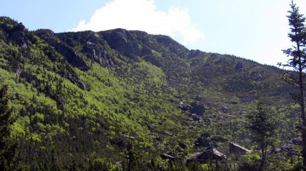
Descending into Carter Notch made for some impressive views, and a very steep descent and ascent of the Carter Dome.

An awesome look at the daunting Carter Dome from the Carter Notch Hut.

Looking back at Wildcat from the hut, one of a few AMC huts fed by spring water.

Ascending Carter, looking back to the glacial ponds of the Notch.
We hung around briefly on top of Carter to re-coup, but then pressed on to Mt. Hight which had far superior views.

Presidential Range panorama. All the photos come from Sweeney’s expert photography and far superior camera.
After Carter the rest of the ~4000 footers started to blur together a bit, but the ridge offered continuous views of the northern Presidential Range.

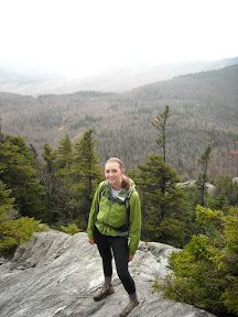
The northern end of our Saturday traverse, soaking in the views
We crested Selburne Moriah in early evening, and booked it to camp. We’d decided to go stoveless, which was not exactly my preference. It worked out okay, and I was never hungry, but I think next time I’d do freeze-dried meals and a pot for approximately the same weight, like Sweeney and I did on our Bigelow Range traverse.

Evening view of the Presidential Range, looking back at the peaks we’d crossed
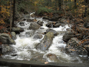
On Sunday we weren’t exactly rearing to go, but we broke camp and got moving quickly. Unfortunately on of the first scenes we encountered was this:

Our first encounter with the Wild River Sunday morning.

Is that the trail across the river? It was. After Rob assured me the depth was a trick of the light, we made a waist-deep wade across, with our shoes around our necks.
After crossing the river, we proceeded down the Wild River Trail, until the trail abruptly disappeared into the river. About .5 miles past the (closed) Wild River Campground, the trail had fallen completely into the riverbed, a remnant of Irene. There had been no warnings, so we attempted to find the trail again, but eventually were forced to re-route and continue down the less exciting, but intact, High Water trail, after re-crossing the Wild River, this time via wooden suspension bridge.
At this point we’d backtracked a fair amount and wasted time locating trails and looking at maps. We re-evaluated our options, settling on a Carter Dome ascent via the Black Angel trail, and descent out Nineteen Mile brook trail from the base of Carter Notch.
We made a dogged ascent of Carter, once again a humbling experience. As we descended, Rob went ahead to get the car, while Sweeney and I hiked out. We were all relieved to get out of our wet trail shoes and head to Moat for a post-hike chow down.
The hike itself stands alone as the hardest, and one of the most rewarding hikes I’ve done to date, hitting 12 4000 footers and totaling ~40 miles round-trip.