Tag Archives: maps

Gear Debacle With a Silver Lining

In preparation for my first tour of the year, I lugged my new skis and boots out into the backyard and practiced getting in an out of my new Dynafit Beast 16 Bindings in the patchy snow.  The 16 is essentially a rare beast, given its niche market, and two years in production followed by discontinuation.  Why I’ve elected to use such an unusual apparatus is a story for another post – my intent here is to establish their rarity and my lack of familiarity with them.  Indeed, upon picking them up mounted to my new skis from the shop, I had to be shown how to use them.

After cycling through the walk and touring modes a few times and shuffling around the backyard I was pretty certain that I had it down.  With plans of dawn patrolling in the AM, the last thing I wanted to was to be fumbling with new gear in the dark, windy, early morning cold.  Having proved reasonable competence to myself, I stowed the skis in the car and headed inside to install Hottronics into my new boots.

Fast forward to 5:30 AM and we find ourselves uttering curses into the wind as I step out of my fancy new bindings with every couple of strides on the skin track.  By the light of our headlamps, we stare in bewilderment at these newfangled contraptions musing about what toggles, levers or processes we could possibly have misunderstood.  Inexplicably they begin touring without prerelease and we sally forth into the pre-dawn haze.

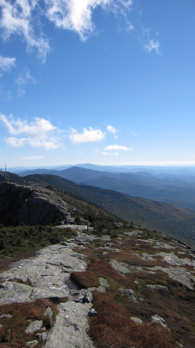
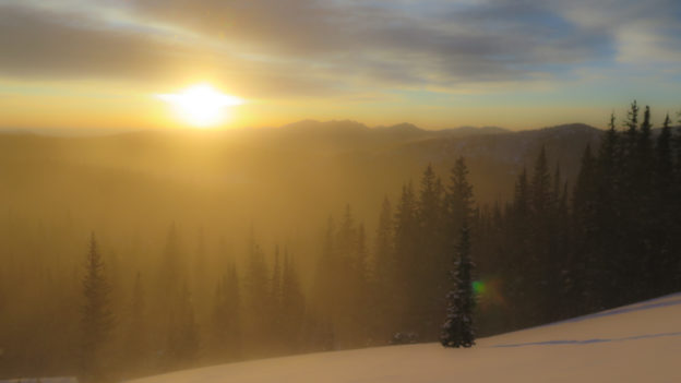
We’re off to a much a slower start than we anticipated, but as luck would have it our timing perfectly coincides with some exceptional sunrise vistas.

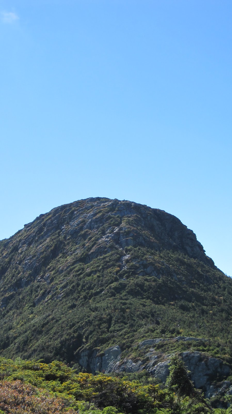
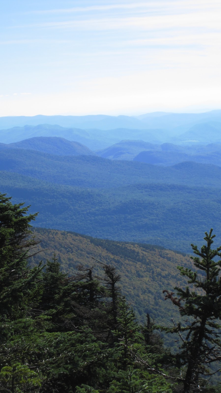
Turns out, the skiing wasn’t too bad either.  The drive up to the trailhead was worrisome, to say the least.  Even the approach on the skin track had us wondering if this was going to be more of a winter hike than the powder chasing extravaganza we’d pined over during this bleak early season.  But, after some poking around we identified the most leeward aspects and found them to be devoid of serious slabs below a certain elevation and a good deal deeper than expected.  By the way, it turns out Dynafit Beast 16s slay deep powder just fine!

So anyway, we figured we’d lap this fluffy zone a few more times before the crowds showed up.  We transitioned and were on the skin track back to Heaven when I was beset by a trifecta of critical gear breakdowns.

First, my (brand new) left boot heater crapped out.  I noticed that the cable was only partially inserted into the battery.  Upon further inspection, I saw that it was nearly severed!  I pulled it out, looked at it, and put it back in when it totally disintegrated.  I guess I owe REI a call…  Ordinarily, the loss of such a luxury item garners little sympathy, but when your a fool like me and go skiing at -40 degrees Fahrenheit in plug race boots and permanently damage your feet, these things can become an issue.  I figured as long as we kept up a decent hustle on the skin track, I’d generate enough heat to stave off any real issues…

Second, the Dynafit Beast 16 touring-mode auto release strikes back!  But unlike the first bout of auto-release where I was standing on flat firm snow next to the car, this time around I was standing on a steep pitch in waist deep snow.  One stride: good.  Two strides: great.  Three strides: whoa I’m wallowing like a pig in his trough up to my belly in snow.  This happened a handful of times during which my one unheated foot became progressively colder…

And finally, for debacle numero tres, a piece of plastic broke off of my brand spanking new Dynafit Beast 16s while I was resetting the bindings to get back into touring mode.  At this stage of the game, I pretty much decided that the number of things gone wrong in rapid succession was tipping the scales too far out of my comfort zone to consider skiing further and we agreed to retreat.  As a public service announcement, I implore anyone who fails to follow my reasoning on this matter to quickly locate a copy of “To Build a Fire” by Jack London, grab a beverage, put your feet up and enjoy a contemplative afternoon on the couch.

We skulked out of the woods and drove down from the mountains, whereupon I proceeded straight to the mountain shop.  The gentlemen at Neptune showed me how to properly use my Beast Bindings – turns out it was mostly operator error.  There’s a small metal tab which is supposed to lock down when you step into the bindings; if it doesn’t you can do it with a ski pole.  For some reason, it was never locking down in walking mode, but the problem has an easy fix.

When the toe wings are opened and prepared to receive the boot, the small metal tab will flip up.

Once you’ve stepped in, the tab should flip down. If not insert a ski pole tip and lever it closed.

And finally, here is the failed piece which I’ll need to call Dynafit about.  Hopefully, they can just send me a replacement part.  This piece is totally independent of the downhill skiing mode, so it won’t be a safety issue.  When the binding is in walk mode, it acts as a guide which prevents the toe piece from pivoting.  Pretty important, but not totally broken, so hopefully I can limp along while I’m waiting for a replacement part.

Not broken.

Broken.

But even amid all of these varied gear debacles, there was no shortage of smiles to be had!

The Bigelows, Revisited

It’s been a while since I’ve been hiking, nearly a year since I’ve had the pleasure of visiting Maine, and even longer since I’ve been kayaking, so with these things in mind, Tripp and I hashed out a plan for a multi-day, multi-mode excursion in the Flagstaff Lake region.


The Bigelow Range makes for one of New England’s best ridge walks.  The only real shortcoming, is that it’s difficult to perform a traverse of the entire range (from end to end) without backtracking anywhere.  Last November, we made a traverse of the ridge starting from the Stratton Pond Brook area and descending well before the end of the ridge, simply because it did not require us to return along the same trails.  This time around, we hoped not only to make a lengthier stay in the region, but to see more of the range and return by a totally novel route.

From these stipulations, we came up with the following template:

  • Day 1 (Friday afternoon / evening)
  • Pick up people / boats
  • Drive to Round Barn Campsite and deposit boats some place secure
  • Drive to Trout Brook Campsite, set up camp, crash
  • Day 2 (Saturday)
  • Depart Trout Brook via car and head to Trailhead and Parking
  • Traverse Bigelows on foot
  • Arrive back at Round Barn Campsite, retrieve boats, setup camp
  • Day 3 (Sunday)
  • Pack up Round Barn camp
  • Put boats in water and begin paddle back toward Stratton, past Trout Brook
  • Arrive at Stratton Elementary school boat launch
  • Potentially stop again at Trout Brook (or wherever else is convenient)
  • Day 4 (Monday morning)
  • In case we don’t finish on Saturday…finish paddling and camp
  • Drive home and store boats

And of course, here is a map of the rough plan:


View Bigelow Range Traverse / Flagstaff Lake Paddle in a larger map

The trip is tentatively scheduled for the second weekend in October for ideal temperatures and foliage viewing.  Update to follow, but for now I need to pack and rest for a warm-up hike in Franconia Notch tomorrow morning!

Mt. Mansfield

Another New England classic, Tripp and I decided to hike Mansfield last weekend. The weather turned out to be excellent with almost no clouds at all and temps in the mid 60s. We got up at the crack of dawn, drove up via I93 to I89 and hit the trail at 11 AM. There are numerous parking areas in Smugglers Notch, providing easy access to the trails.


Conceptually, this hike can be split into three really distinct parts: the ascent (red), the traverse (green), and the descent (orange). Now this statement may appear less than profound, but when broken down and examined it becomes clear.  In my opinion, it’s this feature of Mansfield that makes it such an interesting hike.  There is great variety during the course of the day, leaving you with a distinct sense of having accomplished quite a few different things.  Here’s a quick overview of the route (Note: this map has a lot of detail which is best viewed by following the link below each inset):


View Mt. Mansfield in a larger map

We ascended via the Hell Brook Trail, one of the steepest hiking trails in New England (at least that I’m aware of). Just for reference, it took us about 3 hours to summit and it’s only about 1.5 miles from the parking area to the summit.  I was somewhat under the weather, which only compounded the problem.  Here’s a closer look:


View Mt. Mansfield in a larger map

The first leg is really the hardest part of the hike, which if fortunate because after the first excruciating hour, things only get better.  You basically ascend up a steep watershed hallmarked by step like boulders and well worn tree branches and stumps giving evidence to the numerous hikers who’ve hauled themselves up practically and over hand in the past.

Nearly half way are two points of interest (the blue push-pins).  The lower one denotes a spot that looked good for an emergency bivy, although you’re so closed to the road that it may not really be of much worth.  The second (uphill) pin is extremely confusing.  I’ve done this hike twice and each time we loose the trail in that very spot!  There are numerous tributary water sheds that run across and parallel to the actual trail.  In this case I think what happened, is that the trail hooked to the left, while a small water runoff ran straight down hill and into the trail.  In our beleaguered state, we waltzed right off the trail into increasingly dubious terrain before realizing that this arduous slog over fallen trees and ill marked trail is actually not the trail.  Actually we were only off of the trail for like 30 or 40 yards, but since it’s happened twice now, I thought I’d make a note of it.

The second leg of the ascent mellows out by quite a bit.  Around this time, you begin to get some previews of the views to come.  Eventually you come to Lake of the Clouds, which is more of a pond, and on this particular day there were no clouds…  In any event it’s nice.  Here the trail splits giving you the option of heading over Adams Apple or circumventing it and heading straight for The Chin.  Both routes are equidistant while Adams Apple gives you a gain of several hundred feet.  The view is worth it: you get a good look at the final real ascent of the day:

The Chin – the squirrelly notch up the middle is the trail!

This ascent is up there with other great (non-technical yet precipitous) New England climbs such as Flume Slide Trail or Huntington Ravine Trail.  The route up is less than obvious for much of the way simply because it’s so steep that you can’t see  very far from your present position in either direction.  For example:

About half way up the Chin ascent.
We’re standing about half way up the Chin ascent; the trail descends more or less over that cliff.  It’s basically the same story in the uphill direction!  Shortly you arrive at the summit of Mansfield, reminiscent of other high peaks in New England: bare and rocky punctuated by swirling winds, and also loads of people.  It’s incredibly beautiful, on par with the likes of Franconia Ridge.
Looking south from Mansfield.
There are several ways to traverse the ridge.  Last time we did this, we opted for the Cliff Trail on the eastern side of the ridge.  Cliff Trail basically cuts across the cliff which is the eastern face of Mt. Mansfield.  There’s almost no elevation change but it falls away sharply to one side making it a precarious and exciting stretch.  One section of the trail actually has a steel cable anchored into the rock which climbers can use as a hand hold as they cross the steepest portion.  Last time we were there one end of it had torn out and it was unusable.  The Long Trail runs along the top of the Ridge, however the Stowe gondola generates an incredible amount of foot traffic along this stretch.


View Mt. Mansfield in a larger map

In order to avoid the beltway-esque congestion we descended to the southwest and picked up the Subway trail and Canyon Trail.  This forms what amounts to the western analog to the Cliff Trail: an exposed traverse along a rocky face.  On the eastern flank you get views of Smugglers Notch, the ski areas and the White Mountains in the distance.  On the western flank you get the Vermont country side, Burlington, Lake Champlain and Adirondacks.  A few shots from the Canyon Trail:
Canyon Trail – Champlain and Adirondacks in the distance.
Southwest facing.
Canyon Trail.  Facing south looking
over the Green Mountains.
Burlington, Champlain and the
Adirondacks.  Facing east from
Canyon Trail.
Upon exiting the Canyon Trail, you find yourself back on the ridge proper, and at the foot of The Nose, the last feature that you encounter before descending.  By now it was late in the day, so we decided to omit the Nose and head down the mountain.


View Mt. Mansfield in a larger map

The easiest descent is by way of the Toll Road.  The Toll Road is dirt road which winds it’s way down from the ridge, past the ski area and finally back to Mountain Road, which provides access to the skiing and hiking.  As far as roads go, the Toll Road is a pleasant hike.  There is not really any traffic and it offers several great views of the valley.  It’s also pretty easy hiking.  At several points the road intersects with parts of the ski area.  At our first opportunity we dodged off the road and went straight down the ski area.  There is a hiking trail which descends through the ski area (which would allow you to avoid the ski trails) but it was getting late so we went straight down a trail called Nose Dive.  As you might expect this dumps you out, only about a mile from the where we left the car.
A look back at where we’ve just come from.  The gondola station is seen just underneath the cliffs (of Cliff Trail infamy).
Anyhow, the reason this tends to be satisfying hike, is because of the hugely diverse terrain.  You start by parking in tiny lot in the middle of Smugglers notch after a lengthy car ride, crawl up a lush deciduous forest and suddenly emerge onto a craggy ridge.  Shortly after, you find yourself in a precipitous pine forest followed next by the dirt road and capped off by the meadowy slopes of the ski area.  Now I’ve gotta see about doing this in the winter!

Epic Fall Ridge Walk

The plan: drive to Stratton, ME the coolest way possible, set up camp some place chill, kick back for the night and hit the trail early for a traverse of the Bigelow Range.  The Bigelow Range is due north of Sugarloaf and is in fact where Sugarloaf was originally slated to be cut, however some civil engineers dammed up a river and created Flagstaff Lake where the base village was supposed to be.  This nixed the ski resort plans and they picked Sugarloaf instead, but I digress.  My point: Sugarloaf is awesome, so if the Bigelows were Plan A of that whole endeavor, they really must have something going for them.  I gotta check this out.  Details…


View Best Possible way to Sugarloaf / Bigelow Range in a larger map


The trip there could be 35 minutes faster but I figure as long as were gonna be in the car for 5 hours we may as well have a good view for nearly the entire way and take the scenic route: through and past the White Mountains and then dodge east into Maine, past Umbagog and Rangeley Lakes and finally through Stratton, ME, and into the Carrabassett Valley.


The hike itself is alleged to be one of New England’s “great ridge walks” according to 100 Classic New Hikes.  The idea is to ascend from the southwestern flank of the range, traverse east a ways and then descend along the southeastern flank.  From the bottom we’ll need to hike west along a dirt road back to the car but for not more than a mile or so.  I can hardly imagine being anything short of awesome.  Observe:


View Best Possible way to Sugarloaf / Bigelow Range in a larger map
Bigelow Range from the north with Sugarloaf in the semi-distant background.


Hopefully this gets under way next weekend.