Tag Archives: maps

Moosilauke

Here it is, short and sweet…

Moosilauke is a nice hike, not too challenging, but plenty substance for a solid day followed by some refreshments (which is exactly what we did, by the way).

The hike begins at the Dartmouth Outing Club lodge; getting from there to the correct trail head is mildly confusing due to high number of trails originating at that spot.  A good AMC map is helpful, here.  The first few miles are quick going, with little elevation gain, and a few pleasant stream crossings.  Shortly after you begin to gain any serious elevation (around 3000 ft.) you are treated to one or two south easterly vistas.  Around 4000 you encounter the only real steep part of the ascent, a series of tight switchbacks punctuated by notably wind-stunted trees.  Before long you emerge above the tree line.

I can’t say for certain, but it seems that the bald summit of Moosilauke is more a result of it’s exposure to the wind and jet stream weather than it’s height, a phenomenon common in many of the Whites’ higher peaks.  In fact, I find that this summit was remarkably similar to that of Washington and it’s neighbors: alpine meadows, scrub brush, scree and wind!  Fortunately there is no train station, parking lot or visitor center.  At the summit, the remains of a cabin provide discrete shelter from the wind; all that’s really left are a few corners of the foundation.  It was a beautiful day, and as a consequence it was crowded.  The views to the east are nice; Franconia Ridge is the most prominent and easily identifiable landmark.

After chillin’ at the top for a while we headed south west down the Carriage Trail; allegedly where the backcountry skiing is done.  The trail is comparable to the Sherburne Ski Trail leading down from Tucks, but a bit longer.  There’s no headwall but it looks like a solid option in the event that conditions elsewhere are unfavorable.  The walk down features a pleasant pine forest, is pretty easy and can be done very quickly.


View Larger Map

The Mysterious Great Gully and King Ravine

My latest obsession is King Ravine, off the northwest flank of Mt. Adams in the northern Presidentials of New Hampshire.  Here’s why:

View Great Gully in a larger map

Hopefully this requires no additional explanation, but in case it does:

  • nearly a dozen routes down
  • all in the vicinity of 50°
  • all in excess of 1000 feet of vertical no including the runout!!!!!
To me this seems like Tuckerman Ravine only better in all possible aspects: more varied and technical descents, bigger, steeper, less crowded, etc…  The only thing that concerns me is the avalanche risk.  I have to imagine that it gets tons of snow, and I hope that its northwesterly aspect cuts down on wind-loading.  I guess the remaining variables would be temperature and pitch.  Either way, more research needs to be done here…
My thoughts on the approach:

View Great Gully in a larger map

Parking is on Rte. 2 at the green push pin.  The approach is definitely longer than the hike up the Tuckerman Ravine Trail to get to the bowl, but I think it’s easier.  I’ve never done it in the snow, but it’s straight and mellow.  It can be done in just over an hour in the summer.  The two blue thumb tacks denote spots which seemed suitable for bivouacs or small camp sites; away from any avy run-out, out of the wind, flat.

IMHO, the ideal format for the excursion would be a three day weekend.  Head up to the area on a Thursday night, crash some place, and hit the trail ASAP on Friday morning.  I imagine the slog to the Ravine floor would take around 2 hours in good conditions.  Another hour or two take set up camp and make lunch puts you getting some turns in some time after noon – plenty of time for a few runs in the bowl especially given the lack of a 4 hour car ride home and the presence of a presumably awesome campsite less than a mile away.

Enough logistics, lets get to the skiing!

The bowl, from the floor.

A watery crevasse which I did not fall into.

My thumb, but more importantly a good look at the May snowpack.  Yes May.
Clearly, there are numerous routes.  The mellowest of them, had the most snow and is probably the first thing I’ll try is called The Great Gully.  It is highlighted in red in the satellite map at the top of the post.  The bottom is pretty steep, punctuated by a waterfall which you probably have to huck depending on the snowpack.  Fortunately there is an extensive and mellow runout.  The midsection is highlighted by a weird fall line sloping to lookers right, toward a huge mess of rock and undermined snowpack.  Still pretty darn steep.  Above that, it opens up quite a bit and offers at least two spots from which to drop in providing some options.  This portion is the steepest – just in time for the narrow technical sections.  Sounds sick, right?  The rest of the aspects only get steeper and more technical.  Cannot wait.

Stratton Pond

Tripp has wanted to hit the Stratton Pond loop for a while now. I, on the other hand, was just there; or perhaps more accurately, just escaping from there with my broken water filter and bruised ego. In our haste Alex and I totally skipped the summit of Stratton and about 10 miles leading up to in favor of a short walk down a road. Allegedly, the Stratton Pond loop served as the inspiration for the construction of the entire AT. I hadn’t summited and Tripp needed to see what the hype was all about. These seemed like good enough reasons to return and take another stab at it.


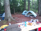
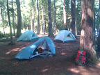
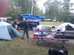
We road out to Arlington, VT on a Saturday night and stayed at the Grout Pond Recreation Area. The rec area consists of a boat launch, a cabin and a number of tent and RV sites. Getting to the place involved a number side roads, each more obscure than the last, culminating in a winding dirt road which apparently was ‘unfit for winter travel’. Thankfully it was not winter. We rolled into the Rec Area at around 10 or 11 and pitched our tents. The skies are overcast but the weather is great otherwise – mid 50s, low humidity and wind. We killed a few beers and retired to our respective tents.
We got up at 6:50 AM, packed up the tents and headed down the road for the trail head – about 2 miles from the Rec Area. We were definitely the last people to arrive and the first people to wake up and leave. I note that sleeping within a mile of the trailhead is a way better strategy for getting an early start than our usual approach of setting some highly improbable wake-up goal and assuming that we won’t need to stop for gas, food, coffee, the bathroom, traffic or otherwise be any less than 100% efficient on the way to the hike.
We hit the trail at the unprecedented (for us anyhow) time of 8 AM. It’s still overcast but it’s also still pleasantly cool. The loop is just under 12 miles including a brief 1 mile stroll down the dirt road. We get this out of the way first for two reasons: A) It’ll get us off to a fast start, and B) We’ll be able to end the hike on a more pleasant trail.

View Stratton in a larger map

The first few miles of the trail are over gently upward sloping terrain. We manage a moving average of 4mph here. Before we know it we’re at the summit of Stratton. At the summit we run into an LT caretaker who directs us to the Stratton gondola. It’s well before noon we check it out. Unfortunately it’s totally socked in with fog so there’s really nothing to see. We skip the fire tower at the summit for the same reason. We decide to move on, in search of some more interesting place to eat and chill for a minute.
The way down Stratton is considerably steeper than the way up making it a lot more interesting. We cruise about half way down the mountain at which time we stop for some lunch, water and a pint. It’s noon-ish by now and we realize that it still hasn’t really warmed up past the mid 60s. It threatens to rain, but with the summit behind us, I almost don’t care if it does.
We make it to the pond at about 1 PM. The pond is outright beautiful but some better lighting wouldn’t have hurt. It’s still pretty dark out; in fact it’s threatening to rain somewhat more aggressively than before. Additionally we’re starting to realize that at our present rate we’ll be out of the woods in plenty of time to hunt around for some apres-hike delicacy. We roll out…
The final 4 miles is virtually flat and we waltz out of the woods around 2 PM. As we’re getting out of our boots and packing up the car, thunder rumbles a few miles away and it begins to rain. Perfect timing. We pile into the car, fire on some tunes, flip into 4wd (totally unnecessary but it’s been my first excuse to use it so far) and snake our way down the dirt road toward town and dinner. This dirt road, known as Stratton-Arlington Rd is dotted with makeshift riverside camp sites and a few hunting or fishing shacks. Every few hundred yards we come by another camp.
Eventually we show up in Manchester Center with the aim of hitting up the tavern where Alex and I hid out upon being defeated by the LT. The only two maps of the area that we have are an LT trail map and a US Atlas. The atlas has nowhere near the granularity that we need to navigate Vermont and the LT trail map, in the words of Tripp, is ‘totally incongruous with reality.’ I’m glad that he explained it in those terms because they were the exact words I needed to explain the source code that I was debugging to my coworker today. In any event Tripp eventually figures out which way to go. We feast and head home.
On the ride home I consider two things: A) The Manchester Tavern or whatever it’s called seemed way cooler after 5 days in the woods than after 6 hours in the woods, and B) some of the trees on the highway are starting to turn already! The fall hiking season draws near…

Last Weekend’s Waterborne Camping Trip

View Umbagog Lake Day 1 in a larger map

Last weekend, me, LBK, Emily and Zac went camping in NH on Lake Umbagog. We spent two nights, one on the shore and one on an island in the lake. This has nothing to do with the LT, except for the fact that I discovered that the solar charger really does not work on overcast days… We were on the water for a few hours and it did not suck up much energy. On the other hand we were in the shade for the entire rest of the day… Nonetheless I may need to pick up an additional unit, if only for the sake of having a backup in the event of two cloudy days in a row. Here are some pictures of our sweet camps…

From Drop Box
From Drop Box
From Drop Box
From Drop Box

View Lake Umbagog Camping Trip in a larger map

Gear List (click links for more product info):
REI Camp Dome 2 TentREI Camp Dome 2 FootprintWilderness Systems Tarpon 140 Sit-On-Top Kayak Blue, One SizeMountain Hardwear Sprite 1 Tent 1-Person 3-Season Humboldt, One SizeFree Shipping on Orders over $50REI Gear Shop