Tag Archives: New Hampshire

One Water, One Coffee, One Beer…

…Such was our demeanor when we lumbered into Cafe Noche in Conway Village and hastily ordered all of the food and drink appropriate to the circumstances.  We had just skulked down from a day of superlative skiing in Tuckerman Ravine and were on the ride home this past Sunday .  Let’s rewind back to last Friday night for a full trip report…

Over the course of last week, Mount Washington somehow managed to pick up enough snow to fill in most of the lines in Tucks to a reasonable state.  Most of it was due not to actual heavy snowfall but to wind loading.  Our hope was that during the course of the week things would sinter enough that much of it would be skiable for the weekend.  We rallied in North Conway and prayed for a favorable weekend update and avy forecast.

As we got closer to the Notch, we were dismayed to see that snow was falling a good deal more heavily than had been forecast – great for the Wildcat crowd, not so great for us.  Between new snow and windloading we could be in for some sketchy conditions.  We arrived at Pinkham to find a fairly startling mix of Moderate and Considerable ratings.

We decided we’d skin up the Tucks Trail, change into crampons at the Lion’s Head Winter Route, climb to the ridge, and have a look at the east snow fields from which point we could easily summit and lap the East Snow Fields.  With so little protection from the wind and such mellow terrain, they should be pretty scoured and free from touchy slabs.

We arrived at the Winter Route to find a log jam of climbers messing around with their gear.  We were promptly advised by one of them, that shortly down the trail we would encounter an hour long wait while dozens of novice climbers were coached up and over the steeps.  None of us relished the idea of standing around in the wind in sub-zero temperatures, and we were forced to abandon Plan A.

We quickly settled upon a contingency plan:  we’d try our hand in The Lobster Claw, with the thought that it might be just filled in enough to be skiable, but still small enough to preclude the presence of any truly large slabs.  We continued to HoJo’s, de-skinned, got dressed for the cold, and prepared for some boot-packing.

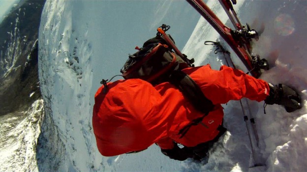
Rob looks dubious as we head up into the bowl.

Alex breaks trail as we begin to wallow into drifts…

We realize it’s time to stop and evaluate the situation.

Some deep and crumbly looking snow pack.

Once we got into the bowl, it became totally socked in and gusty.  We started toward the snow fields under The Lobster Claw, bushwhacking through the un-buried shrubs and into ever deeper drifts.  Eventually, we realized that we needed to seriously consider the safety of the situation.  We started digging some snowpits and discovered small chunks of slab breaking off before we’d even finished digging out columns.  Kinda shady…  The poor visibility and double-digit sub-zero  temperature didn’t help much.  We decided to go no higher than the snow fields at the bottom of the Lobster Claw and stay out of the slide paths.  We’d get a few good turns in, and then pick our way to the Cutler River for maybe a few more untracked turns before the Sherbie.  In short: skunked.

We tried to make the best of it…

Ziehl in front and Alex in the background getting ready for action.

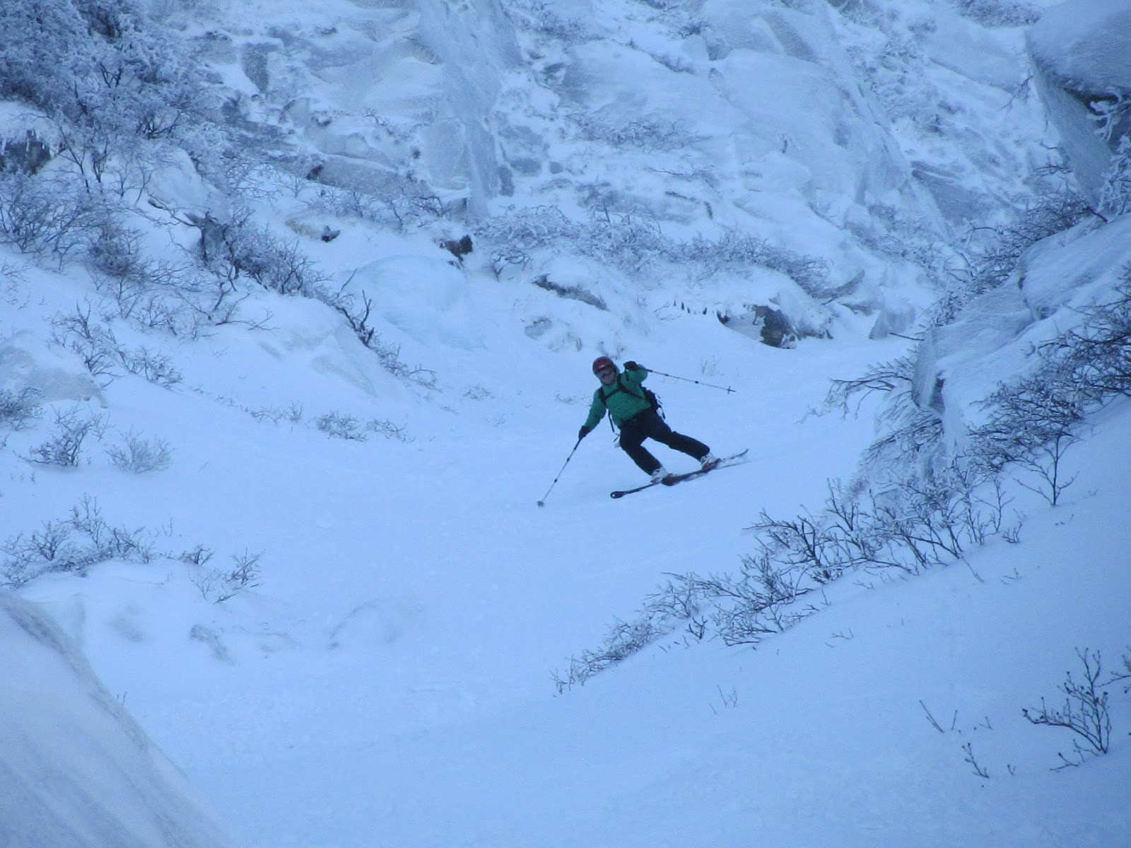
One of about a dozen decent turns….

Gettin’ tossed back…

Alex celebrates our prodigious accomplishment of skiing about 6 turns.

Well we tried to make the best of it anyway.   It was better than not skiing…  After picking our way through all the shrubs and junk in the floor of the ravine we began searching for the Cutler River in what was probably slowest wilderness travel I’ve ever participated in in my life: a knee to thigh deep wallow through frozen bushes and back and forth across the only partially frozen Cutler…

Yea. Adventure…

We finally make it to the skiable part of the drainage and get ready to make about 4 more turns…

Ziehl gets in a few good turns before the bottom of a pitch.


And then there was profanity…

Back at HoJo’s we conclude that we’d made the right choice…

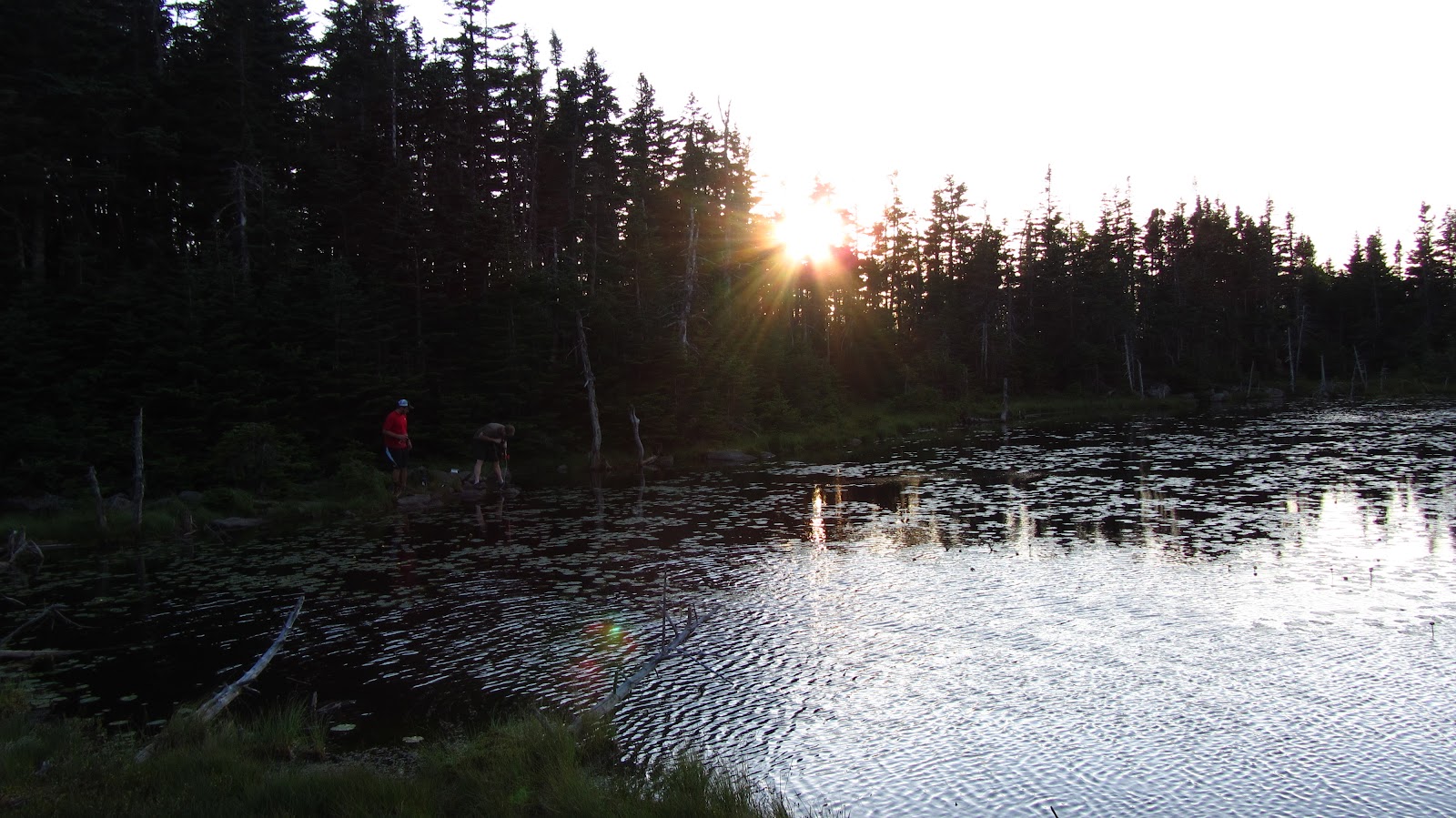
And right on cue, as soon as we get back to the car, the skies clear and it turns into a beautiful day…

Well that was a debacle.  We called it quits for the day, planned out some rest and refueling, and contemplated our next move.  After some thought, we decided we’d get an early, start head up to HoJo’s and see what the report called for.  We were none too enthused about the inbound skiing story in New England, and thought a bad day in Tucks would probably be better than the same day in the resort.  We were pleasantly surprised, to say the least.  We arrived at HoJo’s to find that Left Gully and Lobster Claw were both de-escalated to a rating of Low.  Our path was laid clear before us: we quickly agreed to ski The LG and then make our way across the bowl to The Lobster Claw.  The LG if nothing else would be long, steep, and fast.  The Lobster Claw, we knew from the previous day, would have a decent amount of snow at least toward the bottom.  It was a good 20 degrees warmer, less windy and visibility was great – in hindsight I could have used my black lenses.  We eagerly went after The LG.

Rob leads the charge up LG.
The bowl from about half way up LG. Temping, but maybe not such a great idea.
At the top of LG, setting up a bench to get into our skis.
Check out that boot-pack.
Skier ready!

Rob charges some really firm, wind scoured snow.

Toward the runout, Rob steered us toward this sweet stash.
Ziehl slashes some powder turns toward the bottom of LG.

After warming on Left Gully, we decided to traverse across the floor of the ravine to scope the conditions on the south facing aspects.  In the clear skies, we could see that the coverage in Lobster Claw was a lot worse than we’d expected.  We decided to poke around under Right Gully to see how the conditions would be.  A number of people had already hiked all over lower portions of the south facing aspects.  The snow felt a good deal more stable than it had the previous day, and the southern aspects had been in the sun for a while by the time we got there, but we were still concerned about the pillowy convexities toward the top or the Sluice and Right Gully, so we stuck to the low angle bottom parts.  This was easily the best skiing of the weekend.  Ziehl took a turn behind the camera for a few runs.

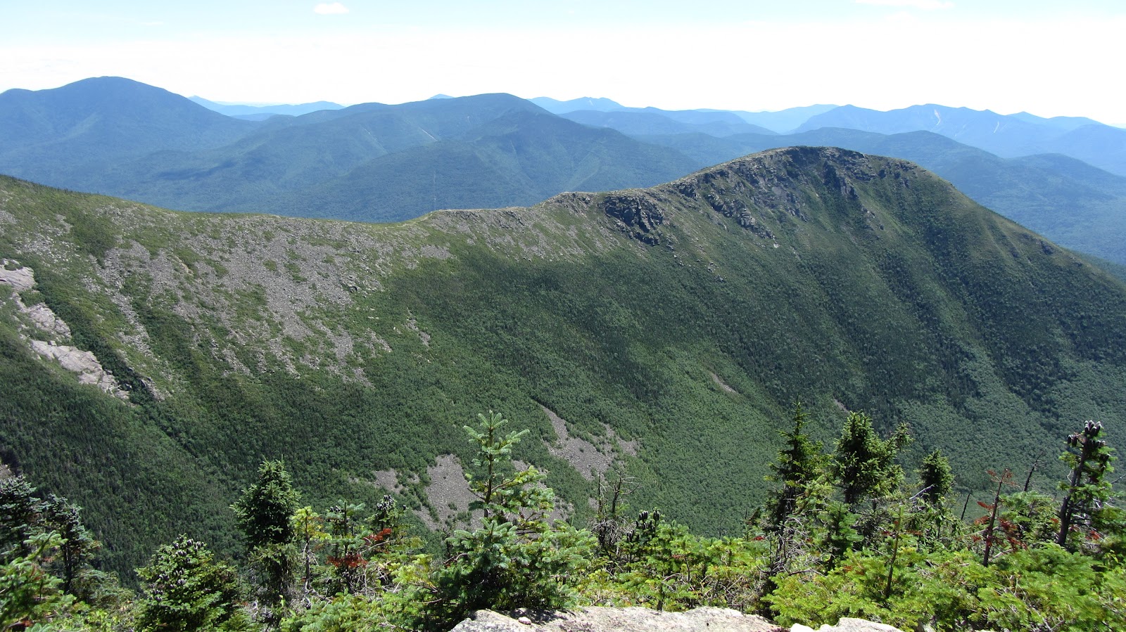
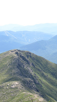
The view on the way out. Has to be one of the bluest days on record for this place.

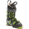
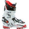
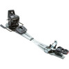
After a short dry spell of epic skiing, we finally hit some good luck and scored some high quality turns.  It seemed like we might finally be through the worst part of the winter (the part with no good skiing) and with lifted spirits we headed back down into The Valley in search of sustenance.Gear List (click links for more product info):

Black Diamond Factor 130 Alpine Touring Boot - Men's Black/Envy Green, 27.0Dynafit Titan TF-X Ski Boot - Men's White/Red, 27.5Dynafit TLT Vertical FT Z12 BindingBlack Diamond Fritschi Diamir Freeride Pro Binding -120MMBlack Diamond Contour Elliptic Trekking Poles - 1 Pair One Color, One SizeBlack Diamond Raven Pro Ice AxeBlack Diamond Raven Ice AxeBlack Diamond Sabretooth Clip CramponsThe North Face Patrol 34 Winter Backpack - 2135cu in TNF Black, M/LBlack Diamond Deploy 3 ShovelBlack Diamond QuickDraw Tour Probe 190Backcountry Access Tracker DTS BeaconBackcountry Access Tracker 2 Avalanche BeaconBlack Diamond Guide Glove - Men's Natural, MPetzl Cordex Belay/Rappel Glove Tan, MPOC Synapsis 2.0 Helmet White, MPOC Lobes Goggle Black/White, One SizePatagonia Capilene 1 Graphic Crew - Men's Mango, LBlack Diamond Ascension Nylon STS Skins One Color, 95mmSea To Summit Ultra-Sil Dry Sack XL/20 Liter, One SizeMountain Hardwear Compressor Insulated Hooded Jacket - Men's Blue Chip Sapphire, MMountain Hardwear Compressor Pant - Men'sMountain Hardwear Mountain Tech Vest - Men's Sapphire Black, MREI Shuksan Pants with eVent Fabric - Men's 32REI Gear ShopBuy GoPro HERO Camera at GoPro.comFree Shipping on Orders over $50

New Years Day Tucks Expedition

Thoroughly fed up with the lackluster in-bounds skiing thus far, and more interested in shredding gnar (there was no real pow, but there was plenty of gnar) than partying our guts out, Rob, Ziehl and I set our sights on a New Years Day 2012 Tucks Expedition.  We rolled out of bed around 7:30, and some how managed to squander a solid two hours of precious daylight before hitting the trail just after 9:30.

View New Years Day Tucks Expedition in a larger map

The Tuckerman Ravine Trail was about 50% water ice mandating some sort of traction.  Rob and I strapped crampons onto our AT boots; while Ziehl, with the winning combo, raced ahead with trail runners and Micro-Spikes.  No part of the trail was skinnable.

On the way up we encountered the Hermit Lake caretakers who confirmed that there may indeed be some half decent skiing to be done in the bowl.  They also assured us that the Avy Fx was essentially unchanged over the last 12 hours and generally favorable.  With so few potential slide paths even in existence with this unseasonably thin snow pack, only isolated and small instabilities could be expected.  We decided to head into the bowl for a closer look at our prospective lines.

The bowl, looking pretty gnarly…

Left Gully in the center.
The Chute.
Hiking…
Gotta have evidence that it was actually us…

Once into the Left Gully, we spaced out and started to be more actively observant of the snowpack.  After having to literally ‘put my back into it’ to cause a small slab to fail in a shear test, and finding almost no slabs in excess of an inch or so, we deemed the situation reasonably safe.  Regardless, we spaced out and kept our beacons transmitting.  Rob took the lead, with Ziehl in the middle, while I brought up the rear.

The climb was smooth going: the snow was dense from the slow trickle of wind-loading seen in the bowls over the previous few days and was firm enough to hike in but easy to kick into and edge on.

The Sun struggles to peak over the Boot Spur in the early winter sky.
Rob and Ziehl on the ascent up Left Gully.
At about 4500′ looking back toward NH 16 and Wildcat, from Left Gully.
Ziehl, on the climb.
Rob, breaking trail.

About 80% of the way up, Rob informs us that the top of the Gully is pretty bullet-proof: climbable but probably not worth it.  Ziehl quickly catches up to Rob while I follow from a safe 200 yards downhill.  When I arrive, they’ve already got a bench set up where we can get into our skis.  I end up with the (slightly dubious) honor of first tracks this run, jump into my new Dynafits and begin to pick my way down.  Check out some gratuitous POV action below:

The snow was cold and fast, and the line was narrow and hairy.  With a conspicuous lack of elegance, but with an eye toward ‘skiing deliberately’ I picked my way down LG.  Having completed  my run without incident, I resumed camera duty…

The Headwall looking thoroughly un-skiable.  Note the ice climbers heading
for The Sluice in the shady lower right region.
Ziehl picks his way down LG.
More…
Eyeing the finish…
Wildlife.
Rob charges out of LG.
Same.
Zoomed out for scale…

As soon as we finished up in the Gully we traversed back toward the bowl to scope out conditions in The Chute.  We were only able to get maybe a third of the way up it before we were stopped by exposed rock. This time Ziehl took first tracks, followed by me and finally Rob. The Chute turned out to be the best skiing of the day, featuring softer and seemingly stable snow.  Check it out:

Rob coming out of The Chute.
Straightened out for the choke point.
Rob rockets out of the choke…
Nice angles.
One last turn, for good measure.
Mission Accomplished!  Leaving the bowl…

There wasn’t really any pow to be slain, but there was plenty of gnar which was sufficient to quench our back-country thirst for at least a few more days.  The Sherburne was kind of a shambles, with a good dose of mud, grass and stumps, but it was skiable nearly to the parking lot at Pinkham Notch.  Rob and I hacked our way down the Sherbie while Ziehl shot down the Tucks Trail with his Spikes and trail runners.

Long story short: season’s off to a decent start, now lets see if we can keep things moving in this direction for a few months!


Gear List (click links for more product info):

Black Diamond Factor 130 Alpine Touring Boot - Men's Black/Envy Green, 27.0Dynafit Titan TF-X Ski Boot - Men's White/Red, 27.5Dynafit TLT Vertical FT Z12 BindingBlack Diamond Fritschi Diamir Freeride Pro Binding -120MMBlack Diamond Contour Elliptic Trekking Poles - 1 Pair One Color, One SizeBlack Diamond Raven Pro Ice AxeBlack Diamond Raven Ice AxeBlack Diamond Sabretooth Clip CramponsThe North Face Patrol 34 Winter Backpack - 2135cu in TNF Black, M/LBlack Diamond Deploy 3 ShovelBlack Diamond QuickDraw Tour Probe 190Backcountry Access Tracker DTS BeaconBackcountry Access Tracker 2 Avalanche BeaconBlack Diamond Guide Glove - Men's Natural, MPetzl Cordex Belay/Rappel Glove Tan, MPOC Synapsis 2.0 Helmet White, MPOC Lobes Goggle Black/White, One SizePatagonia Capilene 1 Graphic Crew - Men's Mango, LBlack Diamond Ascension Nylon STS Skins One Color, 95mmSea To Summit Ultra-Sil Dry Sack XL/20 Liter, One SizeMountain Hardwear Compressor Insulated Hooded Jacket - Men's Blue Chip Sapphire, MMountain Hardwear Compressor Pant - Men'sMountain Hardwear Mountain Tech Vest - Men's Sapphire Black, MREI Shuksan Pants with eVent Fabric - Men's 32REI Gear ShopBuy GoPro HERO Camera at GoPro.comFree Shipping on Orders over $50

Winter Readiness: Shakedown Cruise

With winter fast approaching, Ziehl and I figured it was about time for a pre-ski season shakedown cruise on Franconia Ridge. In light of our lofty backcountry skiing ambitions, we felt compelled to benchmark our conditioning on familiar grounds. I also was interested to see how my new shell pants and jacket would perform in alpine conditions. And, with little else to do besides take in the view one step at a time, mountains make the ideal place to get fired up for the upcoming ski season by endlessly speculating as to the snow conditions of various aspects, potential challenges on the approach, estimated ratio of fun to effort…you get the idea. Any way, here’s the map:


View Franconia Ridge November 2011 in a larger map


The forecast was for a high in the mid 40s, mostly sunny, and light breeze.  When we rolled into the parking lot at 9:30, it was mostly cloudy and very windy.  We threw on our shell jackets, packed our bags and hit the trail eagerly.  


A few weeks ago we switched our work out from mostly simple lifts like flat bench and squats to a more dynamic workout with things like split leg squats and kettle swings and also to work more sprints and stairs.  Our thought was that we’d get as strong as possible and then right before ski season we’d cut over to a high intensity workout to build endurance hopefully without loosing much strength.  


We informally agreed to ‘just go as fast as possible’ on the way up Little Haystack to gauge whether or not our ski season conditioning scheme was coming together and if not, how much work might be remaining between now and Christmas.  After a while of hiking, we stopped to take off our shell jackets and take a drink.  After maybe another hour, we stopped for a breather-snack combo.  We were slowed down by about a half mile of hard-pack and water ice.  Shortly thereafter we broke treeline and hit the summit of Haystack at 11:30 AM.  We speculated that the only adjustment to our conditioning scheme should be to go forward full steam ahead – it seemed to be paying off.  We threw our jackets back on, had a Cliff bar and went after Lincoln.

Ziehl near the Haystack treeline.
Me at the summit of Little Haystack.
Photo Credit: Ziehl

We spent most of the walk from Haystack to Lincoln discussing our plans to try and ski every single chute slide and gully on either side of the ridge.  Between the newly wintery conditions found above treeline, the outstanding offering of ski films this year, and encouraged by our sturdy pace, we could hardly contain our excitement for the ski season.

Ziehl, and the road ahead.
The ridge, and it’s numerous exciting-looking descents.
Photo Credit: Ziehl
Mt. Washington and the Presidentials.  The Bonds are in the foreground.
Before we knew it, we’d cruised over Lincoln and made it to Lafayette.  According to the tracklogs we summit-ted in just under 3 hours (including packing at the car).  Mission success!  We quickly scoped out the old hotel foundation at the summit (a potential ski-touring camp) and made our way down from the ridge toward Greenleaf.
On our way down from Lafayette.
Facing south on our way to Greenleaf.

As we made the dogleg toward the south back to the parking area we got plenty of great views of the Southern Whites, and the Ridge we’d just come down from.  I think that one of the hallmarks of this hike are the opportunities to look back at the terrain you’ve just traveled from a new perspective.

Southern White Mountains.
Rays of light from Greenleaf.
Ziehl with Franconia Ridge in the background.
Nearly sunset.
Left gully: I have no clue; Right gully: Lincolns’ throat.  If anyone knows
the name of the lines in the left gully, please comment!
More sunset.
Detail of Lincoln’s Throat.  Gnarly.

In just under 5 hours we arrived back at the car.  We changed and went straight for the Tilton Diner for a post hike feast.


Gear List (click links for more product info):
Mountain Hardwear Compressor Insulated Hooded Jacket - Men's Blue Chip Sapphire, SMountain Hardwear Compressor Pant - Men's Black, S/RegOakley Bruce Irons Signature Hijinx SunglassesMerrell Chameleon4 Ventilator Gore-Tex Hiking Shoe - Men's Merrell Stone, 12.0Black Diamond Contour Elliptic Carbon Trekking Pole Ink Blue, One SizePatagonia Capilene 1 Graphic Crew - Men's Mango, LREI Shuksan Pants with eVent Fabric - Men's 32REI Gear ShopFree Shipping on Orders over $50

Pemi Loop

After an entire week of sweating my face off around Boston, Rob, Shane and I figured it was about time to head back up north for some cooler climes, fresh air and good old fashioned exercise.  The plan came together at the absolute last minute, with details lacking finalization until some late hour of Friday night.  Per usual, we reasoned that we’d better stock up on calories, so we hit the town in search of beers and burgers.  Around midnight we skulked back to our respective apartments, set our alarms for 6:30 AM and crashed.  Shortly after 7 AM we all rallied and set off for Lincoln, NH.

For those not familiar with the Pemi Loop, familiarize yourselves:


View Pemi Loop in a larger map

View Pemi Loop in a larger map

Ok, so here’s what you’re looking at.  The Pemigewasset Wilderness (or Pemi, for short)  is the large tract of land between I93, the Kancamagus and Rte. 302.  In many cases, the word wilderness might seem a bit overstated.  In the case of the Pemi, not so.  There are many places in the Pemi that are basically a day’s hike from any sort of civilization with the only mode of transport being your feet.  When you get out there, it actually feels like you’re in the middle of nowhere…it’s cool!  The Pemi Loop is a 36 mile loop of trail, which essentially surveys the whole Wilderness.  Much of it overlaps the AT and most of it is at elevation.  In fact, only the 7 or 8 miles on either end of the loop are spent below 3000′.  Totaling about 36 miles, the route is frequented by trail runners looking for a challenging, single-day distance run.

By contrast, we opted for a more casual two day pace: about 14 miles on day one and the other 20 or so on day two.  We tried to pack as light as possible by bringing various ultra-light gear.  Rob and Shane each used a Hennessy Hammock and I used my Sprite in it’s pitchlight configuration.  We each brought summer sleeping bags, ultra-light mattresses, food, rain shells, water/purification equipment, and minimal miscellaneous equipment.  I somehow managed to fit all of this into my North Face Off-Chute 26, all weighing in at 19.8 lbs!  I’m sure people have gone farther with less, but I was pretty proud of myself…

We hit the trail about 10 AM on Saturday morning.  The first few miles are an easy cruise along a former railroad bed.  Eventually you come to the Osseo Trail which heads uphill toward the backside of Mt. Flume and Franconia Ridge.  This is basically the last time you’ll be anywhere near the valley floor for the rest of the hike.  We thought this was great for a number of reasons.  Escaping the heat was certainly a concern.  Gaining elevation quickly and hanging onto it for as long as possible tends to do wonders for morale – it seems as though you’re storing up potential energy that way…  But, perhaps of greatest importance was the outstanding view of the surrounding wilderness offered from the high ridges of the Pemi Loop.  One of our highest priorities on this trip was to produce as much documentation of ski-able backcountry lines as possible for the winter.

After a quick perusal of  the incredible amount of photos and GPS data we collected, I realized that the ski beta probably deserves a post of it’s own.  So… the rest of this entry will be a straight-forward trip report from our Pemi Loop excursion and a follow-up entry will recount all of our ski recon in a more concise and dense format.

And on that note, I’ll let the photos do the rest of the talking…

Rob and Shane at our first break about half way up the backside of Flume.
As it turns out the back is nearly as steep as the front…

Franconia Ridge: Lincoln and Lafayette
Rob atop Liberty with the ridge in the background.
The Ridge north of Lafayette.
Our campsite should be down in there some where…

Our campsite with the days progress in the background:

View Pemi Loop in a larger map

It took us a lot longer to get from Lafayette to Garfield Pond than we expected.  You always intuitively expect the descents to be easy and fast, but frequently, as was the case here, the steep challenging terrain causes you to go even slower than the same slope would were you going uphill rather than down. It didn’t help that we had just climbed four mountains plus like three false summits.

As we got closer to the pond we began to worry that it might be obscured by dense trail side brush and that we might miss it.  This concern turned out to be unfounded, as the pond is easily visible from the trail.  In fact there are a number of reasonable (but totally unofficial) camps on either side of the trail right next to the pond.  Just to be on the safe side we used an an altimeter in conjunction a topo map to get our rough location.  For maximum accuracy, I was able to use Backcountry Navigator on my phone which uses the GPS and pre-cached map tiles to pinpoint your current location.

We arrive just before sunset and make our first priority water…

Rob and Shane at work with the water filter.
As usual, the water filter proved to be kind of a pain in the neck.  When my MSR Sweetwater filter met it’s untimely demise on the Long Trail last summer, I replaced it with the MSR Miniworks.  This model is slightly bigger and heavier, but is 100% field serviceable.  Every single part can be removed without the use to any special tools and the filter element can be cleaned with a simple piece of steel wool, included in the kit.  The pond was a silty mess, so we had to clean the filter a number of times and use the float to keep the intake away from the floor of the pond, but we ended up with plenty of water eventually.
Dusky pond.
Sunset begins over Garfield Pond.
Sprite 1 Pitchlight: ultralight summer
comfort!
The Hennessy Hammocks: pitch anywhere and sleep in
comfort! 
A pretty solid sunset ensued…
Ideal ratio of clouds to clear sky for
maximum sunset action.
Rob hoisting the food into a tree for the night.
We awoke to wisps of cloud drifting across the pond.
Looking back toward Franconia Ridge as we make our way up Garfield,
early Sunday morning.
Our first summit of the day: Garfield.
Same thing…
The Pemi from just below Garfield.

Owl Head and The Pemi.
The precipitous scramble down from
Garfield, and a good example of why
descending frequently takes a long time.
The ridge up on top of Guyot.
The three of us at the summit of Guyot.
Bondcliff.
More Bondcliff…

Rob surveying the land in epic fashion.

Ditto…
After the dramatic West Bond and Bondcliff ridgeline, the trail descends at first steeply, but gradually mellowing, back to valley floor of The Pemi.  It’s not a bad hike, but by this stage of the game it seemed to drag on forever.  We eventually shambled our way out of the wilderness (well Shane and I did some shambling; Rob somehow marched out with the cadence of a soldier fresh out of bootcamp, apparently undaunted).  We threw all of our smelly junk into the back of the car and set off in search of steaks.  We found just what we were looking for at Gordi’s Fish and Steakhouse in Lincoln in the form of 20 oz steaks, all you can eat salad bar (which in our case was more like all you can eat fresh vegetables and other toppings with a bit of lettuce for good measure) a potato each and some complimentary loaves of bread.

Gear List (click links for more product info):
Black Diamond Contour Elliptic Carbon Trekking Pole Ink Blue, One SizeKUHL Trek Short - Men'sMountain Hardwear Sprite 1 Tent 1-Person 3-Season Humboldt, One SizeMountain Hardwear Sprite 1 Footprint PLMountain Hardwear Typhoon Jacket - Men's Cypress/Duffel, LMSR MiniWorks Ex Water FilterAsolo TPS 520 GV Boot - Men'sPetzl Tikka XP 2 Headlamp Graphite, One SizeTherm-a-Rest Prolite Plus Sleeping Pad Pomegranate, SFree Shipping on Orders over $50