Tag Archives: overnight backpacking

Olympic Coast Overnight

With our National Parks re-opening (after much outrage), I thought I’d recount a hike Catherine and I had been wanting to do since we were planning our June Seattle/Portland trip: Backpacking the Olympic Coast.  Due to its relative remoteness, it deserved at least the two days we gave it, and offered a good deal of solitude.

We check the tides and arrived near the coast to hike a section of the “Wildcatter” shore.

Andrew on the beach

The beach near the trailhead.

Our plan was to beat the incoming tide, and the hike to high ground until we reached our campsite.

DSC01202-sm

After much scrambling, we reached a pebbly cove.

Catherine hanging out, surveying the numerous sea stacks.

A view of the cove. I had to give up my walking stick already.

We quickly arrived at a very steep ladder switch-back, which we had luckily read about.  We also encountered our first mud of the trip.

Catherine, perched in the middle of the ladder.

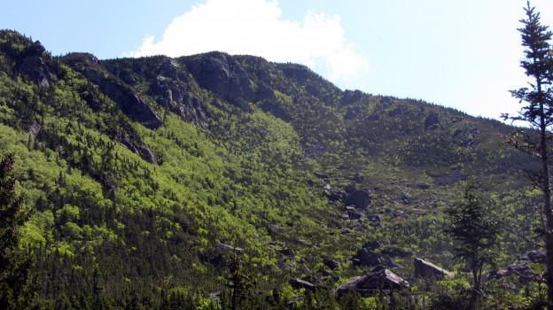
Our route took us over Hoh Head, and then lead us into thick brush, despite being an old trail.  We also encountered more types of mud than a Tough Mudder course.  Tiny spiders seemed to enjoy making their webs across the trail, which we had to keep swatting away.  Constant glimpses of the shore kept us motivated, though.

photo 4(1)

photo 2

Because of the tides and the travel distance we’d gotten a late start, so we set up camp as the sun began to set.  Luckily this lead to some amazing views.

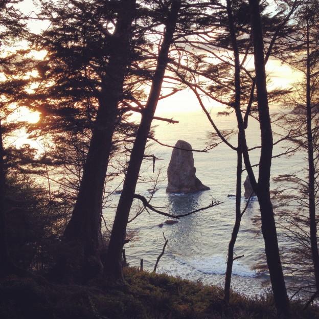
Sunset at Mosquito Creek

As the sun dipped below the horizon, distant sea stacks came into view. I think they might be part of the Washington Islands Wilderness.

Sleeping wasn’t too cold yet and we very comfortable under our Ray-Way quilt, sewn by Catherine’s mom.  It was our first backpacking trip with it, and though light, the synthetic bulk took up a bit more space than carrying two summer down bags, but also warmer.  I think if my pack was 36-40 L (including rolltop) and under 2 lbs, it would fit better than in my current 31 L.  Luckily, everything fit, even with the added bearvault we were carrying.

The next day we packed up and doubled back, since we didn’t have a car to shuttle us from the other end.

It was a great weekend hike, that was over far too quickly!


Wildcat, Wildcat!

On the weekend on the 9th, a planned day hike turned into an ambitious overnight, and Sweeney, Rob and I once again made the trek to North Conway to hike the Wildcat range across the street from our winter hang out.

The plan was to light-weight backpack (~20-25lbs) starting at Glenn Falls, across the Wildcats, up Carter dome and the rest of the Carters, then summit Imp, Moriah, and Selburne Moriah, and descend to Wild River campground on Saturday.  Then on Sunday hike out via Carter Dome and back over the Wildcats.

On Saturday we got off to a great start with beautiful weather after a rough storm the night before.  Eager to make some mileage, we quickly ascended to Wildcat D where the top of Wildcat’s lifts are.

First up for the day, Wildcat summit with the bits of snow in the bowl as a backdrop.

First up for the day, Wildcat summit with the bits of snow in the bowl as a backdrop.

Descending into Carter Notch made for some impressive views, and a very steep descent and ascent of the Carter Dome.

An awesome look at the daunting Carter Dome from the Carter Notch Hut.

An awesome look at the daunting Carter Dome from the Carter Notch Hut.

Looking back at Wildcat from the hut, one of a few AMC huts fed by spring water.

Looking back at Wildcat from the hut, one of a few AMC huts fed by spring water.

Ascending Carter, looking back to the glacial ponds of the Notch

Ascending Carter, looking back to the glacial ponds of the Notch.

We hung around briefly on top of Carter to re-coup, but then pressed on to Mt. Hight which had far superior views.

Presidential Range panorama. All the photos come from Sweeney’s expert photography and far superior camera.

After Carter the rest of the ~4000 footers started to blur together a bit, but the ridge offered continuous views of the northern Presidential Range.

The northern end of our Saturday traverse, soaking in the views

The northern end of our Saturday traverse, soaking in the views

We crested Selburne Moriah in early evening, and booked it to camp.  We’d decided to go stoveless, which was not exactly my preference.  It worked out okay, and I was never hungry, but I think next time I’d do freeze-dried meals and a pot for approximately the same weight, like Sweeney and I did on our Bigelow Range traverse.

Evening view of the Presidential Range, looking back at the peaks we'd crossed

Evening view of the Presidential Range, looking back at the peaks we’d crossed

On Sunday we weren’t exactly rearing to go, but we broke camp and got moving quickly.  Unfortunately on of the first scenes we encountered was this:

Our first encounter with the Wild River Sunday morning.

Our first encounter with the Wild River Sunday morning.

Is that the trail across the river? It was.

Is that the trail across the river? It was. After Rob assured me the depth was a trick of the light, we made a waist-deep wade across, with our shoes around our necks.

After crossing the river, we proceeded down the Wild River Trail, until the trail abruptly disappeared into the river.  About .5 miles past the (closed) Wild River Campground, the trail had fallen completely into the riverbed, a remnant of Irene.  There had been no warnings, so we attempted to find the trail again, but eventually were forced to re-route and continue down the less exciting, but intact, High Water trail, after re-crossing the Wild River, this time via wooden suspension bridge.

At this point we’d backtracked a fair amount and wasted time locating trails and looking at maps. We re-evaluated our options, settling on a Carter Dome ascent via the Black Angel trail, and descent out Nineteen Mile brook trail from the base of Carter Notch.

We made a dogged ascent of Carter, once again a humbling experience.  As we descended, Rob went ahead to get the car, while Sweeney and I hiked out.  We were all relieved to get out of our wet trail shoes and head to Moat for a post-hike chow down.

The hike itself stands alone as the hardest, and one of the most rewarding hikes I’ve done to date, hitting 12 4000 footers and totaling ~40 miles round-trip.