Tag Archives: photos

Head Monsters, Marker Dukes, Mad River Glen, Jay Peak and La Niña…

…Are all my new favorite things.

Northern Vermont got blasted with snow last week and over the weekend. Mad River Glen and Jay were both 100% open so we packed the car and headed north. MRG had been mostly closed during the week, so we figured we’d hit MRG on Saturday for some fresh tracks, and then migrate up to Jay on Sunday to take advantage of the overnight snowfall they were expecting.


I’d never been to MRG before, but I’d heard the stories: they have a single (chair lift), don’t do much in the way of snow-making or grooming, and they still don’t allow boarders. Additionally, from a brief chat with a patroller, Rob discovered that ropes and closed signs at MRG are kind of like stop signs in Italy: more of a friendly suggestion. This all made for some exceptional tree skiing: scratchy in places, but mostly knee deep powder with deeper drifts. The woods there are both tight and steep. We spun around 8 laps in the woods before we ran out of gas around 2 pm.

Jay got nearly a foot over Saturday night, and fortunately for us (but not so fortunately for every behind us) we managed to get the first chair up. We were among the first people to hit the woods to far skiers left (Beaver Pond and Andre’s). Again, there were a few bares spots, but mostly it was knee deep powder, with thigh deep drifts no uncommon. It snowed all day, and we continued to find fresh tracks until our last run of the day, just past 3. Behold:

Be envious!

Plenty of snow left by the afternoon…

Of course, in order to best enjoy these epic January conditions, a sweet pair of powder boards are necessary.  Thanks to Quiver Killers, I was able to pull my Dukes off of my BD Havocs and plop them onto my Head Monsters with relative ease the night before.  At 193 cm long and 95 mm under foot, the Monsters are, well just that: monsters.  When I first pulled them out of the box like two years I began question my judgment in buying such a pair of skis on the East Coast.  And then they sat in the corner of my room while I decided what to do with them.  The excellent snow conditions over the weekend prompted me to pull ’em out and take ’em for a spin.  It took me a run or two to figure out how to handle them in the woods, however due to a variety of factors, I found them to handle nearly as well as a significantly smaller ski.  The Monsters are exceptionally light, even for their size (in fact they are the lightest of all of my skis).  Coupled with the snub-nosed form factor of the Dukes, the whole setup keeps a very low moment of inertia.  I found that this really lets me throw them around quickly.  The Dukes are mounted well aft of center which allows me to pivot on my heels quickly and easily, and the added length up front lets you keep an aggressive forward stance.  All in all, they could hardly have worked out better.  I can’t wait to take these beasts out west…

The Vermont sunset on the way home from Jay.

Cannon Mountain: November

With the winter fast approaching I’ve been more or less hell-bent on getting in as much hiking and other physical activity as possible.  With that in mind a short, steep, late fall hike with some superfluous gear in my pack seemed like just the ticket to get me warmed up for winter.  This time I went with Mike, a veteran 4 season hiker and old friend.  We met at the Lafayette Place Campground ( a primitive tent site) at 10 AM.  We were on the trail just a few minutes later.

View Cannon in a larger map

Pretty serious business…  Photo credit: Mike.

I’ve hiked Cannon several times in the past, but it’s unique terrain, steep ascent and variety of routes up and down make worth the repeat visits, especially as the seasons change.  Despite the forecast of ‘partly cloudy’ it as entirely cloudy in Franconia Notch.  At face value this is disappointing, but I’ve found that such weather, while nixing the view, really puts an emphasis on the remote, forbidding and exciting nature of the mountains.  Also, at this time of year it can create rime ice over nearly every surface – really cool looking.

The trail leads right out of the parking lot and ascends steeply up the southeastern flank of Cannon Mountain.  It’s a short distance as the crow flies, but it’s steep enough to mandate switchbacks and can be slow going.  As we gain elevation the air cools and the foliage becomes more and more encrusted in ice.

View Cannon in a larger map

The way to
Lonesome Lake.

Eventually we begin to find that even the well traveled trail is holding onto a dusting of snow.  With the rain and fog experienced earlier during the week I thought that any snow would have since melted, but the temps were hovering around freezing and the beginnings of solid snow pack were forming on the top of the mountain!

The Rim Trail.  Photo credit: Mike

By the time we summit, the everything around us is coated in a layer of rime ice or snow.  We use our crampons for extra traction, although micro-spikes would have been the most appropriate tool for the conditions – without deep snow or ice, the teeth are slightly too aggressive for comfort.

Enjoying the weather on the
observation deck.

Along the way down we encounter a couple working their way through New Hampshire’s 4000 Footers and they join us for the hike down.  To our surprise, the south and west aspects of the mountains actually hold quite a bit of snow and the crampons turn out to be really helpful.  As we descend the cloud cover breaks from time to giving us great glimpses of Franconia Ridge to the east and Cannon Mountain to the north.

Lonesome Lake with a glimpse of the ridge!

We pass Lonesome Lake under sunny snow-showers and watch snow eddies blow across the most frozen lake.    After a brief rest in the Lonesome Lake Shelter we cruise down the remaining 1.5 miles back to the cars.  It’s a relative short hike, but the constantly changing conditions make it rewarding.

Gear List (click links for more product info):

Black Diamond Sabretooth Clip CramponsKahtoola MICROspikes Traction SystemBlack Diamond Raven Ice Axe Gray, 55cmBlack Diamond Axe Protector Bd Orange, One SizeBlack Diamond Spike ProtectorBlack Diamond Guide Glove - Men's Natural, LPetzl Cordex Belay/Rappel Glove Tan, LBlack Diamond Trail Trekking Pole Cinnamon, One SizeFree Shipping on Orders over $50

Mt. Mansfield

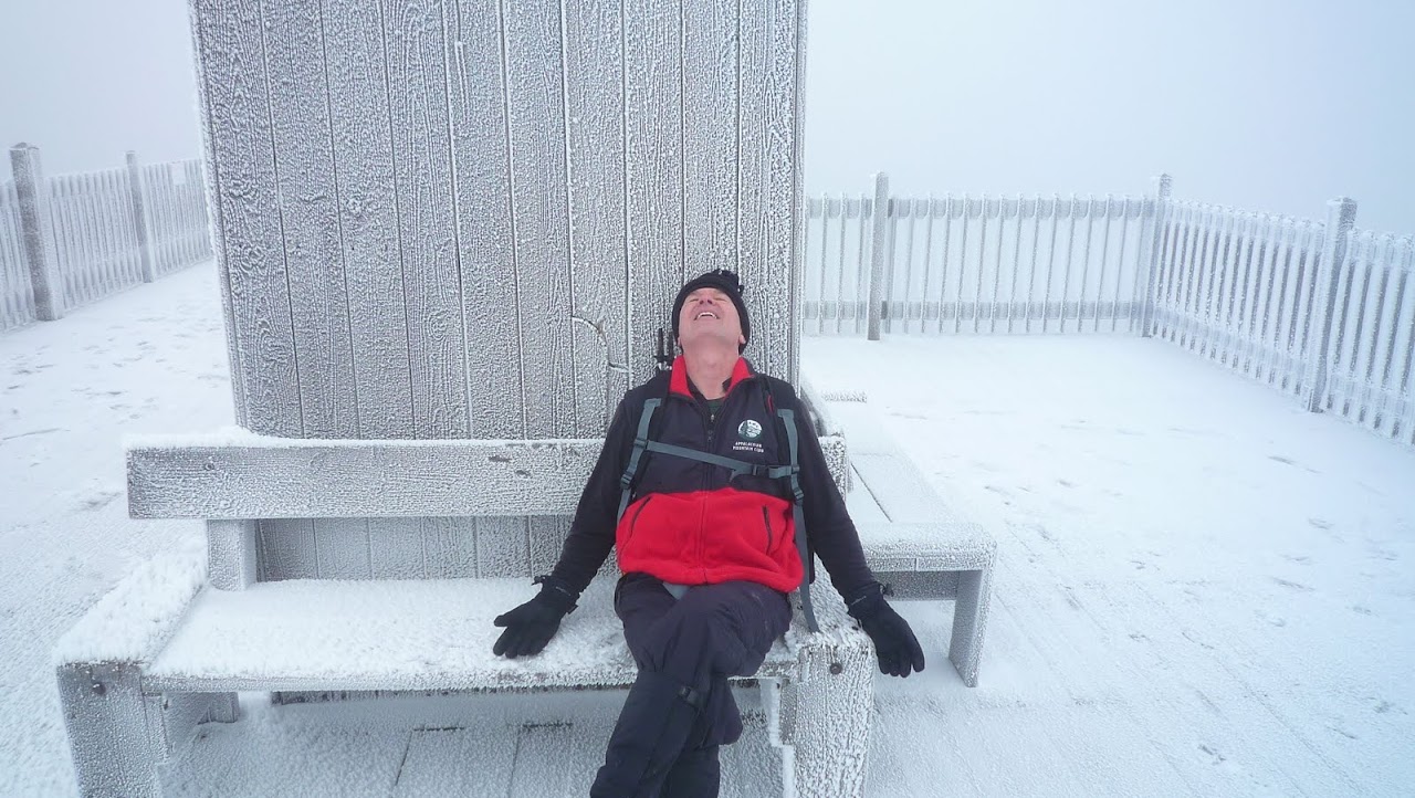
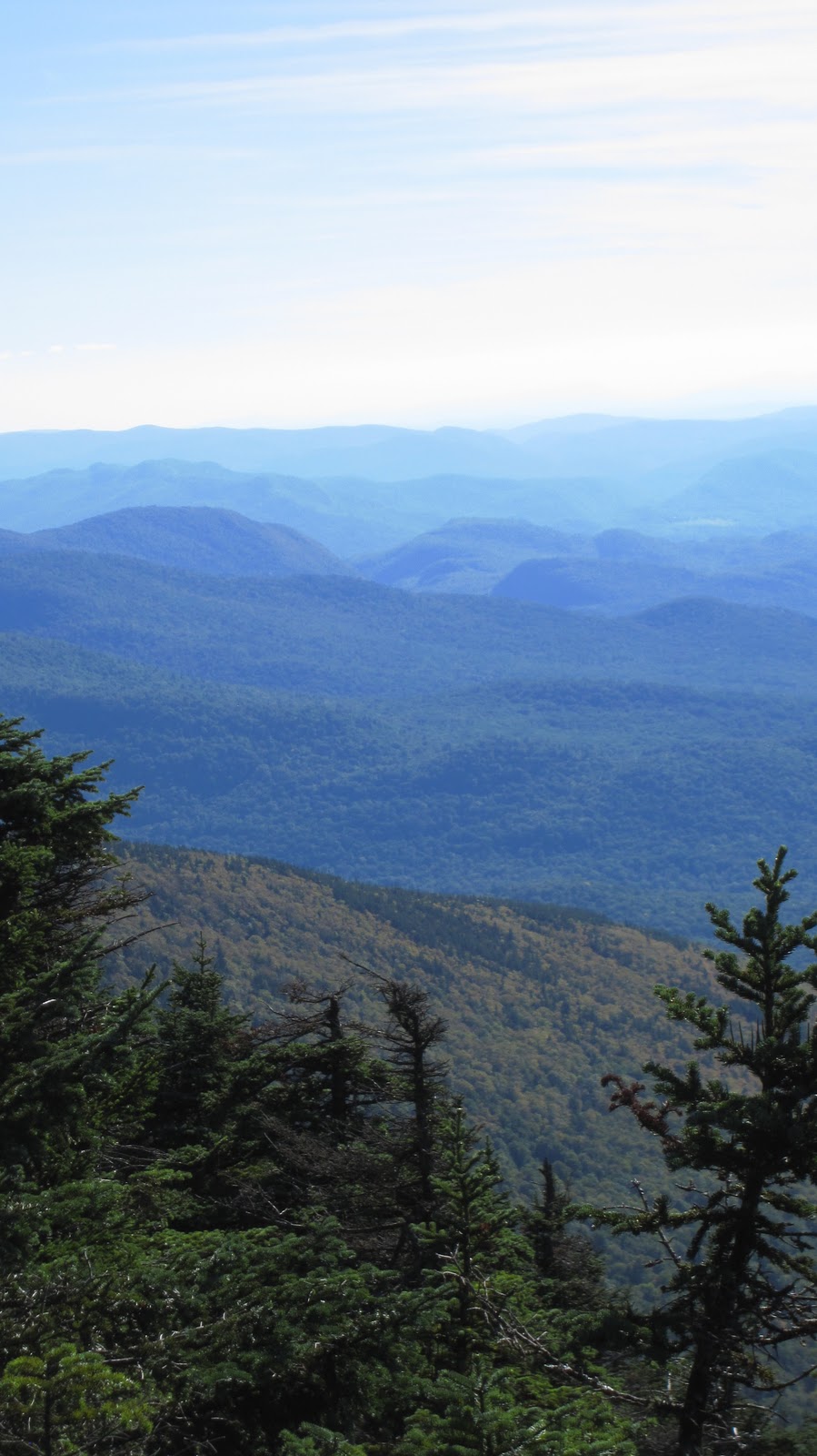
Another New England classic, Tripp and I decided to hike Mansfield last weekend. The weather turned out to be excellent with almost no clouds at all and temps in the mid 60s. We got up at the crack of dawn, drove up via I93 to I89 and hit the trail at 11 AM. There are numerous parking areas in Smugglers Notch, providing easy access to the trails.


Conceptually, this hike can be split into three really distinct parts: the ascent (red), the traverse (green), and the descent (orange). Now this statement may appear less than profound, but when broken down and examined it becomes clear.  In my opinion, it’s this feature of Mansfield that makes it such an interesting hike.  There is great variety during the course of the day, leaving you with a distinct sense of having accomplished quite a few different things.  Here’s a quick overview of the route (Note: this map has a lot of detail which is best viewed by following the link below each inset):


View Mt. Mansfield in a larger map

We ascended via the Hell Brook Trail, one of the steepest hiking trails in New England (at least that I’m aware of). Just for reference, it took us about 3 hours to summit and it’s only about 1.5 miles from the parking area to the summit.  I was somewhat under the weather, which only compounded the problem.  Here’s a closer look:


View Mt. Mansfield in a larger map

The first leg is really the hardest part of the hike, which if fortunate because after the first excruciating hour, things only get better.  You basically ascend up a steep watershed hallmarked by step like boulders and well worn tree branches and stumps giving evidence to the numerous hikers who’ve hauled themselves up practically and over hand in the past.

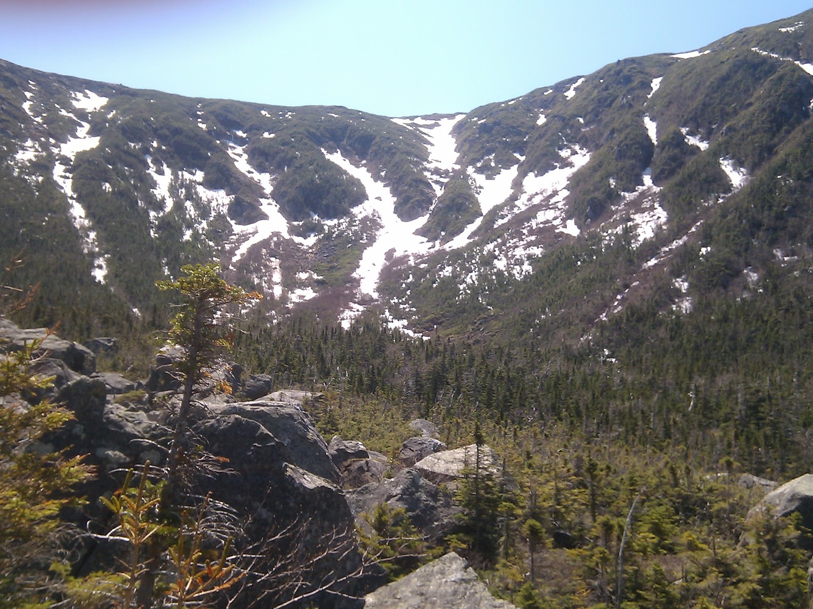
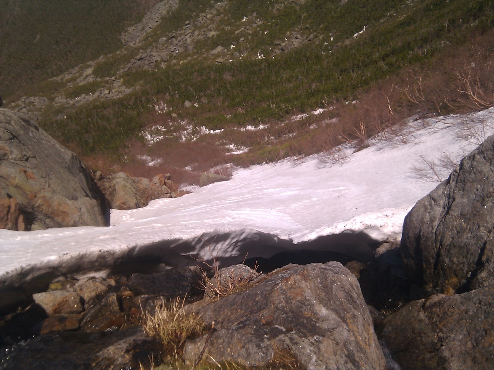
Nearly half way are two points of interest (the blue push-pins).  The lower one denotes a spot that looked good for an emergency bivy, although you’re so closed to the road that it may not really be of much worth.  The second (uphill) pin is extremely confusing.  I’ve done this hike twice and each time we loose the trail in that very spot!  There are numerous tributary water sheds that run across and parallel to the actual trail.  In this case I think what happened, is that the trail hooked to the left, while a small water runoff ran straight down hill and into the trail.  In our beleaguered state, we waltzed right off the trail into increasingly dubious terrain before realizing that this arduous slog over fallen trees and ill marked trail is actually not the trail.  Actually we were only off of the trail for like 30 or 40 yards, but since it’s happened twice now, I thought I’d make a note of it.

The second leg of the ascent mellows out by quite a bit.  Around this time, you begin to get some previews of the views to come.  Eventually you come to Lake of the Clouds, which is more of a pond, and on this particular day there were no clouds…  In any event it’s nice.  Here the trail splits giving you the option of heading over Adams Apple or circumventing it and heading straight for The Chin.  Both routes are equidistant while Adams Apple gives you a gain of several hundred feet.  The view is worth it: you get a good look at the final real ascent of the day:

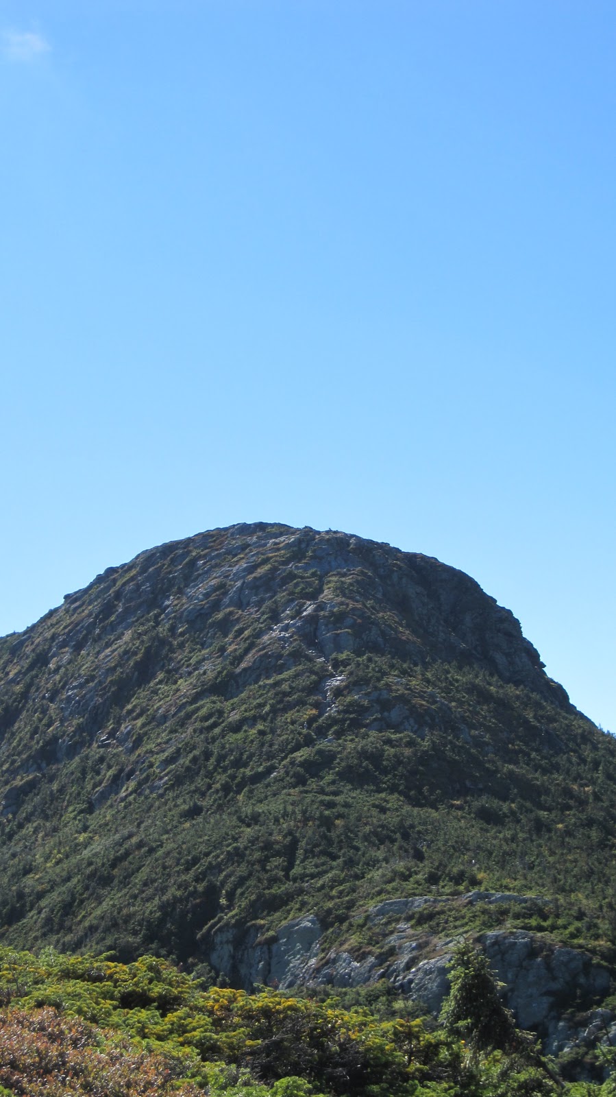
The Chin – the squirrelly notch up the middle is the trail!

This ascent is up there with other great (non-technical yet precipitous) New England climbs such as Flume Slide Trail or Huntington Ravine Trail.  The route up is less than obvious for much of the way simply because it’s so steep that you can’t see  very far from your present position in either direction.  For example:

About half way up the Chin ascent.
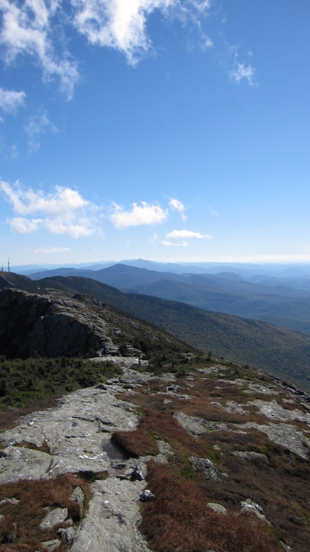
We’re standing about half way up the Chin ascent; the trail descends more or less over that cliff.  It’s basically the same story in the uphill direction!  Shortly you arrive at the summit of Mansfield, reminiscent of other high peaks in New England: bare and rocky punctuated by swirling winds, and also loads of people.  It’s incredibly beautiful, on par with the likes of Franconia Ridge.
Looking south from Mansfield.
There are several ways to traverse the ridge.  Last time we did this, we opted for the Cliff Trail on the eastern side of the ridge.  Cliff Trail basically cuts across the cliff which is the eastern face of Mt. Mansfield.  There’s almost no elevation change but it falls away sharply to one side making it a precarious and exciting stretch.  One section of the trail actually has a steel cable anchored into the rock which climbers can use as a hand hold as they cross the steepest portion.  Last time we were there one end of it had torn out and it was unusable.  The Long Trail runs along the top of the Ridge, however the Stowe gondola generates an incredible amount of foot traffic along this stretch.


View Mt. Mansfield in a larger map

In order to avoid the beltway-esque congestion we descended to the southwest and picked up the Subway trail and Canyon Trail.  This forms what amounts to the western analog to the Cliff Trail: an exposed traverse along a rocky face.  On the eastern flank you get views of Smugglers Notch, the ski areas and the White Mountains in the distance.  On the western flank you get the Vermont country side, Burlington, Lake Champlain and Adirondacks.  A few shots from the Canyon Trail:
Canyon Trail – Champlain and Adirondacks in the distance.
Southwest facing.
Canyon Trail.  Facing south looking
over the Green Mountains.
Burlington, Champlain and the
Adirondacks.  Facing east from
Canyon Trail.
Upon exiting the Canyon Trail, you find yourself back on the ridge proper, and at the foot of The Nose, the last feature that you encounter before descending.  By now it was late in the day, so we decided to omit the Nose and head down the mountain.


View Mt. Mansfield in a larger map

The easiest descent is by way of the Toll Road.  The Toll Road is dirt road which winds it’s way down from the ridge, past the ski area and finally back to Mountain Road, which provides access to the skiing and hiking.  As far as roads go, the Toll Road is a pleasant hike.  There is not really any traffic and it offers several great views of the valley.  It’s also pretty easy hiking.  At several points the road intersects with parts of the ski area.  At our first opportunity we dodged off the road and went straight down the ski area.  There is a hiking trail which descends through the ski area (which would allow you to avoid the ski trails) but it was getting late so we went straight down a trail called Nose Dive.  As you might expect this dumps you out, only about a mile from the where we left the car.
A look back at where we’ve just come from.  The gondola station is seen just underneath the cliffs (of Cliff Trail infamy).
Anyhow, the reason this tends to be satisfying hike, is because of the hugely diverse terrain.  You start by parking in tiny lot in the middle of Smugglers notch after a lengthy car ride, crawl up a lush deciduous forest and suddenly emerge onto a craggy ridge.  Shortly after, you find yourself in a precipitous pine forest followed next by the dirt road and capped off by the meadowy slopes of the ski area.  Now I’ve gotta see about doing this in the winter!

The Mysterious Great Gully and King Ravine

My latest obsession is King Ravine, off the northwest flank of Mt. Adams in the northern Presidentials of New Hampshire.  Here’s why:

View Great Gully in a larger map

Hopefully this requires no additional explanation, but in case it does:

  • nearly a dozen routes down
  • all in the vicinity of 50°
  • all in excess of 1000 feet of vertical no including the runout!!!!!
To me this seems like Tuckerman Ravine only better in all possible aspects: more varied and technical descents, bigger, steeper, less crowded, etc…  The only thing that concerns me is the avalanche risk.  I have to imagine that it gets tons of snow, and I hope that its northwesterly aspect cuts down on wind-loading.  I guess the remaining variables would be temperature and pitch.  Either way, more research needs to be done here…
My thoughts on the approach:

View Great Gully in a larger map

Parking is on Rte. 2 at the green push pin.  The approach is definitely longer than the hike up the Tuckerman Ravine Trail to get to the bowl, but I think it’s easier.  I’ve never done it in the snow, but it’s straight and mellow.  It can be done in just over an hour in the summer.  The two blue thumb tacks denote spots which seemed suitable for bivouacs or small camp sites; away from any avy run-out, out of the wind, flat.

IMHO, the ideal format for the excursion would be a three day weekend.  Head up to the area on a Thursday night, crash some place, and hit the trail ASAP on Friday morning.  I imagine the slog to the Ravine floor would take around 2 hours in good conditions.  Another hour or two take set up camp and make lunch puts you getting some turns in some time after noon – plenty of time for a few runs in the bowl especially given the lack of a 4 hour car ride home and the presence of a presumably awesome campsite less than a mile away.

Enough logistics, lets get to the skiing!

The bowl, from the floor.

A watery crevasse which I did not fall into.

My thumb, but more importantly a good look at the May snowpack.  Yes May.
Clearly, there are numerous routes.  The mellowest of them, had the most snow and is probably the first thing I’ll try is called The Great Gully.  It is highlighted in red in the satellite map at the top of the post.  The bottom is pretty steep, punctuated by a waterfall which you probably have to huck depending on the snowpack.  Fortunately there is an extensive and mellow runout.  The midsection is highlighted by a weird fall line sloping to lookers right, toward a huge mess of rock and undermined snowpack.  Still pretty darn steep.  Above that, it opens up quite a bit and offers at least two spots from which to drop in providing some options.  This portion is the steepest – just in time for the narrow technical sections.  Sounds sick, right?  The rest of the aspects only get steeper and more technical.  Cannot wait.