Tag Archives: spring skiing

Montana Lodge Life

The plan was hatched before the East got pummeled with snow and the West had one of the lowest snow years on record. In a way, it worked out. Sweeney and Kelly flew out and Catherine, Dylan, Atlas and I met them in Montana for some hut living, hot tubing, warm weather, and spring skiing.

We had a 8.5 hour drive from Seattle across the state, through Idaho and over 3 mountain passes. With Atlas still only 6 months, it was our first long trip with a dog in tow, and while he did well, it’s a bit different road tripping with a dog. But this story is about spending a few days up on a ridge with friends in western Montana, and doing some skiing, so let’s focus on that. Unfortunately Dylan and Catherine had to work part of the time, but we all got to enjoy the views and the hut amenities.

20150308_081041

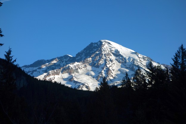
Dawn on Downing Mountain from our motel.

DCIM100GOPRO

Sunrise on Downing Mountain Lodge from Sweeney’s goPro.

20150310_075143

20150309_082025

IMG_1521

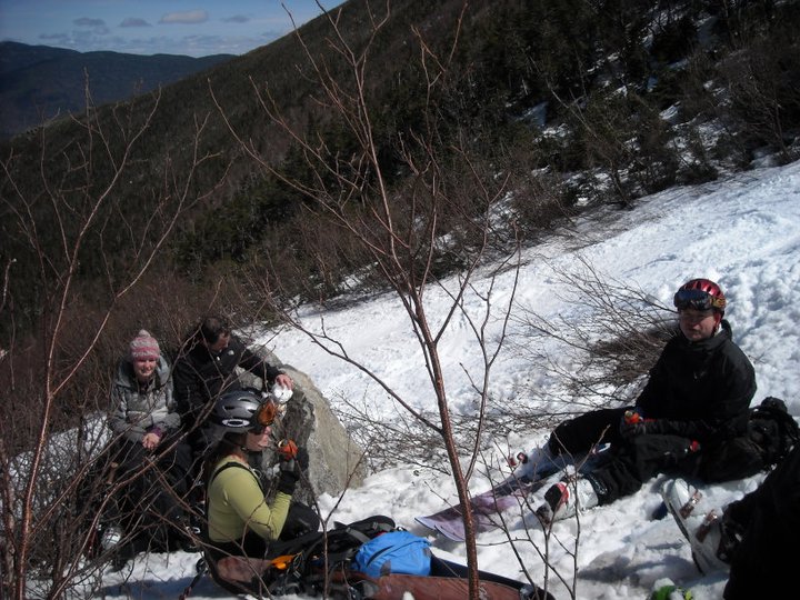
We met at a motel the night before, and it was great to see old friends again. The next morning, Sweeney, Kelly and I drove up early to ski until the hut was open to us. Catherine and Dylan took care of the pup and met us after.

IMG_0954

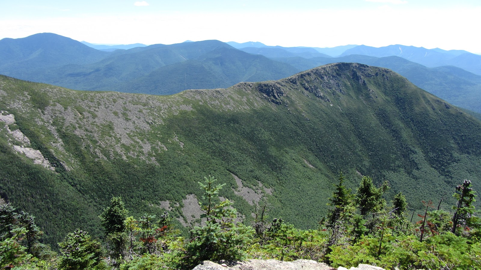
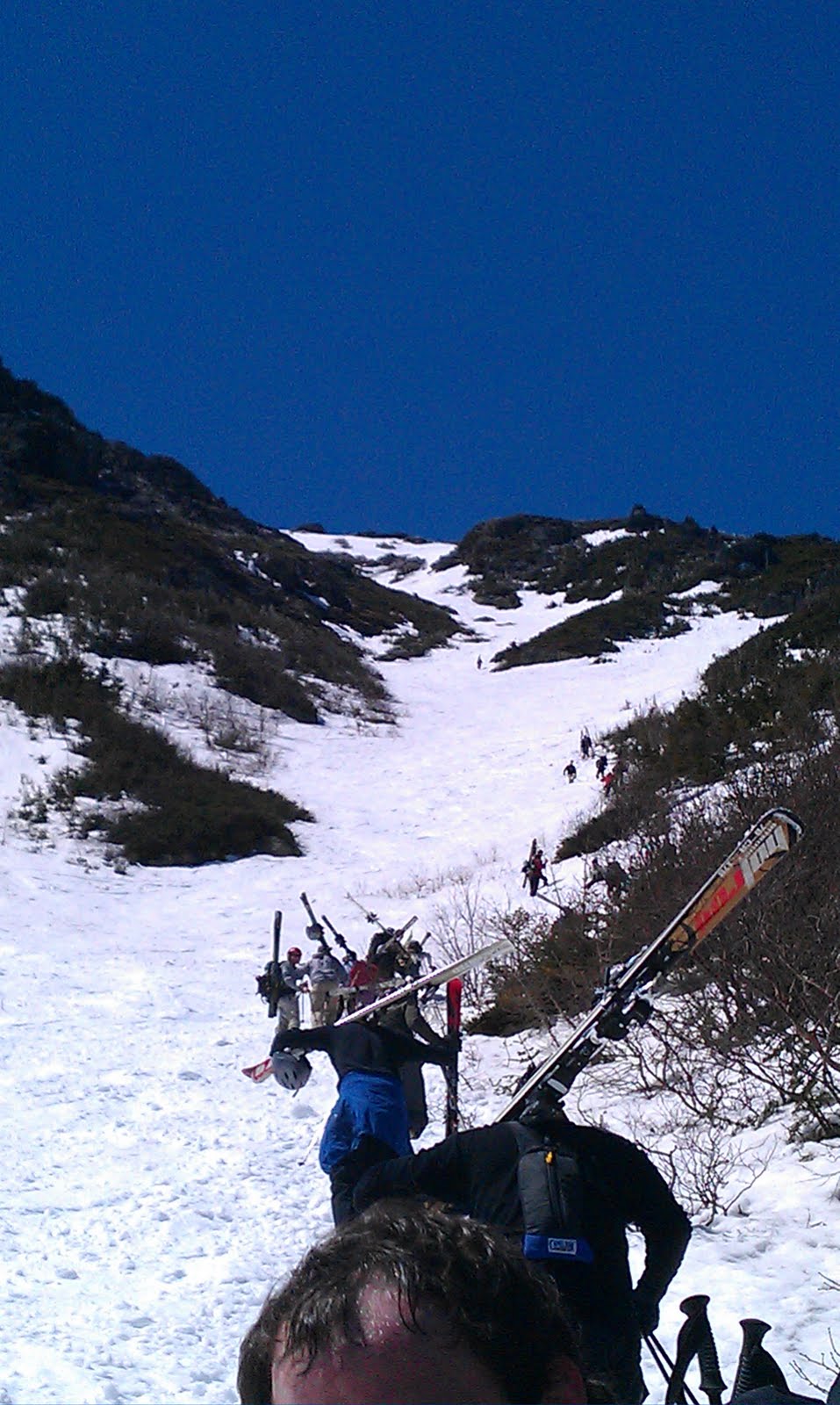
Usually, there’s several feet of snow blocking the road for the last 1.5 miles to the lodge. Not this year. We drove up, and still had about a half mile hike to the snow each way. Behind us, the avalanche basin and upper zone glistened in the midday sun on the upper mountain.

IMG_0968

20150308_122242

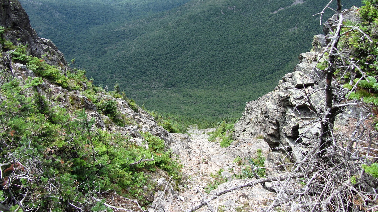
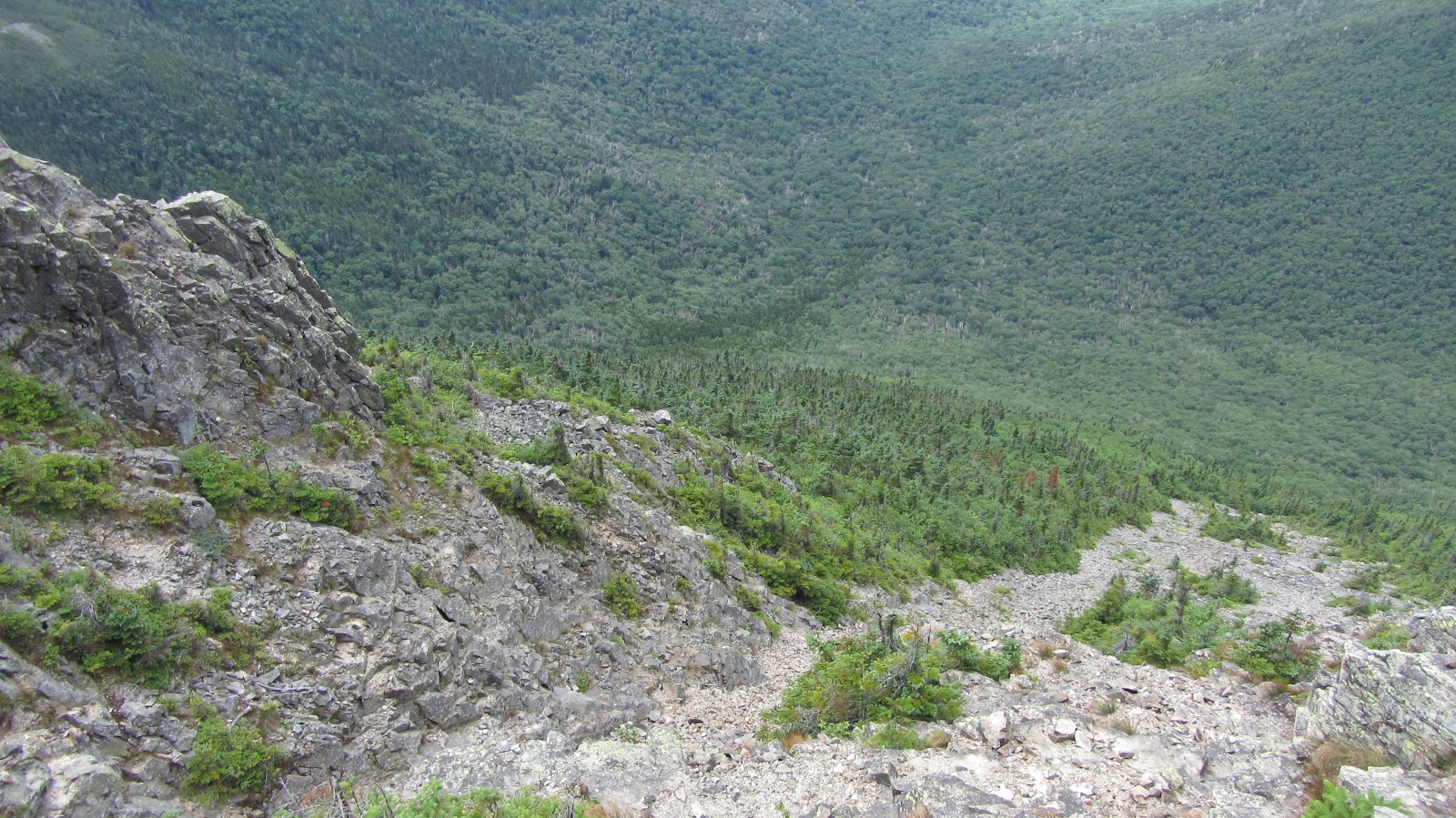
Skinning commenced in the base of the gully and we set a steep track up. Luckily the snow had plenty of time to consolidate and the Low danger meant we were mostly concerned with timing the corn right. Day one was mostly a quick up and back, following the skier’s right side of the gully where some lightly crusted powder lay. The hike out was what made it unique.

GOPR0054.MP4.Still007

GOPR0046.MP4.Still003

GOPR0051.MP4.Still001

20150308_135927

20150308_135935

That evening we all sampled Montana brews, and enjoyed the hot tubs and dry sauna and sunset over the valley below. We let Atlas outside on a long lead but as he’d never been ‘off leash’ outside a dog park, we kept an eye on him.

Day Two

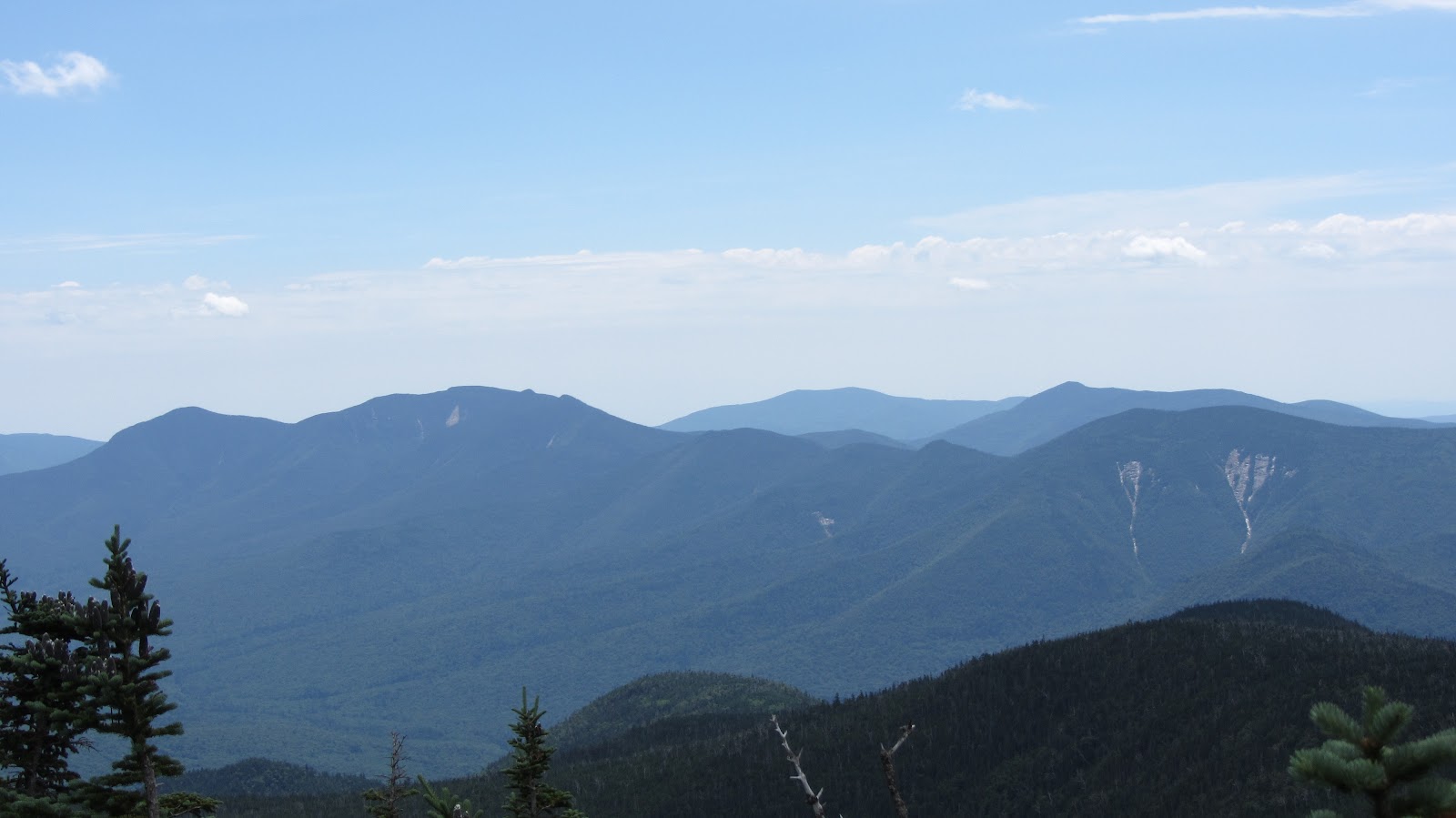
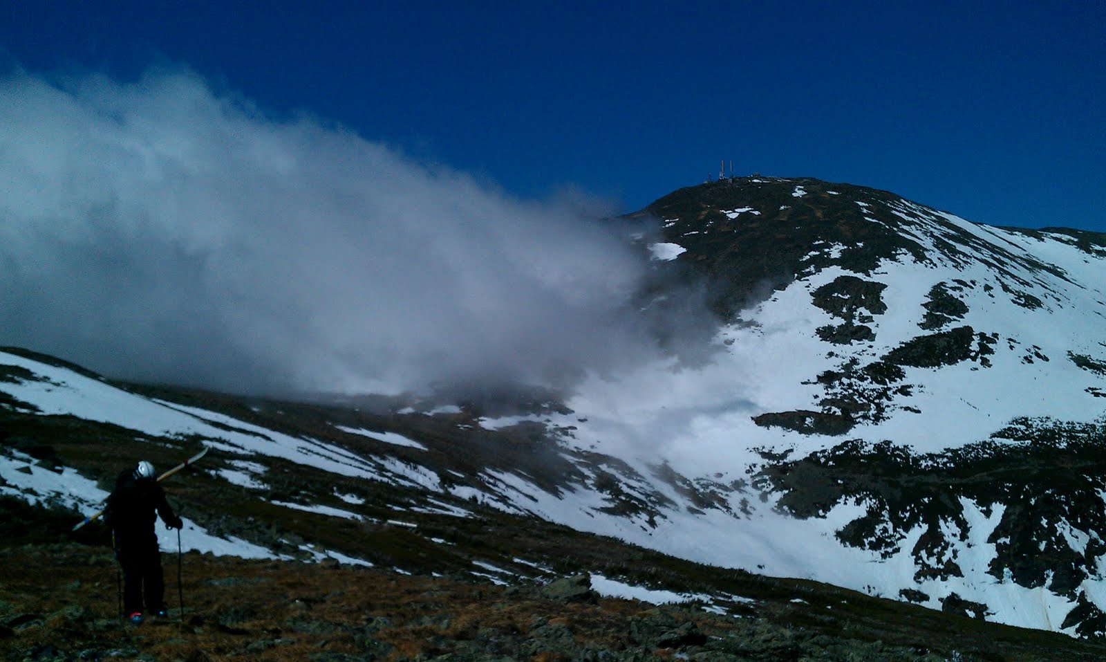
We set out sights a bit higher for the second day, and skinning up past our previous days top out over the looker’s right shoulder and neared the summit ridge. Up there we found cool lines and some powder. Sweeney wanted to push on, but Kelly and I were content to hang out. I found myself in especially rough shape after being sick for months.

20150309_110758

IMG_0966

Sweeney got the best views as he pressed on a bit higher than us, all around were snow capped peaks and enough lines for a lifetime.

IMG_0972

IMG_0978

IMG_0975

On the descent we found some variable powder, then snaked through trees in the burn zone and back out to the main gully.

IMG_1027

IMG_1069

IMG_1037

GOPR0054.MP4.Still002

IMG_1244GOPR0059.MP4.Still001


IMG_1093

GOPR0050.MP4.Still001

IMG_1214

20150309_102611

We were hoping to make an afternoon group jaunt with skis, skins and snowshoes, but because of the lack of snow we instead took short walks on old logging roads and hung around the lodge.

Day 3

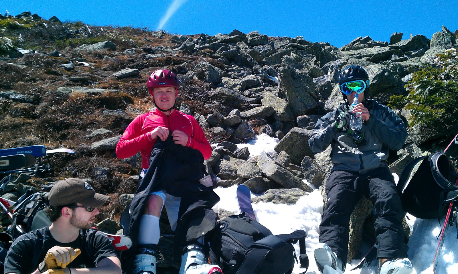
The last day I was pretty beat. Sweeney, Kelly and I make the trek up once again, first to our ski cache, and then following our day old skin track. The day was warm and I wanted to maximize lounging, so I turned around and did my best to make the most of the pristine corn for one last run. Sweeney and Kelly followed suit not far behind after they’d gained a few hundred more vert. They still had a whole second half left of their trip. After one more day at Downing Mountain they were headed to Whitefish.

Catherine and Atlas greeted me at the lodge. After we said our hellos and were headed inside, Atlas spotted a crow, and took off exploring for the first time. We were a little concerned at first, but he came back when called, and after handing out treats to everyone, we turned it into a fun game. By the afternoon he was playing fetch in the yard and was good and beat from romping about in the open spaces.

20150311_113114

Day 4

We let Atlas tire himself out a bit as we packed up for the long ride come. We chased the sunset across Washington, where it beat us to the horizon near Ellensburg. After the long drive, we felt good to be home.

Here’s a short video of some of my skiing footage from the trip. Sweeney has much more, and everyone snapped some great shots of the trip.

June-uary on Rainier

For the first time of my life, I’ve skied a volcano.  It’s a cool thought, although many people make the trip to Rainier, and yesterday was no exception.  After eye-balling topo-maps, NWAC, and talking with a local shop, I decided to head to Rainier solo and see what it’s all about.

I’ve learned that even when conditions in the PNW are lame, Rainier can still be good, and it was awesome corn skiing…in January.  NWAC was reporting green light conditions due to warm temps and consolidation, along with blue skies.

Upon arriving, I learned the stories I’d heard were true.  The Paradise gate is locked until 9 a.m.  A bit unfortunate, but it gave me time to gear and wake up.  My intended trip plan was to stick to the classic Muir Snowfield route, and follow some people up.  It begins at the Paradise parking lot, which is at ~5400′.  Luckily I met Jeff and John who were great company and we veered slightly off the beaten path onto some variations of the route.  It was also the maiden voyage for my Movement Response-X skis, which I was quite fond of by the end of the day.

DSC01269-edit

Our first look up at Panorama Point. Our route took us left around behind the rocks and shrubs to the climb.

DSC01280

Booting up. Almost broke out the boot crampons here. Ski crampons were used later.

Jeff and John on the point.  Snack time.

Jeff and John on the point. Snack time.

DSC01272-edit

The views were pretty good, too.  Mt. Hood is visible on the far right.

More booting.  I switched back to skins + crampons.

More booting. I switched back to skins + crampons.

It was a gorgeous day, and by the afternoon temps on the mountain were ~50 degrees.

Rainier, up close and personal.

Rainier, up close and personal.  The Nisqually glacier is front and center with the chutes on lookers right.  It was great to finally get a closer look than staring at it in the distance from the city, or even Crystal.

Things were looking good as we neared 8600′, give or take a bit.

DSC01299-edit

Adams as the backdrop as we neared our transition. We also got a good look at Mount St. Helens.

One more look at Rainier.

One more look at Rainier.

We hugged the other side of the ridge from the Muir Snowfield up-track, away from the masses, careful not to dive too far skier’s left down into glaciers.  Suddenly the views we’d been getting sank in and I realized, man, Rainier is huge!

DSC01292-edit

John, with some incredible relief behind.

The first few hundred vertical were decent, though the Movements made for a bit of a bumpy ride on uneven wind-scour.  Then it turned to sweet corn and it was grins all the way down.

DSC01291-edit

McClure Rock face. I quickly measured it with the ol’ inclinometer at 52 degrees +/- human error from where this photo was taken.  Steepest face I’ve skied in awhile at least.  You couldn’t see much but the bottom while looking down on it.

John and Jeff had some fun on a steep face, which may have been slightly iffy, if there hadn’t been a few tracks and a snowboarder landing into it sideways, then side-slipping half of it.

DSC01309-edit

DSC01329-edit

The Movement’s performed excellently on steeps, corn and firmer snow.  I almost forgot what it’s like to lay over a ski narrower than 100mm underfoot.  I was able to ski confidently on them at speed, and the flex didn’t feel weak or too soft.  We’ll have to see how they perform in powder, whenever we get some more snow in the PNW.  And another thing, the mixed skins from Movement felt great.

The trip took us approximately from 9:45 – 3ish.  Jeff broke out his goPro so there may be some footage out there in the works.

An awesome introduction to Rainier!

Pemi Loop: Ski Beta

As per the main Pemi Loop TR, here is the ski beta companion post.  If you are not interested in backcountry skiing, this is probably a good post to skip: it’s pretty dry and in essence just a bunch of maps and weird photos.  At the risk of providing too much detail (not sure if that’s possible for this topic), each entry will follow this general format:

  • Quick textual blurb about what we’re looking at.
  • Photos – these are the main artifacts that we took away from the whole thing.
  • Google Earth View – I’ve tried to highlight the regions of interest and panned to a view similar to that shown in the photo(s).
  • Topo Map – Same highlighting; more informative for those actually trying to hike / skin / walk there with the aid of a map, compass, or GPS.
  • Satellite Map – These actually give you a better idea of where the skiable part is.
  • Additional Photos, etc…
The entries are sorted roughly in the order in which we were able to photo these things.  We took a counter-clockwise route around The Pemi and snagged shots of promising looking lines as we encountered them.  This is simply the easiest way for me to catalog this stuff.I suppose I should probably provide some sort of disclaimer here at this point…  I have not actually skied most of the lines discussed below.  In fact, I haven’t even seen many of them in winter.  The idea here is simply to collect information so that we can have an idea of where to continue looking when the snow actually falls.  Just because I think a given run looks sweet does not mean that it can be safely skied.  When winter rolls around, the next challenge will be to give each of the highlighted runs significant individual consideration, and then maybe ski them.Also worthy of note is the fact that this post is probably going to take forever to load.  By the time you are reading this paragraph, most of the maps have probably loaded, but if not give it some time, or try to refresh the page.  If things totally are not working, just open these maps in Google Maps by following the little blue links.  Also, for the love of God, do try to use a modern web browser…

And without further ado…

Guyot South Bowl
Guyot is exceptionally remote, even for The Pemi, but there are two large bowls both of which contain several slides.  They are mostly quite long (~1000′ vert.) and upon closer inspection, they are quite smooth.  There are few boulders or other obstructions meaning that it probably doesnt take super long for things to fill in.


View Pemi Loop in a larger map


View Pemi Loop in a larger map


View Pemi Loop in a larger map


West Bond and Bondcliff
Bondcliff is tempting for obvious reasons, but it’s questionable at best.  It’s extremely steep and all of the crazy terrain features would require a stupendous amount of snow to fill it in.  It’s northwest facing, so it probably get’s blasted but upslope weather, but may well get scoured by the prevailing winds.  I think the more promising looking runs are actually on West Bond.

View Pemi Loop in a larger map

View Pemi Loop in a larger map

View Pemi Loop in a larger map


Osceola and Scar Ridge Slides
These are actually not in The Pemi, their across the Kancamagus just east of Loon.  I hear they slide left and right but if appropriate conditions could be found, they look like fun.  These slides are roughly a mile from the highway and each of them drains out into the Hancock Branch of the Pemi River which runs parallel to the Kanc, so access is pretty straight forward.

View Pemi Loop in a larger map

View Pemi Loop in a larger map

View Pemi Loop in a larger map


View Pemi Loop in a larger map

View Pemi Loop in a larger map


View Pemi Loop in a larger map

View Pemi Loop in a larger map


Flume Slides
Of Flume Slide Trail infamy.  This is one of those runs where people assume you’re totally out of your mind since the Flume Slide Trail basically goes straight up the mountain.  As it turns out the Slide itself makes for relatively mellow skiing when compared to say the Lincoln Slides, according to my partner in crime, Rob.  In fact, I think the Lincoln Slides are probably slightly easier to get to and offer greater variety, but if you’re looking for a mellow backcountry season warm up run, this might be it.


View Pemi Loop in a larger map

View Pemi Loop in a larger map

View Pemi Loop in a larger map

Haystack Slides
Two or three skiable-looking slides can be found between Haystack and Lincoln.  We managed to snag a number of photos of this area, but the GPS on my camera was disabled when we took them and I’m now having a hard time identify which was which.  (Rob, Shane, or anyone for that matter; feel free to weigh in on these…)  In any event, here are the photos and their rough locations.

View Pemi Loop in a larger map

View Pemi Loop in a larger map

View Pemi Loop in a larger map

Lincoln Slides
To me, these appear to be the best skiing (good lines, ease of access, long runs) on the west slope of Franconia Ridge.  Here’s a quick photo of the drainage containing Lincoln’s Throat and the other unnamed slides off Lincoln.  These lines are covered in greater detail here, and here.

View Pemi Loop in a larger map

Bridle Path Slides
The shrewd observer will have noticed a few short but steep slides on the shoulder of Lafayette that leads down from the Greenleaf Hut back toward I93.  They can be seen above in the mid-ground, in front of the distinctive cliffs on the west slope of Cannon.  Or just look at this way better photo:

View Pemi Loop in a larger map

View Pemi Loop in a larger map

View Pemi Loop in a larger map


Lincoln Slides – East Slope
The east slope of Franconia ridge has several nice looking runs however, there’s no easy way of getting to them.  The shortest route may be to climb the west side of Lincoln, and then simply ski down the west side.  Of course then you need to get back.  Additionally, conventional wisdom dictates that you climb the line you’re going to ski.  The safer route involves a 5 or 6 mile slog through The Pemi over easy terrain, followed by some bushwhacking to get to the base of the slides.  Yet another alternative, would be to follow Lincoln Brook, possibly skinning up it all the way to the bottom of the drainage.  This is more direct than following the Franconia Brook Trail, but may not be faster due to the comparative slowness of bushwhacking on skis.  The north aspect of these slides is wide and relatively mellow, however punctuated by lots of passenger car sized boulders, which should make for good fun on a powder day.  The south aspect is considerably steeper and narrower – an exciting looking technical line.  The photo we got is actually not a great perspective (I think the sun was starting to get to me…), so really rely on the maps to see what’s going on here.

View Pemi Loop in a larger map

View Pemi Loop in a larger map

View Pemi Loop in a larger map

Lafayette Slides
These look gnarly and could be accessed without any sort of bushwhacking at all, although the fastest route would almost certainly be to take the Old Bridle Path to the base of the drainage and just follow it up from there.

View Pemi Loop in a larger map

View Pemi Loop in a larger map

View Pemi Loop in a larger map


Spring: the part of the ski season where the weather is more enjoyable.

That’s right, even after hanging out on the beach in California I could not be deterred.  As of April 30th there was still plenty of snow on the mountains (if you know where to look) and it wasn’t going to get skied on by itself!  This time out, me managed to round up a pretty epic crew: myself, Alex, Rob, Shane, Hannah, Ziehl, and Christine.  The plan was ski Tucks (or more accurately, what’s left of it) on Saturday.  The weather was shaping up nicely: partly sunny, breezy, and highs in the mid 40s.  An excellent day of spring skiing by any measure!

Anticipating crowds, we tried to arrive reasonably early.  Even so, we ended up parking down the street from the trail head.  All of the overflow parking was in use.  I dropped Alex, Ziehl and the gear in the main parking lot and went to park the car.  Miraculously (given the thousands shambling around the area), when I got back to the parking lot, Alex and Ziehl had managed to meet up with the rest of the party who had arrived separately.  After messing around with our backpacks and skis for a good 20 minutes we were ready to hit the trail.

Tucks, on a late spring day is a sight to see.  Whether you love it or hate it, it’s a spectacle.  In fact there is no shortage of people who are along just for the ride: to watch hundreds of people rocket down the icy slopes.  On  one hand, the situation is annoying: you’ve come to do some backcounty skiing and enjoy the pristine White Mountains but find yourself surrounded by hordes of people who may or may not have any idea what they’re doing, and seemingly going out of their way to be right in front of you at all times.  On the other hand, it’s pretty cool: the place is transformed into a huge staging area, full of people ready to embark on various expeditions, which likely have gone through several stages of planning and possibly hours of travel, all leading up to this point.    You really have to take a glass is half full approach here: it just so happens that loads of like minded people have arrived to enjoy the same awesome place.  Who can blame them?

After a couple hours of mixed hiking and skinning, we arrive at Hojos, which serves as a base camp of sorts.  Here we get our first good look at the bowl.

Some obvious deterioration, but still plenty of snow!

After a quick breather, we start planning our attack.  Word on the street was that Dodge’s Drop, one of steepest, tightest and most technical runs in the area was skiable.  The Drop is not really in the bowl proper, it’s to looker’s left of Hillman’s Highway, which in turn is to lookers left of the Bowl.  We decided that we’d head for Dodge’s by way of Hillman’s Highway and take a stab at it, while anyone not wishing to tackle the Drop could return via the slightly mellower Hillman’s.

Wait, so much further?
Photo Credit: Ziehl
A long way up!
Photo Credit: Ziehl
Our approach: Hillman’s Highway.
And a long way down…
Photo Credit: Ziehl

Anxious to get to the top, we climb up about as fast as we can, laden with skis, clothes and other equipment.

Just for frame of reference…

Once at the top we re-assemble and start getting into our ski gear – near the top of the run the wind is quite a bit stronger and the temps are probably a good 10 degrees cooler than at the base.  From the top of Hillman’s be begin the short walk south-east toward Dodge’s Drop.  Up on the ridge, the weather is up to it’s usual tricks.  High winds, wand fast moving clouds race up and over the ridge in dramatic fashion.

The usual business…
Shane outrunning the clouds.
We find the Drop without too much trouble, click into our skis and give Rob the honor of first tracks, as it was mostly his route finding that led us here.

Rob, off to an aggressive start…

Unfortunately, shortly after he dropped in, we started to hear him calling back to us.  Over the wind, we can just barely make out something along the lines of ‘still pretty firm’, ‘not worth it’ and ‘no fun.’  We hastily get out of our skis and head back to Hillman’s Highway, where we knew the snow to be plenty soft.  Rob took one for the team this time…

The staging area.
Ditto…
Hannah declares victory.
Photo Credit: Ziehl
Just about ready for the good part.
Photo Credit: Ziehl

This is where the left entrance to Hillman’s
rejoins the main part of the run.

We take a nice run about two thirds of the way down Hillman’s where we stop for lunch and rest.  We find a sunny spot by a rock where we can all sit comfortably and watch other skiers going up an down.  

Snacks and beers.
Photo Credit: Ziehl

After another run we pack up our gear and roll out.  The snow from the top of Hillman’s, all the way down past Hojo’s until about one mile from the end of the the Sherburne was excellent spring skiing: bumped up but soft and forgiving.  We all but ran our way out for the last mile.  By this stage of the game I was starting to turn my thoughts toward dinner, which would certainly be more attainable at the bottom of the mountain, out of my ski boots and with the aid of car.

View Hillman’s Highway in a larger map


Gear List (click links for more product info):

Petzl Cordex Belay/Rappel Glove Tan, LMerrell Chameleon3 Ventilator GTX Hiking Shoe - Men's Gunsmoke, 8.0Black Diamond Contour Elliptic Carbon Trekking Pole Ink Blue, One SizeBlack Diamond Factor Alpine Touring Boot - Men'sPOC Synapsis 2.0 HelmetPOC Lobes Goggle Black/White, One SizeBlack Diamond Ascension Nylon STS Skins One Color, 95mmBlack Diamond Havoc SkiOakley Bruce Irons Signature Hijinx Sunglasses Polished Black/Warm Gray, One SizeMountain Hardwear Axial Jacket - Men's Red, XLFree Shipping on Orders over $50